[<][<=][=>]Index of this webpage
**++Climatology from Satellites Group++**
**++Postgraduate++**
++Current Research Assistants (and Doctorate Students):++
++Doctorate on Remote Sensing Students:++
++Master Postgraduate:++
++Master Students:++
++Advanced Undergraduate:++
++Practicum - Practical Training:++
++Current External:++
++Past ..., but very close to us ...:++
**++Publications++**
**++Links to Significant Meetings++**
''**++2015++**''
''**++2014++**''
**++Active Collaborations++**
**++Acknowledgments**++
**++Book suggestions++**
**++Link of the Day++** (in reality, ... every now and then)
2013
December
**++Teaching Subjects++**
Postgraduate Course on ''New Observation and Watching Systems in Meteorology and Climatology''
**Some Teaching Publications**
**++Research Lines++**
**''I Validation of low spatial resolution remote sensing data and products (GERB, SMOS, EPS/MetOp, SMAP)''**
**''II Radiative balance studies (GERB, CERES, SEVIRI, EarthCARE)''**
**''III Soil moisture from passive microwaves (SMOS)''**
**++Valencia & Alacant Anchor Stations++**
**What is an ''ANCHOR STATION''**? (from Professor H.-J. Bolle)/
**Rationale**/
**Desirable measurements at ''Anchor Stations''**/
How Representative are the ''Alacant and the Valencia Anchor Stations'' Measurements of their Respective Surrounding Meteorology?
Proposal for a ''Water Cycle Observatory'': The VALENCIA and the ALACANT ANCHOR STATIONS, Meteorological Reference Stations for Remote Sensing Data and Products
**Publications**
2008
2007
2006
2005
2003
2002
**++Involvement in Satellite Earth Observation Missions++**
**SMOS (''Soil Moisture and Ocean Salinity'')**/
**SMOS Validation Rehearsal Campaign Activities at the Valencia Anchor Station**
**Scientific Team**
**Purpose**
**Activities
**SM Measurements**
**Vegetation Measurements**
**Soil texture**
**Airborne Operations during the SMOS Validation Rehearsal Campaign (Tauriainen, 2008)**
**Modelling**
**Publications**
2011
2010
2008
2007
2006
2005
2004
2003
2002
**Projects**
**EarthCARE (''Earth Clouds, Aerosols and Radiation Explorer'')**
**Publications**
2012
2011
2007
2006
2004
2003
2002
2001
**Projects**
**GERB (''Geostationary Earth Radiation Budget'')**/
**Publications**
2011
2008
2007
2006
2005
2004
2000
**Projects**
**CERES (''Clouds and the Earth's Radiant Energy System'')**/
**Publications**
2012
2008
2007
2006
2005
2004
2000
**Projects**
**EPS/MetOp (''EUMETSAT Polar System / MetOp'')**/
**Publications**
**Projects**
**++Other Significant Research Projects and Contracts++**
**Publications**
**++Field Campaigns++**
**++Supervision of Research Academic Work++**
**++Selected Significant Publications++**
**++Photographic Album: A Sample++**/
2014
2013
2012
2008
2007
2006
2005
2004
2003
2002
2001
2000
1988
[<][<=][=>][*]
**Purpose**
The general purpose of the SMOS Validation Rehearsal Campaign is to repeat the Commissioning Phase execution with all centres, all tools, all participants, all structures, all data available, assuming all tools and structures are ready and trying to produce as close as possible the post-launch conditions. The aim is to test the readiness, the ensemble coordination and the speed of operations, and to avoid as far as possible any unexpected deficiencies of the plan and procedure during the real Commissioning Phase campaigns (Bouzinac et al., 2008). A specific added-value objective of the Valencia Anchor Station Team is to validate the ground sampling strategy defined for this campaign (10 x 10 km2) by comparing the ground area-estimated products with the aircraft area-integrated measurements in order to be able to extend the methodology to the larger SMOS footprint representative area (125 x 125 km2). The scientific framework in which context these objectives will be studied is monitoring of soil drying after a significant rainfall event takes place in the study area.
(Bouzinac, C., S. Delwart and P. Wursteisen + members of the validation teams (2008): SMOS Validation Rehearsal Campaign Plan. ESA-ESTEC)

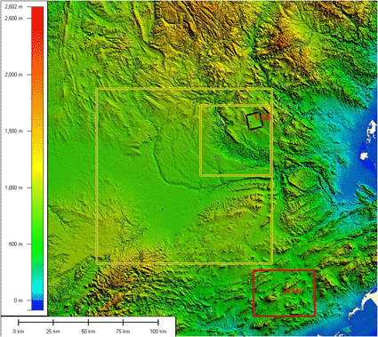
Coordinates of the different validations zones defined:
VAS:
(39�34�15��N, 1�17�18��W, 813 m)
For 10x10 km2:
UTM (ED50) coordinates:
NW: 643966 4386507
NE: 653735 4388886
SE: 655995 4378531
SW: 646226 4376152
or
NW corner: 39�36�51.83� - 001�19�26.57�
SW corner: 39�31�14.71� - 001�18�00.04�
NE corner: 39�38�02.85� - 001�12�35.08�
SE corner: 39�32�25.66� - 001�11�09.08�
For 50x50 km2:
NW -> 1.698423W 39.683639N
NE -> 1.115635W 39.675642N
SE -> 1.127737W 39.225365N
SW -> 1.706786W 39.233235N
For 125x125 km2:
NW -> 2.563715W 39.799068N
NE -> 1.104126 39.784399N
SE -> 1.134179W 38.658662N
SW -> 2.570636W 38.672758N

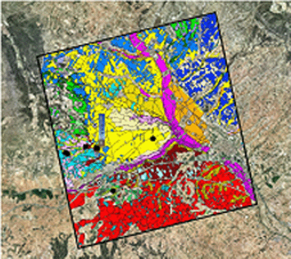
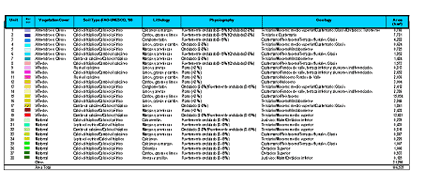
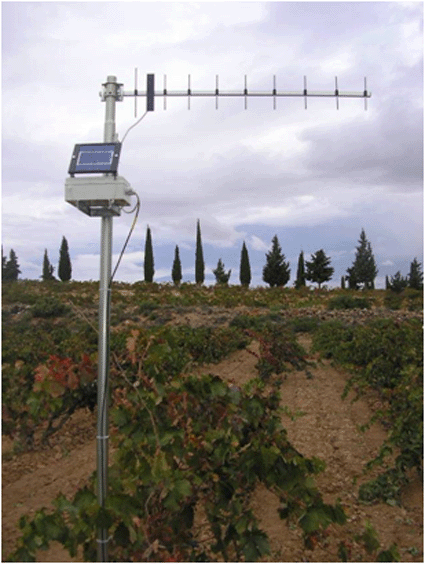
Physio-hydrological Units defined in the 10 x 10 km2 area attending to criteria of lithology, geology, climate, soil type, slope, topography, physiography, and vegetation cover (see picture below). An automated wireless network of SM sensors (Theta Probe) has been designed and is currently under development and being implemented over the most significant physio-hydrological units
SM network ■ VAS � SM stations (operative) o SM stations (tbc)

Definition and characteristics of the physio-hydrological units defined

Example of wireless SM station

