
[<][<=][=>]Index of this webpage
**++Climatology from Satellites Group (GCS)++**
**++Research Lines++**
**I ''VALIDATION OF LOW SPATIAL RESOLUTION EARTH OBSERVATION REMOTE SENSING DATA AND PRODUCTS. THE VALENCIA ANCHOR STATION''**
**II ''SOIL & VEGETATION''** (tbc)
**III ''WATER STUDIES''**
**IV ''TERRESTRIAL APPLICATIONS OF GNSS-R, -IR''**
**V ''RADIATIVE BALANCE STUDIES (CERES, GERB, EarthCARE, SEVIRI)''**
**++[The Valencia Anchor Station https://tinyurl.com/yyzc4url]++**
**What is an ''ANCHOR STATION''**? (from Professor H.-J. Bolle † March 2013)
**Rationale**/
**Desirable measurements at ''Anchor Stations''**/
How Representative are the ''Valencia Anchor Stations'' measurements with respect to its surrounding meteorology?
**++Recent Research Projects++**
**++Publications++**
**Other Significant Publications++**
**++Capacity Building & Professional Education in Earth Observation**++
**++Postgraduate Course on ''New Observation and Watching Systems in Meteorology and Climatology''++**
**++Hosting Foreign Young Researchers / Students in Short Stays for I+D+i / Academic Work Activities**++
**++Acknowledgment**++
[<][<=][=>][*]
**++Recent Research Projects++**
Ground Based Observations for Validation (GBOV) of Copernicus Global Land Products
(2017- )
Joint Research Center ITT JRC/IPR/2016/D.6/5019/OC. ACRI-ST(France), leader of the consortium with partners UCL Consultants (UK), University of Leicester (UK), University of Southampton (UK), University of Valencia (Spain), and INFORMUS (Germany) (assistant)
The GBOV service provides multiple years of high quality in-situ measurements to validate 7 core land products (Top-of-canopy reflectances, Surface albedo, fAPAR, LAI, fCover, Land Surface Temperature and Soil Moisture)


Comparison of the three upscaling proposed methods for soil moisture, namely simple average, TVDI-weighted average and land cover weighted average over the Valencia Anchor Station (2014). Figure 11 in GBOV Algorithm Theoretical Basis Document. Soil Moisture Products(LP06, RM10 and RM11)
Validation of Earth Observation Data and Products at the Valencia Anchor Station (VARIETAL-2). Application to OLCI, EarthCARE and GNSS-R Missions
(2018-2019)
(Spanish State Agency for Research. Ministry for Science, Innovation and Universities)
Since January 2002, the Valencia Anchor Station has successfully been the center of operations of the Climatology from Satellites Group (GCS) contributing to the validation of Earth Observation products from the CERES, GERB, SMOS, SMAP, Copernicus Sentinels, EPS/MetOp, IASI missions, and complementary activities in the framework of EarthCARE and other GNSS-R missions. The Valencia Anchor Station and VARIETAL-2 try now to continue offering the suitable good natural, human and scientific conditions for the validation of low-spatial resolution Earth Observation missions.
Together with the continuation of ground-based soil moisture measurements from the Valencia Anchor Station network, the VARIETAL-2 Project will continue offering a unique robust validation site for the Sentinel-3 OLCI mission with respect to the ground-based measurements of FAPAR, LAI, chlorophyll and now with ground estimations of nitrogen. Also included in the site, there is a robust met station, a fully equipped shortwave and longwave radiation station with sun-tracking direct radiation measurements, and an eddy-covariance station including water vapour
and carbon fluxes estimations.
The excellent collaboration with the European Space Agency (ESA), Beihang University, Beijing, China, Shandong Agricultural University, China, and the Chinese Meteorological Administration (CMA), leads the VARIETAL-2 Team to continue with the GNSS-R intercomparison experiments proposing now more advanced activities on the determination of soil and vegetation moisture by reflected GNSS signals. The VARIETAL-2 Team counts on the use of the GNSS reflectometry application system for retrieval of soil moisture, CHC-N72, that utilises BeiDou, Galileo, GPS and GLONASS reflected signals to retrieve land surface soil moisture within a certain area with the ground-based configuration. The Department of Cartographic Engineering, Geodesy and Photogrammetry, Polytechnic University of Valencia, is also providing their TRIMBLE R10 GNSS receiver for the experiment.
The third task incorporates the preparation for the validation of EarthCARE. The GCS contributed to the ESA EarthCARE MAG (Mission Advisory Group) from the beginning of the mission, year 2000, to 2007 and was in charge of the development of the BroadBand Radiometer (BBR). The GCS is now collaborating with the Royal Meteorological Institute of Belgium (RMIB) to participate in the consortium of the EarthCARE BBR L1 and L2 Products Assessment project (ESA AO for EarthCARE CalVal, ID 37730). With the Valencia Anchor Station activities, the GCS is contributing to the development of the work package WP5 of the project on Quantitative Evaluation of Level 2 Flux Products, Closure Analysis which constitutes part of the VARIETAL-2 Task 3.
Validation of Earth Observation Data and Products at the Valencia and the Alacant Anchor Stations
(2016-2018)
(Spanish State Agency for Research. Ministry for Science, Innovation and Universities)
The project Validation of Earth Observation Data and Products at the Valencia and the Alacant Anchor Stations of the Spanish Space Research Programme has been able to combine and optimise the knowledge, experience and resources of the Climatology from Satellites Group (GCS), collaborators of the Polytechnic University of Valencia and other international collaborators to validate products of the space missions SMOS, SMAP, Copernicus Sentinel-3 OLCI (OGVI and OTCI) and initiate the preparation for the validation of EarthCARE and other GNSS-R missions. The project once again highlights the excellent characteristics of the Valencia Anchor Station (homogeneity, topography, land uses, climate, etc.) as a reference area to provide independent measurements and estimations of area-averaged products to establish the quality of the significant related products of the above mentioned missions.
In relation to soil moisture content, the VARIETAL has continued keeping and maintaining the GCS sensor network (Fig. 1) to produce data for this parameter and compose area-integrated values that are systematically used in the SMAP validation (Das et al. , 2018, Colliander et al., 2017, 2018, Reichle et al., 2017 and Seung-bum, et al., 2017). Even the project has contributed, with the ELBARA-II radiometer work, to the SMOS Science Group to propose a new algorithm SMOS INRA-CESBIO (SMOS-IC) that allows to provide global soil moisture and vegetation optical thickness research products in a more simplified way than the original operating algorithm, being these products more robust and less affected by potential uncertainties stemming from the heterogeneity of the vegetation cover (for example over forests), from the instrument antenna pattern and from the complex SMOS observation geometry (Fernandez-Morán et al. , 2017, CATDS SMOS-IC).
In relation to vegetation biophysical products, VARIETAL has allowed the installation and setting up of 4 measuring stations of the four independent flows that determine the fraction of the photosynthetically active radiation absorbed by the vegetation (fAPAR) to carry out photosynthesis and where chlorophyll concentration content and leaf area index (LAI) of the plant have also been measured. The validation results of these parameters in relation to Sentinel-3 OLCI corresponding products have been presented at the appropriate scientific meetings (Lopez-Baeza et al. 2016, 2017). Thanks to the good work done and properly shown, the VARIETAL Research Team was asked to host the NERC (National Environmental Research Council) Airborne Campaign at the Valencia Anchor Station (NERC_AC@VAS) for the validation of the land OTCI (OLCI Terrestrial Chlorophyll Index) and OGVI (OLCI Global Vegetation Index) products of Sentinel-3. The campaign developed during the period 13-19 June 2017 which, in addition to producing significant communications in international congresses, has originated the publication by (Brown et al ., 2019).
VARIETAL has also contributed to the final defense of the Doctoral Theses of M.A. Coll Pajarón (2017), M.A. Benlloch Casabán (2017) and R. Fernández Morán (2018).
The excellent contribution of other members of the VARIETAL Task Force, in this case from the School of Electronic and Information Engineering, BeiHang University, Beijing, China, and the School of Information Science and Technology, Shandong Agricultural University, China which, together with the Chinese Meteorological Administration, have offered GCS the possibility of jointly establishing a Joint GNSS-R Laboratory for Terrestrial Applications of GNSS. The first step was the possibility for the GCS of the indefinite use and exploitation of the BGRSv1 product developed by SDOE (Shandong Orientation Electronic Technology, Co. Ltd) of the People's Republic of China, to continue developing joint future research at the Valencia Anchor Station. This instrument uses signals from the BeiDou, Galileo, GPS and GLONASS GNSS systems to estimate soil moisture content and other biophysical parameters of the vegetation.

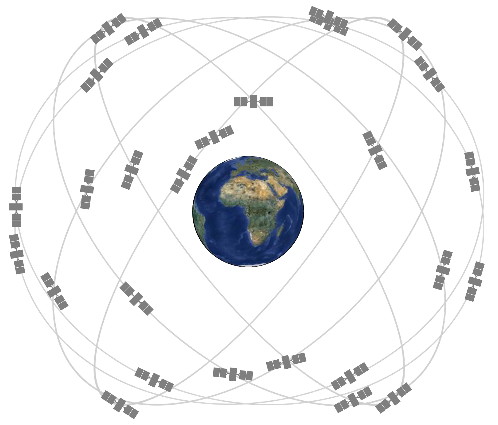
From left to right: Illustration of the future Compass/BeiDou-2 constellation (image credit: CSNPC). The Galileo constellation of 30 spacecraft (image credit: ESA). GPS constellation: Expandable 24-Slot satellite constellation, as defined in the SPS Performance Standard. The GLONASS constellation includes 24 satellites evenly spread over three orbital planes in groups of eight
References
• Benlloch Casabán, M.A. (2017): Comparación de las temperaturas de brillo en banda L proporcionadas por SMOS y Aquarius sobre distintas zonas de La Tierra (in Spanish) [Comparison of L-band brightness temperatures provided by SMOS and Aquarius over different zones of the Earth]. Doctorate on Remote Sensing. Supervisors: E. López Baeza and E. Navarro Camba. University of Valencia
• Brown, Luke A., Jadunandan Dash, Antonio L. Lidón, Ernesto Lopez-Baeza, and Steffen Dransfeld (2019): Synergetic Exploitation of the Sentinel-2 Missions for Validating the Sentinel-3 Ocean and Land Colour Instrument (OLCI) Terrestrial Chlorophyll Index (OTCI) over a Vineyard Dominated Mediterranean Environment. Journal of Selected Topics in Applied Earth Observations and Remote Sensing, JSTARS (accepted)
• Coll Pajarón, M.A. (2018): Distribución de la humedad de suelo mediante observaciones del satélite SMOS, modelización con SurfEx y medidas in situ sobre la Valencia Anchor Station (in Spanish) [Soil moisture distribution through SMOS observations, SurfEx modeling and in situ measurements over the Valencia Anchor Station]. Supervisors E. López Baeza and S. Khodayar. University of Valencia
• Fernández Morán, R. (2018): Calibration of soil roughness and vegetation parameters in the SMOS retrieval algorithm and validation at local and global scale. Doctorate on Remote Sensing. Supervisors: J.-P. Wigneron, Y.H. Kerr and E. López Baeza. University of Valencia
• Lopez-Baeza, E., A. Lidon, E. Albero, E. Asadi, I. Bautista, D. Castaño, D. Catalan, C. Garcia, D. Iglesias, C. Lull (2016): First OLCI-Land-Val S3VT Project (AO #13767) Validation Results at the Valencia Anchor Station. Sentinel-3A Expert Users Meeting on Preliminary User Feedback on Sentinel-3A Data, ESA-ESRIN, Frascati, 28-30 June 2016
• Lopez-Baeza, E., A. Lidon, E. Albero, I. Bautista, D. Castaño, D. Iglesias, C. Lull, F.M. Martinez Campos (2017): Full Vine Phenological Cycle OLCI Ground Validation Measurements at the Valencia Anchor Station [OLCI-Land-Val S3VT Project (AO #13767)]. Sentinel-3 Validation Team Meeting (S3VTM). 15-17 February 2017, ESRIN, Frascati, Italy
