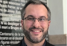
Manuel Campos Taberner, from Villarreal (Castellón), has received the outstanding PhD thesis award in the area of Physics for his thesis “Development of an Earth observation processing chain for crop biophysical parameters at local and global scale”. The work was dircted by Francisco Javier García Haro, main researcher of the LSA-SAF project of the ERS group, and Gustau Campos Valls, professor of electronic engineering and researcher at the IPL in the Image and Signal Processing (ISP) group. The thesis shows that the use of Big Data technology in real applications in agriculture and in monitoring the vegetation of the earth is feasible.
Manuel Campos Taberner has a degree in Physics from the University of Valencia, where he later studied the Master’s Degree in Remote Sensing, to continue his training in the field of study of the physical processes involved in the observation of Earth from satellites. The interest in this area led Campos to carry out the studies of the Doctorate in Remote Sensing, in order to delve into the biophysical parameters of the vegetation that can be derived from spectral signals obtained by sensors on board of satellites. The thesis developed during this PhD, in addition to obtaining the outstanding PhD thesis award in Physics, was also awarded by the IEEE Spain Geoscience and Remote Sensing as the best Spanish thesis in the field of Remote Sensing in 2017.
Currently, Manuel Campos is part of the Environment Remote Sensing group of the University of Valencia, the UV-ERS, as a doctor researcher, where he continues the work he did during his thesis. In this unit, physical models and operational methodologies are developed to study the vegetation cover through satellite images.
In addition, Manuel is also a professor in the Master’s Degree in Remote Sensing as well as in different subjects in the degrees of Physics and Chemical Engineering at the University of Valencia.
What difficulties have you encountered while undertaking the thesis?
As for the moment of choosing the doctoral program and the direction of the thesis, I did not have any difficulty, since during the master’s degree I was able to initiate contacts with several professors specialized in this field. Regarding the economic aspect, in spite of not having had a scholarship during the thesis, thanks to the contact with the teaching staff I have obtained financing through an FP7 project, promulgated by the European Union, called ERMES, and a contract with the LSA-SAF project, financed by EUMETSAT. With these I developed the research of the thesis.
What continuity does your research have?
The work carried out during the thesis is having continuity in the LSA-SAF project, specifically in the field of the improvement of estimates of biophysical parameters of the vegetation from the sensors of the EUMETSAT satellites. In addition, the statistical tools of artificial intelligence developed are allowing collaboration with other groups of the University, such as the UV Image and Signal Processing (ISP) group.
What do you think your research contributes to the scientific community as a whole and to society?
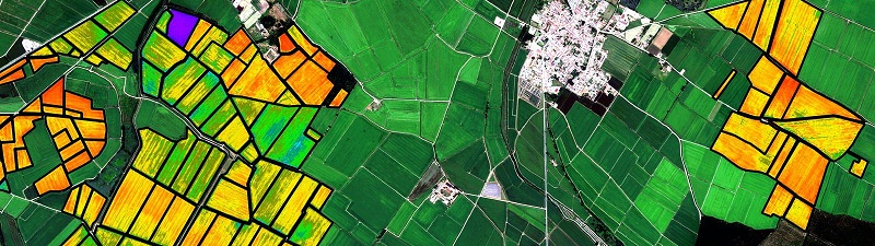
The large amount of data used in the thesis, both in simulations and in the processing and storage of large amounts of images from several satellites, makes this work a clear example to show the scientific community that the use of Big Data technology in real applications in agriculture and in monitoring the vegetation of the Earth is feasible. In addition, smartphones have been used for the first time as tools for measuring biophysical parameters of vegetation in the field, key to validate the estimates obtained from satellite. This makes it possible for anyone not expert in taking measurements in the field can easily measure it thanks to the use of smartphones.
What applicability can your work have?
The results obtained have implications and applications in the food and agriculture industry. For example, in the application of fertilizers in areas of low vigorousness of the vegetation that have been automatically detected through the use of remote sensing tools developed in the thesis. In addition, the work developed in the thesis leads to the possible creation of spin-offs dedicated to supporting this industry through data processing from satellites. This aspect is in line with the strategy of the European Space Agency (ESA) on food security.
Does getting a Doctorate facilitate employability?
In my case, it does. Thanks to the thesis and the publication of scientific articles in journals of international scope, I have received job offers to continue my research in other centres in Spain and abroad.
Would you recommend starting doctoral studies? What advice would you give to a person who wants to get a PhD?
In my experience, yes, I would recommend it. I would encourage future doctorates to try to participate in congresses and scientific meetings to give visibility to their work and learn from others.
Have you actively participated in outreach activities and scientific communication? How important do you think these activities are?
I have participated in scientific congresses, both for dissemination and scientific education, such as the International Technology, Education and Development Conference, which took place last year in Valencia. In this congress we present a mobile application that uses the components of smart mobile phones to measure biophysical parameters.