
This morning, an emergency drill was held at the Paterna Research Institutes of the Burjassot Campus, organized by the Health, Safety and Environment Service of the Universitat.
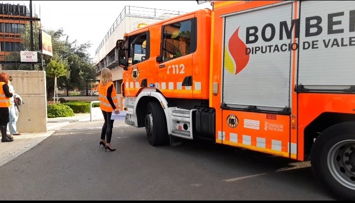
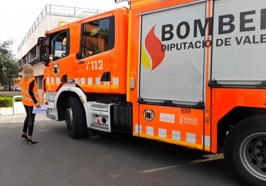
With the collaboration of the Provincial Fire Consortium of Valencia (CPBV), the City Council of Paterna and the 112 Service of the Valencian Community.
The Science Park of the Universitat (PCUV), located in the municipality of Paterna, has seven research institutes, four of them belonging to the Universitat de València (UV), one to the Spanish National Research Council (CSIC) and two mixed UV/CSIC, the Image Processing Laboratory, the Astronomical Observatory and other unique spaces. All of them compose the academic area ofthis framework for innovation that is the Science Park. All of them stand out for their participation in scientific projects of international impact, as well as for their high level of collaboration with companies and institutions and their participation in projects applied for the benefit of society.
The research institutes that have participated in the drill are the following:
- Institute of Material Science (ICMUV)
- Institute of Molecular Science (ICMOL)
- Institute for Corpuscular Physics (IFIC)
- University Research Institute on Robotics and Information and Communication Technologies (IRTIC)
- Image Processing Laboratory (LPI)
- Cavanilles Institute of Biodiversity and Evolutionary Biology (ICByBE)
- Astronomical Observatory
- The pilot section of aquariums of the SCSIE
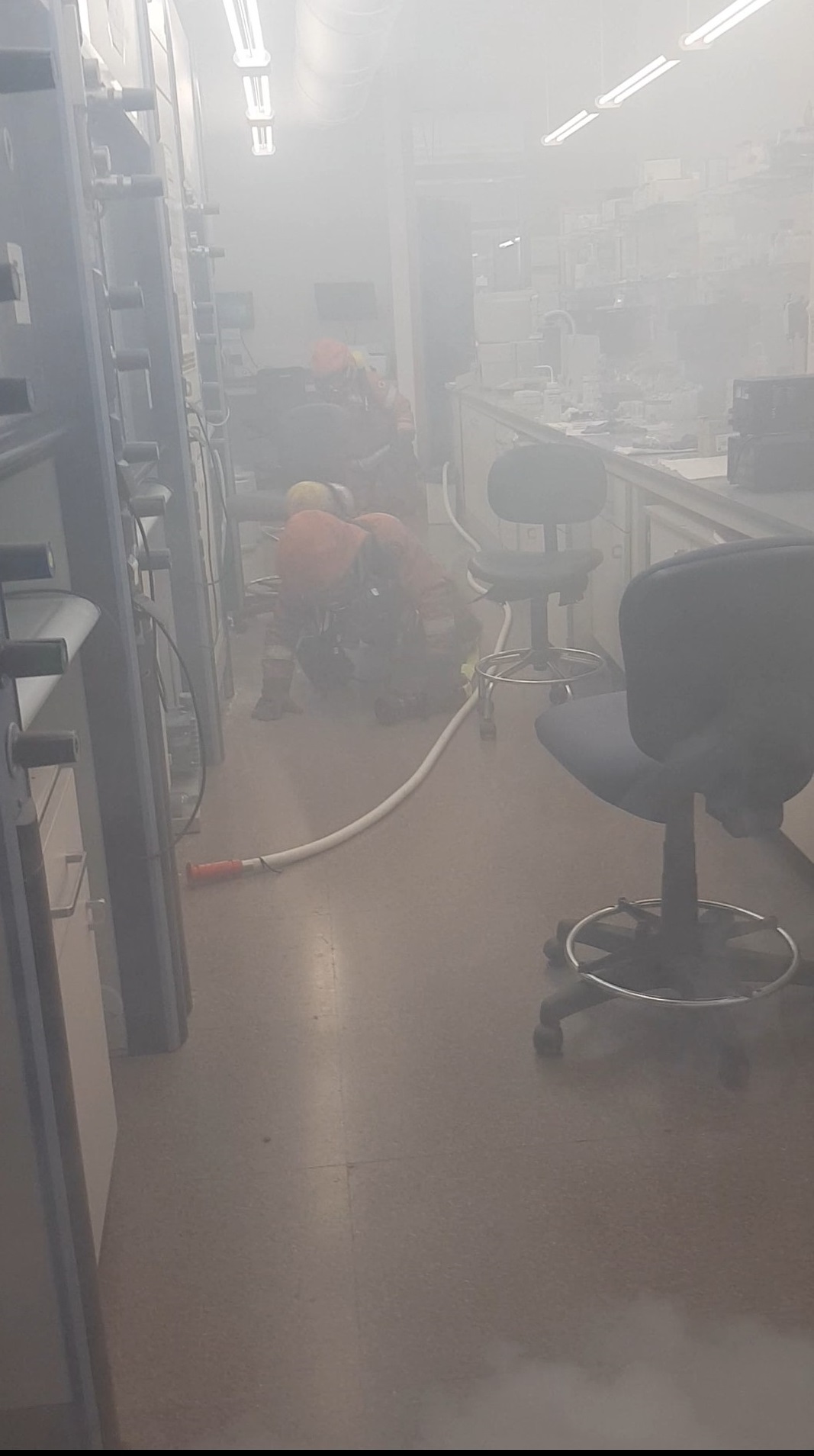
The drill has consisted of simulating a fire inside a laboratory with toxic products and fixed installations of flammable gases. Given the rapidity of the spread of the fire by having a significant volume of fuel and the possible generation of one or several explosions, the emergency head of the building and the general emergency head of the Science Park, decide the general evacuation of all buildings that may be affected and that correspond to:
- Cabecera Building (Edificio Cabecera),
- ICMOL Building (Edificio ICMOL)
- Institutos Building (Edificio Institutos)
- Experimental Unit (Nave experimental) of the IFIC
- Contenedor 1 Building
- Robatics Building (Edificio de Robótica)
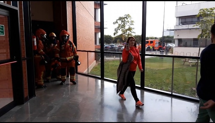
As a result of the smoke generated by the fire, people have been confined in the offices of the laboratory that must be rescued by firefighters.
Prior to the drill and to be able to give the general alarm as quickly as possible, all the buildings in the academic area of the Science Park have been interconnected through a general extension pulse, monitored from the control centre.
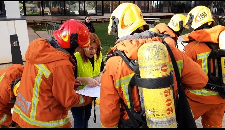
Firefighters from Burjassot's and Paterna's Fire Station have actively participated. Whose main task has been the rescue of confined persons and the control of fire and/or explosions.
The emergency teams of each building have helped in controlling the emergency, in the alarm and evacuation of their spaces and in everything that has been deemed appropriate. In general, the actions carried out are:
- Receipt and emergency check
- Emergency communication
- Emergency management and coordination
- Call 112
- Alarm and evacuation of all buildings
- Receipt of external help
- Rescue and loss control
Performing drills and exercises test everything planned which involves a practical exercise for all the staff involved. In this drill, in addition, the operation of an informative tool of geolocation of the buildings and identification of the level and type of risks of the same has been verified. This computer development has been developed between the Provincial Fire Consortium and the Safety Area ofthe Burjassot-Paterna Campus of the UV Health, Safety and Environment Service. Through it, firefighters, once the warning of an emergency has been received and on the way to it, will be able to visualize, through a cartographic server, the exact point at which the incident has occurred, the closest accesses and exits, what is the route within the establishment to reach the site of the incident, the nearest hydrants, the characteristics of the infrastructure where it has been produced, if there are adjacent elements or nearby industrial areas, among other useful information.
To make this development possible, we have had to gather all the relevant information of all the buildings and singular spaces, define the terms and cartography to be implemented and proceed to the elaboration of the new maps in digital format.
The computer tool collects detailed images and data on the accesses and exits of the enclosure, protection elements, access route, evacuation routes, special premises, enclosures and buildings, and also all the risk activities of nearby companies, as well as the possible transport of dangerous goods. It includes telephones of those responsible for the most dangerous spaces and the emergency equipment of the establishment.
In Spain there is no agency with a GIS mapping tool as powerful as the one we have developed at the Science Park, Burjassot Campus and ETSE, for emergency management. Thanks to the collaboration of both institutions we have managed to take another step towards giving an quick and effective response to emergencies or incidents that may occur at the Universitat de València.
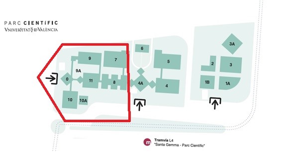
Plan of the Science Park. Academic Area involved in the drill
Images: