


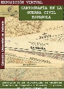
The virtual exhibition "Cartography in the Spanish Civil War. Collection of the Universitat de València" inaugurates a new line in the dissemination of the bibliographic and documentary heritage of the digitized university in RODERIC. Its purpose is, in addition to showing the different collections or the various themes of our funds, to provide additional information to explain and understand them, thus facilitating their interpretation and exploitation, both by researchers and specialists and society as a whole.
This first exhibition shows the collection of maps of the Civil War of 1936-1939 of the Map Library of the University of València.
Our fund is a good example of this material, both for its quantity - more than two hundred pieces - as for its quality and for the geographical areas that reach.
The exhibition halls show the different types of maps, both Republicans and Franquistas, their production and use, and show some of the most emblematic places of the conflict. The last part studies, from the stamps and other imprints of use, to which military units they belonged and the destination of the maps of the war once finished this one.
The exhibition was carried out by the Map Library staff, responsible for collecting, processing and disseminating the cartographic collections of the University of Valencia.
Links: