
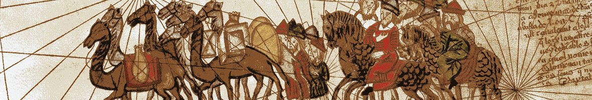
The main objectives of this activity are: identification, analysis, cataloguing and valuing Valencian cultural heritage related to the Silk Road (crafts such as the production of silk and ceramics, architecture linked to factories, farmhouses (alquerías and masías) and mulberry landscape).
- Interactive map through Wikiloc tool.
- Publishing of a cultural, natural and tourist heritage resource ATLAS related to the Valencian Community Silk Road.
Description of the activity:
Cataloguing implementation through citizen collaboration, regional and local study centres for the identification and cataloguing of heritage elements linked to the Silk Road (Museums, files, museum collections, singular buildings and emblematic architecture, landscapes, etc.).
The activity is related to undergraduate students of History, History of Art, Geography and the Environment and Information and Documentation at Universitat de València through the final degree project and internships. As well as Master’s degree students in History of Art, Cultural Heritage, Local development and Environmental and Territorial Management Techniques, through the Master’s Degree Final Project.
And also students and teachers of the Universitat de València Degree in Tourism and other degrees and master’s degree at Faculty of Economics.
To that end, the activity is coordinated by the involved faculties (Degrees and Masters) and by the office of the vice-principal for Territorial Projection and Participation.
Following stages will be carried out:
- Documentation. Faculty of Geography and History, under the supervision of several experts in cultural, documentary and natural heritage (art, history, archaeology, geography, palaeography) will carry out an initial work of documentation and identification of the heritage resources linked to the Silk Road.
- A wikiloc will be implemented for the identification of the related heritage elements through GoogleEarth. The significant advantage of this tool is that it allows the citizen participation in the identification of landscape units and patrimonial goods from coordination and academic filter. The spreading work and the territorial knowledge of regional and local study centres is vital in the second phase. The proposal is to develop an active and open tool (see wikipedra example). This tool will serve as a key reference to the implementation of Valencian Community heritage routes throughout the different towns linked to the Silk Road, with the support of GIS (Geographic Information System) from GIS and remote sensing laboratory at Faculty of Geography and History of the Universitat de València.
- Development of materials. Writing and preparation of Heritage Resoruces Atlas and Valencian Silk Road, with cartographic, photographic and documental support.
A team of experts in Information and Documentation of the Faculty of Geography and History will carry out the scientific research and texts. Vice-Principal for Territorial Projection and Participation technical staff will prepare the graphic material. Degree in Tourism teachers of the Faculty of Economics will be present for the elaboration of maps and texts related to the linkage of touristic resources.
Communications campaign: social networks, web, written press articles. Posters and diptyches (Faculties and Office of Vice-principal).
Location: Faculty of Geography and History.
Date: 2016-2019


