J. A. Sobrino Global Change Unit Imaging Processing Laboratory Facultat de Fisica
Universitat de Valencia-Parc Cientific
Polígono La Coma S/NE-46071Burjassot, SPAIN
Phone:+34 96 354 3115
Fax.:+34 96 354 3115
Field Campaign
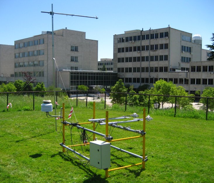
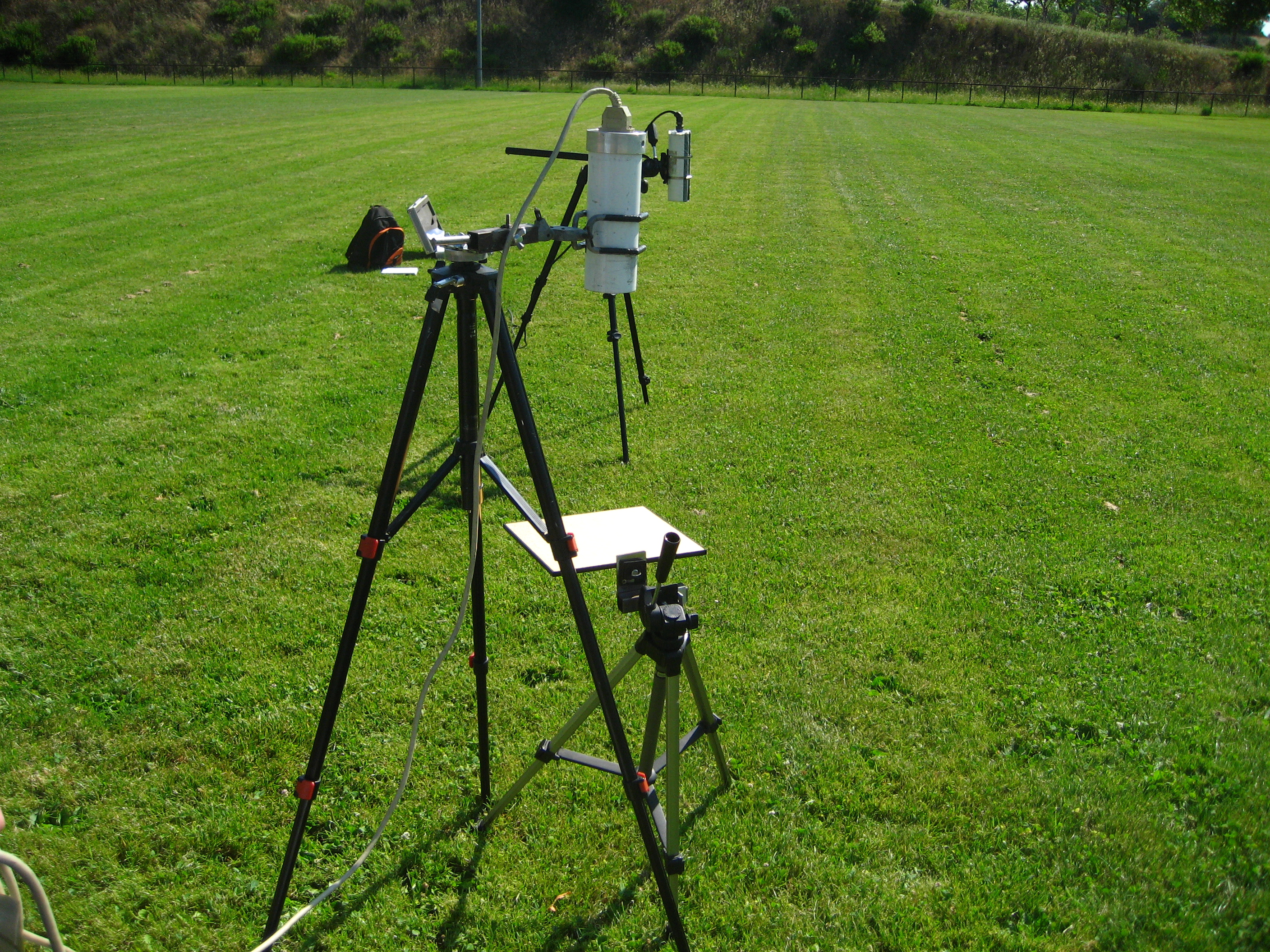
Rugby field ground measurement station
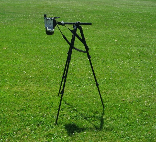
Thermal camera measurements
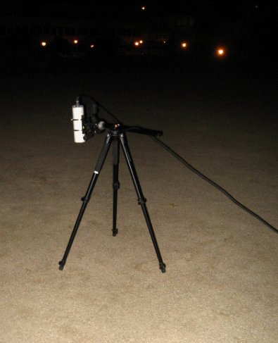
Thermal measurements at night
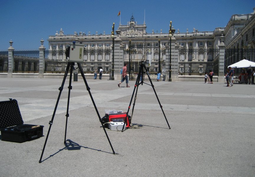
Thermal and visible range measurements in the Real Palace
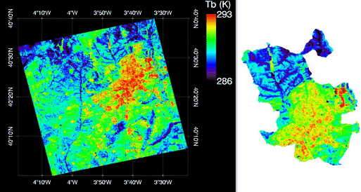
At-sensor brightness temperature obtained from ASTER TIR band 13 (10.66 um). ASTER image was acquired on 4-July, at night time. The image on the left shows the full ASTER scene (60x60 km2), whereas the right image shows a resize for the Madrid district.
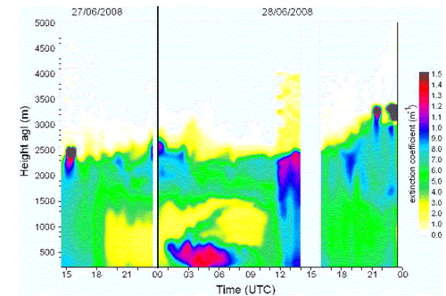
Extintion coefficient profiles during 27th and 28th June measured by the LIDAR system.
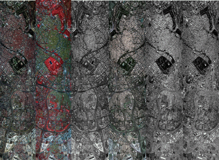
DESIREX 2008 UHI survey. FLIGHT 4. June 28, 2008 UTC1100. Set of quicklooks of P01 line (central part) from Pozuelo (NW) to Vallecas (SE), crossing the city center. Pixel size of 4.6m, GSD of 3.9m and swath of 3678m
In-situ calibration validation measurements in the visible range
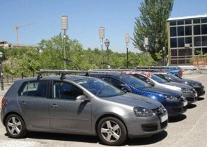
Cars aconditioned with Air temperature, Relative humidity and thermal radiometer sensors
In-situ calibration validation measurements in the thermal range
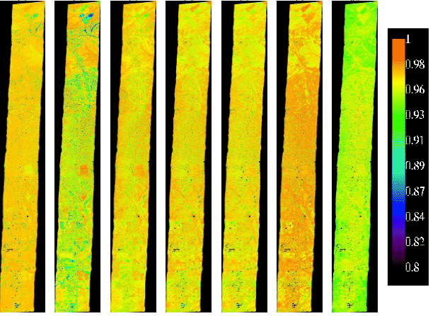
AHS emissivity image obtained with TES algorithm on July 4th at 11:32 UCT. It presents bands 72, 73, 75, 76, 77, 78 and 79 (left to right)
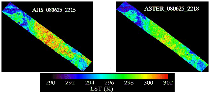
LST image from June 25th from AHS image resized to 90m resolution (left) and from ASTER image (right) at 2215 UTC (aprox.)
Classification map for the east-weat transect (AHS flight P01I1, 4th July at 11:16 UTC)
LST AHS image (top) with a line indicating the a spatial profile. Numbers correspondes to the position indicated in the LST profile (Bottom)