LINCE (Incidence Locator on the Roads of Spain) is a system for incorporating, managing and manipulating information about traffic events that has been designed for Dirección General de Tráfico.
VEOS (Event Geo-localized Visualization tool) is the system used by LINCE for visualizing, representing and making queries about traffic events information in real time on a WEB cartography.
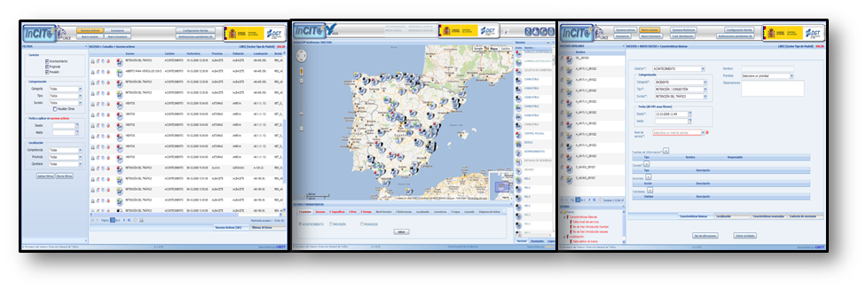
Description

LINCE (Incidence Locator on the Roads of Spain) is a system for incorporating, managing and manipulating information about traffic events that has been designed for Dirección General de Tráfico.
VEOS (Event Geo-localized Visualization tool) is the system used by LINCE for visualizing, representing and making queries about traffic events information in real time on a WEB cartography.
Both systems use a multilayered architecture that manages a group of databases, which are unique for all the DGT traffic management applications (the so-called INCITAR).
LINCE is a centralized WEB system for managing traffic events and conditions on the roads supervised by the 48 traffic management centres that are distributed in the country. It includes a verification system for adapting the functionalities and delimiting the actions that each user can undertake.
The system may be used for managing traffic events globally, making queries, filtering and exploiting existing and historical events, generating periodical alerts, distributing information automatically to other systems and users through email or messages, and so on. All this information may be used by operators on geo-referenced maps by using the VEOS application.
MARKETING: The LINCE and VEOS systems are marketed under the custom-made methodology and should be adapted to the characteristics of the management process of traffic incidences and events of the country and to the existing regulations in this area.
Non-UV principal researchers
Juan José Martínez Durá
Start date
2009
November
End date
2014
December
Funding agencies:
DGT