The project has three distinct sections:
- Definition of the evaluation plan and preparation of the initial models.
- Conducting studies for the validation and verification of the data coming from the measuring equipment.
- Study and development of new data models for the evaluation of traffic parameters.
a)Definition of the evaluation plan and preparation of the initial models.
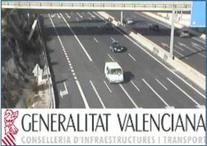
This section provides the necessary tools for the realisation of the evaluation and definition of systems, so that a protocol for testing equipment dependent of the Ministry of Infrastructure and Transport installed on the CV35 road can be established.
Covering the following points:
- Evaluation of different traffic parameters, determining the ranges of quality and admissible level of service and obtaining descriptors associated with the physical and geometrical features of the outline. The studies are based on the traffic parameters analysis that can be obtained directly from the sensors, such as intensity and speed, and others whose value has to be calculated depending on road and traffic parameters, as the level service.
- Identification and prioritization of the measurement points and regrouping in study areas, according to the characteristics of the road and traffic conditions.
- Defining an appropriate data model for the storage of traffic parameters to be evaluated. This model allows the calculation of indirect parameters and the obtaining of regular statistics on the performance and quality of installed equipment, and also the interpretation of the traffic evolution on the CV35 road.
- Development of a software application for recording, storing and processing of traffic parameters obtained from the measuring points, facilitating the validation of its correct functioning.
b)Conducting studies for the validation and verification of the data resulting from the measuring equipment.
A number of traffic studies on a set of defined areas have been done on the following roads: CV-35 from Valencia to Losa del Obispo and northern variant CV-50 of Benaguasil.
To that effect a number of monthly, determined and specified studies have been carried out, where the traffic behavior in these sectors and their development over the first ten months are analysed. On each of the road segments, including sensors, have been made the following analysis:
- Compilation and integration of basic parameters.
- Calculation and integration of complex parameters (demand average, hazard index, annual indicator of road traffic congestion, level of service (LOS), temporary reduction of capacity and service level (50 and 70), transverse roughness coefficient (CRT), international regularity index (IRI),traffic flow value at maximum 30 hours of the year.
- Collection and analysis of alarms in measurement systems.
- Periodic verification of the quality of basic data collected.
c)Study and development of new data models for the evaluation of traffic parameters.
A data model evolved over the initial basic model has been studied and designed, which offers higher performance on tasks measuring, monitoring and evaluation. Also, an analysis of basic requirements has been made for the architecture of a management and validation of quality traffic parameters system, an analysis and development of new data models for capturing and processing new information and a study and specification of new automated services for the evaluation and exploitation of information. This specification has focused on the following areas: road equipment inventory, monitoring and evaluation of the parameters and the quality of information, exploitation and reporting the real-time information, display of road equipment information by using the tool gvSIG oriented to manage the geographic information.
Conselleria de Infraestructuras y Transporte – Generalitat Valenciana


