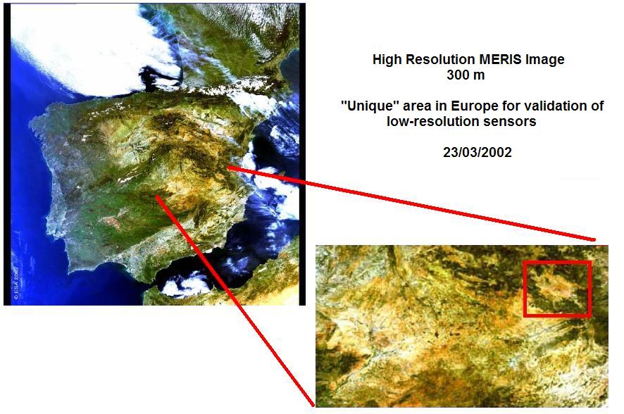
Location: Utiel-Requena Plateau (Valencia, Spain)
Coordinates: 39º3415N, 1º1718W [WGS84]
Height: 813 m over sea level
Relief: Plain (slope <2%) and wavely (8%-15%) regions, quaternary sediments surrounded by mountainous regions at North and East, and finally Gabriel river basin in western and southern slope.
Soil: Calcic and haplic soil. Deep soils with carbonates accumulated and low organic mater content.
Land uses: Vineyard crops surrounds Valencia Anchor Station, close to it there are olive and almond trees and not far pine and mediterranean forests.
Climate: Region presents a relative plain topography, but the little variations in height have a hard influence in the climate type. This it oscillates between semi-arid of Caudete de la Fuentes and Utiel stations, and the dry-subhumid of Villagordo del Cabriel station. Height diference between both climate types locates about 800-850 m levels
Annual average temperatures oscillate between the 12 ºC of Villagordo del Cabriel and the 14.2 ºC of Caudete de las Fuentes, whereas annual precipitation varies between the 396 mm of Utiel and the 451 mm of Caudete de las Fuentes and Villagordo del Cabriel. Frost-free period is the same for three stations, from May to November.
Maximum precipitations happen on spring and autumn. For the three stations maxim of spring occur on May, whereas for the autumn is variable, on October for the Caudete de las Fuentes and Utiel stations, and November for the Villagordo de Cabriel station.
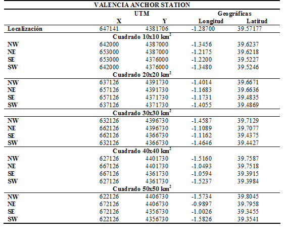
Coordinates location: UTM and geographic (longitude, latitude) location for Valencia Anchor Station and differents squares surround. (WGS-84)
 |