- Universitat de València
- Fundación Centro de Estudios Ambientales del Mediterráneo
- Niclos Corts, Raquel
- PDI-Catedratic/a d'Universitat
- Coordinador/a de Programa de Doctorat
- José Antonio Valiente Pardo
Measurement of land surface temperature (LST) and total precipitable water (TPW) is essential for understanding surface-atmosphere interactions and in a wide range of useful applications, both environmental and water, as well as meteorological and climatological. The estimation of these variables on a regional or synoptic scale uses satellite images taken by thermal infrared radiometers (TIR) in the case of the LST, and atmospheric sounders, mainly with bands in the near infrared (NIR) in the case of the TPW.
At the same time, these satellite sensors and their images require calibrations and validations against ground truth data that demonstrate their usefulness and accuracy. To date, in order to acquire these reference data, specific campaigns are usually designed in which measurements are acquired along transects in homogeneous and extensive areas. However, these campaigns are punctual and costly, so acquiring data from permanent stations is an advantage.
In some cases, measurements have been made on permanent sites with radiometers installed to observe the surface at nadir, or at a pair of fixed viewing angles with different radiometers, however this can lead to problems of instrumental response intercomparability.
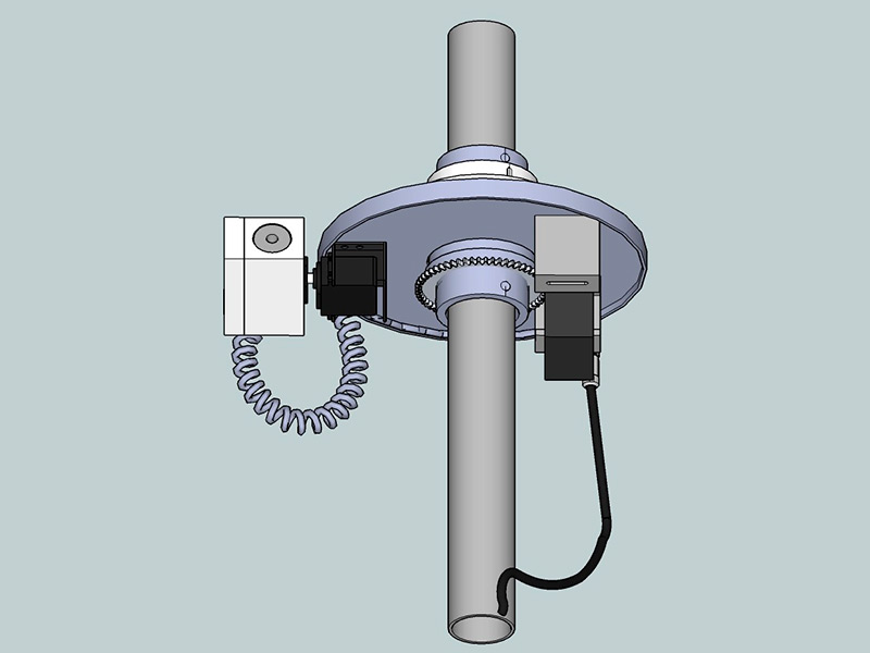
Researchers from UV and CEAM have developed a novel method and automatic field-measuring device for the calibration of radiometers on board satellites and/or validation of satellite products. The method allows continuous measurement by TIR radiometry of both variables, LST and TPW, which can serve as key surface and atmospheric data and as ground-truth data for the validation of Earth observation satellite products that are useful for the space sector.
The device incorporates in the design a system to perform angular sweeps, both on the land surface and the sky. The system points accurately a TIR radiometer using an accelerometer, which allows, besides a more precise pointing, the obtaining of the TPW, and thus a greater precision in the LST retrieval. The angular system also provides essential data to increase the knowledge of the emissive properties of the observed surfaces. All the observations are done with a single TIR radiometer, so the instrumental cost is much lower than the cost of making such measurements with the usual techniques, avoiding intercomparibility problems as well.
This invention has a wide range of environmental, meteorological, climatological and water applications, such as estimates of crop productivity and irrigation needs, among many other potential applications.
The advantages provided by the invention could be summarized in:
- better targeting of the device for continuous and autonomous acquisition of accurate directional TIR radiometric data from standard weather stations, thanks to the inclusion of an accelerometer in the angular system
- enables continuous TPW data collection in cloudless conditions, even at night, and improves LST data collection with the device
- a reduction of the instrumental cost necessary for these purposes, by requiring only one TIR radiometer,
- low cost of the device, low power consumption, as it can be powered by photovoltaic systems, and integrability in weather stations.
- Patent granted
Blasco Ibáñez Campus
C/ Amadeu de Savoia, 4
46010 València (València)


