
[<]Index of this webpage
**++Climatology from Satellites Group (GCS)++**
**++Research Lines++**
**I ''VALIDATION OF LOW SPATIAL RESOLUTION EARTH OBSERVATION REMOTE SENSING DATA AND PRODUCTS. THE VALENCIA ANCHOR STATION''**
**II ''SOIL & VEGETATION''** (tbc)
**III ''WATER STUDIES''**
**IV ''TERRESTRIAL APPLICATIONS OF GNSS-R, -IR''**
**V ''RADIATIVE BALANCE STUDIES (CERES, GERB, EarthCARE, SEVIRI)''**
**++[The Valencia Anchor Station https://tinyurl.com/yyzc4url]++**
**What is an ''ANCHOR STATION''**? (from Professor H.-J. Bolle † March 2013)
**Rationale**/
**Desirable measurements at ''Anchor Stations''**/
How Representative are the ''Valencia Anchor Stations'' measurements with respect to its surrounding meteorology?
**++Recent Research Projects++**
**++Publications++**
**Other Significant Publications++**
**++Capacity Building & Professional Education in Earth Observation**++
**++Postgraduate Course on ''New Observation and Watching Systems in Meteorology and Climatology''++**
**++Hosting Foreign Young Researchers / Students in Short Stays for I+D+i / Academic Work Activities**++
**++Acknowledgment**++
[<]
Climatology from Satellites Group (GCS)

[Climatology From Satellites Group]
Department of Earth Physics & Thermodynamics
Faculty of Physics
University of Valencia
Ernesto Lopez Baeza
A/Professor of Applied Physics (Profesor Titular de Fisica Aplicada)
Ernesto.Lopez(at)uv.es
Tel. (direct): +34.96.354.4049
Tel. (research group): +34.96.354.4048
Tel. (Dept. Secretariat): +34.96.354.4350

Erika Albero Peralta
Research Assistant. Regional Government Grant for Doctorate in Remote Sensing
Erika.Albero(at)uv.es
Tel. (research group): +34.96.354.4048
Tel. (Dept. Secretariat): +34.96.354.4350
Research Lines
I VALIDATION OF LOW SPATIAL RESOLUTION EARTH OBSERVATION REMOTE SENSING DATA AND PRODUCTS. THE VALENCIA ANCHOR STATION
I.1 Validation Site Characterization
I.2 Development of validation methodologies
• I.2.1 Soil moisture content and vegetation water content
• I.2.2 Vegetation biophysical parameters (fraction of absorbed photosynthetic active radiation -fAPAR, terrestrial chlorophyll, leaf area index -LAI)
• I.2.3 Radiation (including cloud and aerosol effects)
II SOIL & VEGETATION (tbc)
III WATER STUDIES
III.1 Development of a reliable soil moisture network
III.2 Soil moisture upscaling and downscaling techniques
III.3 Impact of soil moisture on land surface - atmosphere interactions
III.4 Remote Sensing for Water Management Optimisation (RESEWAM-O)

Fig. 1. Valencia Anchor Station soil moisture network

Fig. 2. Soil moisture validation methodology. Generation of ground-based soil moisture maps (upscaling) from the soil moisture network measurements through the definition of homogeneous physio-hydrological units considering soil type, vegetation cover, lithology, physiography topography, ...
(Ernesto Lopez-Baeza & the VAS Team: Ahmad Al Bitar, M. Carmen Antolin, Jan Balling, Fernando Belda, Catherine Bouzinac, Alejandro Buil, Fernando Camacho, Aurelio Cano, Ester Carbo, J. Cernicharo, M. Amparo Coll, Malcolm Davidson, Steven Delwart, Arancha Fidalgo, Achim Hahne, Silvia Juglea, Yann Kerr, Beatriz Martinez, Christian Mätzler, Susanne Mecklenburg, Arnaud Mialon, Cristina Millan, Cecilia Narbon, Mickael Parde, Fernando Requena, Kauzar Saleh, Mike Schwank, Niels Skou, Sten S. Søbjærg, Jorge Tamayo, I Torralba, Elena Torre, Ingo Voelksch, Jean-Pierre Wigneron, Patrick Wursteisen, Mehrez Zribi (2019): Towards Validation of SMOS Land Products Using the Synergy Between Models, Airborne and Ground-based Data Over the Valencia Anchor Station. Definition of Matching-up Points to SMOS Observations. IEEE International Symposium on Geoscience and Remote Sensing-IGARSS 2010. Remote Sensing: Global Vision for Local Action. Session on SMOS: The Beginning of an L-band Generation of Global Remote Sensed Soil Moisture Observations II. Honolulu, Hawaii, 25-30 July 2010)
IV TERRESTRIAL APPLICATIONS OF GNSS-R, -IR
IV.1 Intercomparison of different GNSS receivers
IV.2 Intercomparison of different configurations (Beidou, Galileo, GPS, GLONASS)
• IV.2.1 soil moisture
• IV.2.2 vegetation

SOMOSTA (SOil MOisture STAtion) Experiment (2014-2016): Intercomparison of L-Band GNSS-R and ELBARA-II passive radiometer soil moisture retrievals with in situ ground measurements at the Valencia Anchor Station. GNSS-R retrieved soil moisture is in good agreement with the soil moisture probes. Both L-band remote sensing techniques show the same variation tendency and are sensitive to the influence of precipitation (Cong et al., 2019)

SOMOSTA (SOil MOisture STAtion) Experiment (2018- ): Intercomparison of CHC_N72 and Trimble GNSS receivers as a previous step to intercomparing their respective soil moisture retrievals both under the different BeiDou, Galileo, GPS and GLONASS constellations (Lopez-Baeza et al., 2018)

Preliminary analysis of the variation pattern of the SNR registered at the RHCP antenna of the CHC-N72 receiver showing amplitudes and initial phases (Lopez-Baeza et al., 2018)
[Lopez-Baeza, Ernesto; Lei Yang, Mutian Han, Julian Tortola, Lili Jing, Cong Yin, Erika Albero, Jose Darrozes, Dongkai Yang, Natalia Garrido, Jose Luis Berne, Manuel Martin-Neira (2018): GNSS-IR Soil Moisture Retrieval at the Valencia Anchor Station . 7th Joint China-ESA GNSS-R Workshop, Beijing, China, 19 Nov 2018]

Results obtained over the successive locations of the CHC-N72 receiver at the Valencia Anchor Station (Yang et al., 2021)
[Lei Yang, Ernesto Lopez-Baeza, Zhouzhou Ma, Xuebao Hong, Dongkai Yang, Lili Jing, Fan Gao, Jose Darozzes (2021): GNSS-R Soil Moisture Inversion Using Robust Kalman Filter Model and Status Update at the Valencia Anchor Station. 10th Joint China-ESA GNSS-R Workshop, Beijing, China, Nov 17-19, 2021]
V RADIATIVE BALANCE STUDIES (CERES, GERB, EarthCARE, SEVIRI)
V.1 top of the atmosphere, atmosphere, surface
V.2 clear sky, all sky
V.3 radiative transfer models
The Valencia Anchor Station

What is an ANCHOR STATION? (from Professor H.-J. Bolle † March 2013)
Anchor Stations are instrumented sites to measure in representative areas quantities which are needed to
• run
• calibrate
• validate
models and algorithms e.g. such as those needed to quantitatively evaluate satellite data and convert them into geophysical information.
The stations must be instrumented with equipment for long time measurements of basic quantities (meteorological and hydrological background data) and, in addition, for quantities that are not readily assessed at operational meteorological and hydrological stations.
Anchor Stations, furthermore, must offer the infrastructure to undertake more refined measurements for shorter intensive observation periods in the surrounding of the station.
In addition to background quantities (temperature, moisture, pressure), they should also be measured:
• fluxes (surface albedo, the four components of net radiation, soil heat flux, sensible and latent heat flux, carbon fluxes, water fluxes in the soil),
Bowen ratio
• spectral atmospheric optical depth
• atmospheric water vapour
• aerosol parameters
• ground water level
• soil moisture
• vegetation parameters (type, height or z0, resistances, biomass, NPP, LAI)
Not all Anchor Stations need to measure all parameters permanently
Rationale/
Mesoscale models
can in principle be operated with little instantaneous input from ground observations if topography and synoptic scale flow are known. Whether they produce the correct interactions with the surface (momentum, energy and mass fluxes) must be checked at least occasionally by direct measurements
Hydrological models
The same is true. In their case, it has to be validated whether they produce the correct soil moisture and run-off
Satellite data
are evaluated with complicated algorithms that tie the measured radiances to surface properties. These algorithms have to be tested against direct measurements and satellite instruments have to be re-calibrated

(From F. Becker, H.-J. Bolle and P.R. Rowntree, 1988, The International Satellite Land Surface Climatology Project)
Climate models
Not only need in addition to meteorological data carbon dioxide and other trace gas fluxes, they also need, according to the latest results, aerosol data. Anchor Stations should therefore also be equipped with instrumentation for spectral optical depth measurements or other kind of equipment that provides information about aerosol concentrations and types. The state of vegetation can, to some degree, be estimated from satellite observations. The conclusions from such kind of measurements may, however, be misleading if no ground truth is available
Desirable measurements at Anchor Stations/
Continuously:
• Atmospheric transmittance (spectral)
• Net radiation flux; preferable all four radiation fluxes plus in addition independently the net flux
• Bowen ratio (including the measurements of air temperature and humidity at two levels)
• Soil heat fluxes and temperatures at least at four levels
• Precipitation
• Soil moisture at three levels: near surface, intermediate, root layer
• Effective radiation temperature of the surface
• Ground water (piezometric) level
Occasionally (especially under extreme situations):
• Sensible and latent heat fluxes separately by advanced methods (e.g. eddy correlation)
• Vegetation parameters such as leaf area index (LAI), fractional coverage, biomass area density, stem flow, stomata resistance, vegetation height, vegetation structure, leaf orientation & size
• Land use at and around the station
From time to time at longer intervals:
• Soil quality
• Radiometric characteristics (e.g. reflectance function)
At the central data bank the following derived quantities have to be computed from the measured values:
• Wavelength dependent optical depth and vertical distribution of water vapour mass as needed for the correction of satellite data. The goal must be to derive a climatology of aerosol optical properties for the region. If reliable algorithms become available to compute atmospheric corrections from measurements made in space, this network serves the validation of these algorithms and the quality control of atmospheric corrections. This task can be supported by measurements made in the areas of the anchor stations by aircraft in order to obtain a better areal coverage.
• Daily and monthly values of all flux components (radiation, sensible heat, latent heat, soil heat flux respectively heat storage in the soil).
• Soil moisture as the difference between precipitation, latent heat flux, and storage.
• Ratio of directional reflectance to albedo (according to models parametrized with respect to the measured quantities that are still to be developed).
• Surface conductance.

Instruments on the Valencia Anchor Station
How Representative are the Valencia Anchor Stations measurements with respect to its surrounding meteorology?
The application of the Valencia Anchor Station to validation activities of low spatial resolution Earth Observation remote sensing missions makes it necessary to study the representativity and significance of the actual meteorological station measurements with respect to the area that it represents.
Meteorological simulations carried out with The Atmospheric Pollution Model (TAPM) (Hurley, 2005) were performed for the whole year of 2004 with the temporal resolution of 1 h (Vidal et al., 2007). The spatial resolution was 1 km, covering a total area of 75 x 75 km2. The grid was chosen such that the Anchor Station is placed in the central point, that is, the coordinate (38, 38).
The correlation between the simulated time series for every grid point and the Anchor Station simulated values was established by means of the Pearson's correlation coefficient. The following figure shows the correlation maps obtained for the parameters analysed, namely, temperature, relative humidity, u and v wind components, and precipitation.

Correlation maps centered at the Valencia Anchor Station relative to the meteorological parameters: a) temperature, b) relative humidity, c) u wind component, d) v wind component, e) precipitation (Vidal et al., 2007)
A limit was established in the correlation coefficients for each of the parameters. The zone of influence of the whole station was taken as the intersection of the zones obtained for each of the parameters. Instead of using five correlation coefficients -one for each parameter-, a specific percentile value, namely, 75, 85, 95, was chosen as limiting value for each of the correlation coefficients, thus defining different approximations degrees. The values of the limiting correlation coefficients relative to each meteorological parameter and for each proposed percentile are given in the Table shown in the figure above.
The graphical representation of the intersection of the areas obtained for each meteorological parameter is also shown in the bottom right figure above, where the red area represents the intersection of the zones obtained for each parameter taking as limiting R values those obtained for percentile 95; the yellow area for percentile 85 and the white area for percentile 75. The black area shows lower correlation values.
References
• Hurley P. (2005): The Air Pollution Model (TAPM) Version 3. Part 1: Technical Description, CSIRO Atmospheric Research Technical Paper No. 55
• Vidal,S.; C. Narbon, A. Cano, E. Lopez-Baeza (2007): Methodology for the Definition and Delimitation of Validation Areas for Remote Sensing Algorithms and Low-resolution Products. Application to the Valencia and Alacant Anchor Stations. IEEE International Geoscience and Remote Sensing Symposium, Barcelona, Spain, 23-27 July 2007
Recent Research Projects
Ground Based Observations for Validation (GBOV) of Copernicus Global Land Products
(2017- )
Joint Research Center ITT JRC/IPR/2016/D.6/5019/OC. ACRI-ST(France), leader of the consortium with partners UCL Consultants (UK), University of Leicester (UK), University of Southampton (UK), University of Valencia (Spain), and INFORMUS (Germany) (assistant)
The GBOV service provides multiple years of high quality in-situ measurements to validate 7 core land products (Top-of-canopy reflectances, Surface albedo, fAPAR, LAI, fCover, Land Surface Temperature and Soil Moisture)


Comparison of the three upscaling proposed methods for soil moisture, namely simple average, TVDI-weighted average and land cover weighted average over the Valencia Anchor Station (2014). Figure 11 in GBOV Algorithm Theoretical Basis Document. Soil Moisture Products(LP06, RM10 and RM11)
Validation of Earth Observation Data and Products at the Valencia Anchor Station (VARIETAL-2). Application to OLCI, EarthCARE and GNSS-R Missions
(2018-2019)
(Spanish State Agency for Research. Ministry for Science, Innovation and Universities)
Since January 2002, the Valencia Anchor Station has successfully been the center of operations of the Climatology from Satellites Group (GCS) contributing to the validation of Earth Observation products from the CERES, GERB, SMOS, SMAP, Copernicus Sentinels, EPS/MetOp, IASI missions, and complementary activities in the framework of EarthCARE and other GNSS-R missions. The Valencia Anchor Station and VARIETAL-2 try now to continue offering the suitable good natural, human and scientific conditions for the validation of low-spatial resolution Earth Observation missions.
Together with the continuation of ground-based soil moisture measurements from the Valencia Anchor Station network, the VARIETAL-2 Project will continue offering a unique robust validation site for the Sentinel-3 OLCI mission with respect to the ground-based measurements of FAPAR, LAI, chlorophyll and now with ground estimations of nitrogen. Also included in the site, there is a robust met station, a fully equipped shortwave and longwave radiation station with sun-tracking direct radiation measurements, and an eddy-covariance station including water vapour
and carbon fluxes estimations.
The excellent collaboration with the European Space Agency (ESA), Beihang University, Beijing, China, Shandong Agricultural University, China, and the Chinese Meteorological Administration (CMA), leads the VARIETAL-2 Team to continue with the GNSS-R intercomparison experiments proposing now more advanced activities on the determination of soil and vegetation moisture by reflected GNSS signals. The VARIETAL-2 Team counts on the use of the GNSS reflectometry application system for retrieval of soil moisture, CHC-N72, that utilises BeiDou, Galileo, GPS and GLONASS reflected signals to retrieve land surface soil moisture within a certain area with the ground-based configuration. The Department of Cartographic Engineering, Geodesy and Photogrammetry, Polytechnic University of Valencia, is also providing their TRIMBLE R10 GNSS receiver for the experiment.
The third task incorporates the preparation for the validation of EarthCARE. The GCS contributed to the ESA EarthCARE MAG (Mission Advisory Group) from the beginning of the mission, year 2000, to 2007 and was in charge of the development of the BroadBand Radiometer (BBR). The GCS is now collaborating with the Royal Meteorological Institute of Belgium (RMIB) to participate in the consortium of the EarthCARE BBR L1 and L2 Products Assessment project (ESA AO for EarthCARE CalVal, ID 37730). With the Valencia Anchor Station activities, the GCS is contributing to the development of the work package WP5 of the project on Quantitative Evaluation of Level 2 Flux Products, Closure Analysis which constitutes part of the VARIETAL-2 Task 3.
Validation of Earth Observation Data and Products at the Valencia and the Alacant Anchor Stations
(2016-2018)
(Spanish State Agency for Research. Ministry for Science, Innovation and Universities)
The project Validation of Earth Observation Data and Products at the Valencia and the Alacant Anchor Stations of the Spanish Space Research Programme has been able to combine and optimise the knowledge, experience and resources of the Climatology from Satellites Group (GCS), collaborators of the Polytechnic University of Valencia and other international collaborators to validate products of the space missions SMOS, SMAP, Copernicus Sentinel-3 OLCI (OGVI and OTCI) and initiate the preparation for the validation of EarthCARE and other GNSS-R missions. The project once again highlights the excellent characteristics of the Valencia Anchor Station (homogeneity, topography, land uses, climate, etc.) as a reference area to provide independent measurements and estimations of area-averaged products to establish the quality of the significant related products of the above mentioned missions.
In relation to soil moisture content, the VARIETAL has continued keeping and maintaining the GCS sensor network (Fig. 1) to produce data for this parameter and compose area-integrated values that are systematically used in the SMAP validation (Das et al. , 2018, Colliander et al., 2017, 2018, Reichle et al., 2017 and Seung-bum, et al., 2017). Even the project has contributed, with the ELBARA-II radiometer work, to the SMOS Science Group to propose a new algorithm SMOS INRA-CESBIO (SMOS-IC) that allows to provide global soil moisture and vegetation optical thickness research products in a more simplified way than the original operating algorithm, being these products more robust and less affected by potential uncertainties stemming from the heterogeneity of the vegetation cover (for example over forests), from the instrument antenna pattern and from the complex SMOS observation geometry (Fernandez-Morán et al. , 2017, CATDS SMOS-IC).
In relation to vegetation biophysical products, VARIETAL has allowed the installation and setting up of 4 measuring stations of the four independent flows that determine the fraction of the photosynthetically active radiation absorbed by the vegetation (fAPAR) to carry out photosynthesis and where chlorophyll concentration content and leaf area index (LAI) of the plant have also been measured. The validation results of these parameters in relation to Sentinel-3 OLCI corresponding products have been presented at the appropriate scientific meetings (Lopez-Baeza et al. 2016, 2017). Thanks to the good work done and properly shown, the VARIETAL Research Team was asked to host the NERC (National Environmental Research Council) Airborne Campaign at the Valencia Anchor Station (NERC_AC@VAS) for the validation of the land OTCI (OLCI Terrestrial Chlorophyll Index) and OGVI (OLCI Global Vegetation Index) products of Sentinel-3. The campaign developed during the period 13-19 June 2017 which, in addition to producing significant communications in international congresses, has originated the publication by (Brown et al ., 2019).
VARIETAL has also contributed to the final defense of the Doctoral Theses of M.A. Coll Pajarón (2017), M.A. Benlloch Casabán (2017) and R. Fernández Morán (2018).
The excellent contribution of other members of the VARIETAL Task Force, in this case from the School of Electronic and Information Engineering, BeiHang University, Beijing, China, and the School of Information Science and Technology, Shandong Agricultural University, China which, together with the Chinese Meteorological Administration, have offered GCS the possibility of jointly establishing a Joint GNSS-R Laboratory for Terrestrial Applications of GNSS. The first step was the possibility for the GCS of the indefinite use and exploitation of the BGRSv1 product developed by SDOE (Shandong Orientation Electronic Technology, Co. Ltd) of the People's Republic of China, to continue developing joint future research at the Valencia Anchor Station. This instrument uses signals from the BeiDou, Galileo, GPS and GLONASS GNSS systems to estimate soil moisture content and other biophysical parameters of the vegetation.

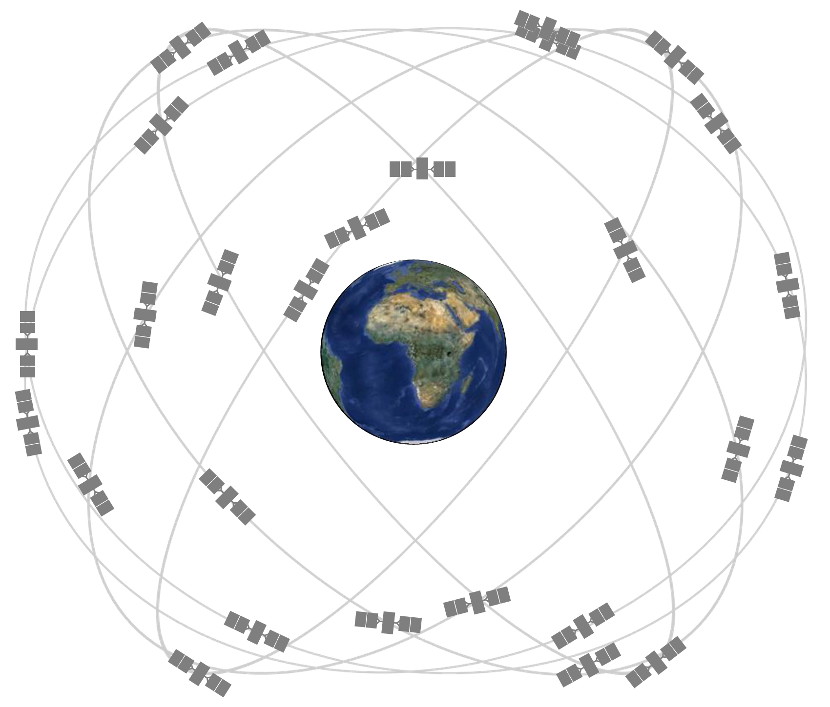
From left to right: Illustration of the future Compass/BeiDou-2 constellation (image credit: CSNPC). The Galileo constellation of 30 spacecraft (image credit: ESA). GPS constellation: Expandable 24-Slot satellite constellation, as defined in the SPS Performance Standard. The GLONASS constellation includes 24 satellites evenly spread over three orbital planes in groups of eight
References
• Benlloch Casabán, M.A. (2017): Comparación de las temperaturas de brillo en banda L proporcionadas por SMOS y Aquarius sobre distintas zonas de La Tierra (in Spanish) [Comparison of L-band brightness temperatures provided by SMOS and Aquarius over different zones of the Earth]. Doctorate on Remote Sensing. Supervisors: E. López Baeza and E. Navarro Camba. University of Valencia
• Brown, Luke A., Jadunandan Dash, Antonio L. Lidón, Ernesto Lopez-Baeza, and Steffen Dransfeld (2019): Synergetic Exploitation of the Sentinel-2 Missions for Validating the Sentinel-3 Ocean and Land Colour Instrument (OLCI) Terrestrial Chlorophyll Index (OTCI) over a Vineyard Dominated Mediterranean Environment. Journal of Selected Topics in Applied Earth Observations and Remote Sensing, JSTARS (accepted)
• Coll Pajarón, M.A. (2018): Distribución de la humedad de suelo mediante observaciones del satélite SMOS, modelización con SurfEx y medidas in situ sobre la Valencia Anchor Station (in Spanish) [Soil moisture distribution through SMOS observations, SurfEx modeling and in situ measurements over the Valencia Anchor Station]. Supervisors E. López Baeza and S. Khodayar. University of Valencia
• Fernández Morán, R. (2018): Calibration of soil roughness and vegetation parameters in the SMOS retrieval algorithm and validation at local and global scale. Doctorate on Remote Sensing. Supervisors: J.-P. Wigneron, Y.H. Kerr and E. López Baeza. University of Valencia
• Lopez-Baeza, E., A. Lidon, E. Albero, E. Asadi, I. Bautista, D. Castaño, D. Catalan, C. Garcia, D. Iglesias, C. Lull (2016): First OLCI-Land-Val S3VT Project (AO #13767) Validation Results at the Valencia Anchor Station. Sentinel-3A Expert Users Meeting on Preliminary User Feedback on Sentinel-3A Data, ESA-ESRIN, Frascati, 28-30 June 2016
• Lopez-Baeza, E., A. Lidon, E. Albero, I. Bautista, D. Castaño, D. Iglesias, C. Lull, F.M. Martinez Campos (2017): Full Vine Phenological Cycle OLCI Ground Validation Measurements at the Valencia Anchor Station [OLCI-Land-Val S3VT Project (AO #13767)]. Sentinel-3 Validation Team Meeting (S3VTM). 15-17 February 2017, ESRIN, Frascati, Italy
Publications
2022
Abdolreza Ansari Amoli, Hossein Aghighi and Ernesto Lopez-Baeza (2022). Drought Risk Evaluation in Iran by Using Geospatial Technologies. Remote Sens. 2022, 14(13), 3096; . 10th paper within Remote Sensing Special Issue on Earth Observation in Support of Sustainable Soils Development https://doi.org/10.3390/rs14133096 - 27 Jun 2022
Ebrahim Asadi Oskouei, Bahareh Delsouz Khaki, Saeedeh Kouzegaran, Mir Naser Navidi, Masoud Haghighatd, Naser Davatgar, and Ernesto Lopez-Baeza (2022). Mapping Climate Zones of Iran Using Hybrid Interpolation Methods. Remote Sens. 2022, 14(11), 2632; . 9th paper within Remote Sensing Special Issue on Earth Observation in Support of Sustainable Soils Development https://doi.org/10.3390/rs14112632 - 31 May 2022
2021
Ernesto Lopez-Baeza, Antonio Lidon Cerezuela, José Darrozes, Guest Editors (2021). Special Issue Earth Observation in Support of Sustainable Soils Development. A special issue of Remote Sensing (ISSN 2072-4292). Closing (20 June 2022) Ongoing.
Carbó, E.; Juan, P.; Añó, C.; Chaudhuri, S.; Diaz-Avalos, C.; López-Baeza, E. (2021). Modeling Influence of Soil Properties in Different Gradients of Soil Moisture: The Case of the Valencia Anchor Station Validation Site, Spain. Remote Sens. 2021, 13, 5155; . 8th paper within Remote Sensing Special Issue on Earth Observation in Support of Sustainable Soils Development https://doi.org/10.3390/rs13245155
Volanti, M., C. Cubillas Martínez, D. Cespi, E. Lopez-Baeza, I. Vassura, F. Passarini (2021). Environmental sustainability assessment of organic vineyard practices from a life cycle perspective. Int. J. Environ. Sci. Technol. (2021)
V. Vazquez-Verdera, J. Domingo, E. Dura, D. Gabaldon-Estevan, E. Lopez-Baeza, S. Machause Lopez, F. Meco-Tebar, S. Rueda, J.J. Serrano-Lara, I. Signes-Soler, M.L. Vazquez de Agredos Pascual and E. Martinez-Garcia (2021). The Future We Want: a Learning Experience to Promote SDGs in Higher Education from the United Nations and University of Valencia. Sustainability, 2021, vol 13, Issue 15, 8550;
A. Colliander, R.H. Reichle, W.T. Crow, M.H. Cosh, F. Chen, S. Chan, N. Das, R. Bindlish, J. Chaubell, S.B., Kim, Q. Liu, P. O’Neill, R.S. Dunbar, L. Dang, J. Kimball, T.J. Jackson, H.K. al Jassar, J. Asanuma, B. K., Bhattacharya, A. Berg, D.D. Bosch, L. Bourgeau-Chavez, T. Caldwell, J-C. Calvet, C. Holifield Collins, K.H., Jensen, S. Livingston, E. Lopez-Baeza, J. Martínez-Fernández, H. McNairn, M. Moghaddam, C. Montzka, C., Notarnicola, T. Pellarin, I. Pfeil, J. Pulliainen, J. Ramos, M. Seyfried, P. Starks, Z. Su, Rogier van der Velde, Yijian Zeng, M. Thibeault, M. Vreugdenhil, J.P. Walker, M. Zribi, D. Entekhabi, S. Yueh (2021): Validation of Soil Moisture Data Products from the NASA SMAP Mission. Submitted to IEEE JSTARS, TechRxiv. Preprint.
2020
Jamei, M.; Mousavi Baygi, M.; Oskouei, E.A.; Lopez-Baeza, E. (2020). Validation of the SMOS Level 1C Brightness Temperature and Level 2 Soil Moisture Data over the West and Southwest of Iran. Remote Sens. 2020, 12, 2819; . 3rd paper within Remote Sensing Special Issue on Earth Observation in Support of Sustainable Soils Development
Montzka, C., M. Cosh, B. Bayat, A. Al Bitar, A. Berg, R. Bindlish, H. R. Bogena, J. D. Bolten, F. Cabot, T. Caldwell, S. Chan, A. Colliander, W. Crow, N. Das, G. De Lannoy, W. Dorigo, S. R. Evett, A. Gruber, S. Hahn, T. Jagdhuber, S. Jones, Y. Kerr, S. Kim, C. Koyama, M. Kurum, E. Lopez-Baeza, F. Mattia, K. McColl, S. Mecklenburg, B. Mohanty, P. O´Neill, D. Or, T. Pellarin, G. P. Petropoulos, M. Piles, R. H. Reichle, N. Rodriguez-Fernandez, C. Rüdiger, T. Scanlon, R. C. Schwartz, D. Spengler, P. Srivastava, S. Suman, R. van der Schalie, W. Wagner, U. Wegmüller, J.-P. Wigneron, F. Camacho, and J. Nickeson (2020): Soil Moisture Product Validation Good Practices Protocol Version 1.0. In: C. Montzka, M. Cosh, J. Nickeson, and F. Camacho (Eds.): Good Practices for Satellite Derived Land Product Validation (p. 123), Land Product Validation Subgroup (WGCV/CEOS),
2019
Cong Yin, Ernesto Lopez-Baeza, Manuel Martin-Neira, Roberto Fernandez-Moran, Lei Yang, Enrique A. Navarro-Camba, Alejandro Egido, Antonio Mollfulleda, Weiqiang Li, Yunchang Cao, Bin Zhu and Dongkai Yang (2019): Intercomparison of Soil Moisture Retrieved from GNSS-R and from Passive L-Band Radiometry at the Valencia Anchor Station. Sensors 2019, 19(8), 1900 DOI: 10.3390/s19081900
Narendra N. Das, Dara Entekhabi, R. Scott Dunbar, Mario J. Chaubell, Andreas Colliander, Simon Yueh, Thomas Jagdhuber, Fan Chen, Wade Crow, Peggy E. O'Neill, Jeffrey P. Walker, Aaron Berg, David D. Bosch, Todd Caldwell, Michael H. Cosh, Chandra H. Collins, Ernesto Lopez-Baeza, Marc Thibeault (2019): The SMAP and Copernicus Sentinel 1A/B microwave active-passive high resolution surface soil moisture product. Remote Sensing of Environment 233 (2019) 111380. DOI: 10.1016/j.rse.2019.111380
Brown, Luke A., Jadunandan Dash, Antonio L. Lidón, Ernesto Lopez-Baeza, and Steffen Dransfeld (2019): Synergetic Exploitation of the Sentinel-2 Missions for Validating the Sentinel-3 Ocean and Land Colour Instrument (OLCI) Terrestrial Chlorophyll Index (OTCI) over a Vineyard Dominated Mediterranean Environment. Journal of Selected Topics in Applied Earth Observations and Remote Sensing, JSTARS, vol. 12, no. 7, pp. 2244-2251, July 2019 DOI: 10.1109/JSTARS.2019.2899998
Khodayar Samiro, Amparo Coll, Ernesto Lopez-Baeza (2019). An improved perspective in the spatial representation of soil moisture: Potential added value of SMOS disaggregated 1 km resolution "all weather" product. Hydrology and Earth System Sciences 23(1):255-275. DOI: 10.5194/hess-23-255-2019
2018
Das, N.N., D. Entekhabi, R.S. Dunbar, A. Colliander, F. Chen, W. Crow, T.J. Jackson, A. Berg, D.D. Bosch, T. Caldwell, M.H. Cosh, C.H. Collins, E. Lopez-Baeza, M. Moghaddam, T. Rowlandson, P.J. Starks, M. Thibeault, J.P. Walker, X. Wu, P.E. O'Neill, S. Yueh, E.G. Njoku (2018): The SMAP mission combined active-passive soil moisture product at 9 km and 3 km spatial resolutions. Remote Sensing of Environment 211 (2018) 204-217, DOI: 10.1016/j.rse.2018.04.011
Colliander, A., T.J. Jackson, S.K. Chan, P. O'Neill, R. Bindlish, M.H. Cosh, T. Caldwell, J.P. Walker, A. Berg, H. McNairn, M. Thibeault, J. Martínez-Fernández, K.H. Jensen, J. Asanuma, M.S. Seyfried, D.D. Bosch, P.J. Starks, C. Holifield Collins, J.H. Prueger, Z. Su, E. Lopez-Baeza, S.H. Yueh (2018): An assessment of the differences between spatial resolution and grid size for the SMAP enhanced soil moisture product over homogeneous sites. Remote Sensing of Environment 207 (2018) 65-70, DOI: 10.1016/j.rse.2018.02.006
Lopez-Baeza, Ernesto; Albero-Peralta, Erika; Rivero Moro, C.; Catalán Alcober, D.; Baur, T.; Bansal, R. (2018): Diagnosing the Burjassot Urban Drainage System. THE EVER GROWING USE OF COPERNICUS ACROSS EUROPE’S REGIONS. A selection of 99 user stories by local and regional authorities. Copernicus4Regions. European Commission, European Space Agency and Network of European Regions Using Space Technologies (NEREUS), pg. 188-189
2017
Reichle, R.H., G.J. De Lannoy, Q. Liu, J.V. Ardizzone, A. Colliander, A. Conaty, W. Crow, T.J. Jackson, L.A. Jones, J.S. Kimball, R.D. Koster, S.P. Mahanama, E.B. Smith, A. Berg, S. Bircher, D. Bosch, T.G. Caldwell, M. Cosh, Á. González-Zamora, C.D. Holifield Collins, K.H. Jensen, S. Livingston, E. Lopez-Baeza, J. Martínez-Fernández, H. McNairn, M. Moghaddam, A. Pacheco, T. Pellarin, J. Prueger, T. Rowlandson, M. Seyfried, P. Starks, Z. Su, M. Thibeault, R. van der Velde, J. Walker, X. Wu, and Y. Zeng (2017): Assessment of the SMAP Level-4 Surface and Root-Zone Soil Moisture Product Using In Situ Measurements. J. Hydrometeor., Published Online: 28 July 2017 DOI: 10.1175/JHM-D-17-0063.1
Fernandez-Moran, R., J.-P. Wigneron, G. De Lannoy, E. Lopez-Baeza, M. Parrens, A. Mialon, A. Mahmoodi, A. Al-Yaari, S. Bircher, A. Al Bitar, P. Richaume, Y. Kerr (2017): A new calibration of the effective scattering albedo and soil roughness parameters in the SMOS SM retrieval algorithm. International Journal of Applied Earth Observation and Geoinformation, Volume 62, October 2017, Pages 27-38. DOI: 10.1016/j.jag.2017.05.013
Fernandez-Moran, R.; Al-Yaari, A.; Mialon, A.; Mahmoodi, A.; Al Bitar, A.; De Lannoy, G.; Rodriguez-Fernandez, N.; Lopez-Baeza, E.; Kerr, Y.; Wigneron, J.-P. (2017): SMOS-IC: An Alternative SMOS Soil Moisture and Vegetation Optical Depth Product. Remote Sens. 2017, 9, 457 doi:10.3390/rs9050457
A. Colliander, T.J. Jackson, R. Bindlish, S. Chan, N. Das, S.B. Kim, M.H. Cosh, R.S. Dunbar, L. Dang, L. Pashaian, J. Asanuma, K. Aida, A. Berg, T. Rowlandson, D. Bosch, T. Caldwell, K. Caylor, D. Goodrich, H. al Jassar, E. Lopez-Baeza, J. Martínez-Fernández, A. González-Zamora, S. Livingston, H. McNairn, A. Pacheco, M. Moghaddam, C. Montzka, C. Notarnicola, G. Niedrist, T. Pellarin, J. Prueger, J. Pulliainen, K. Rautiainen, J. Ramos, M. Seyfried, P. Starks, Z. Su, Y. Zeng, R. van der Velde, M. Thibeault, W. Dorigo, M. Vreugdenhil, J.P. Walker, X. Wu, A. Monerris, P.E. O'Neill, D. Entekhabi, E.G. Njoku, S. Yueh (2017): Validation of SMAP surface soil moisture products with core validation sites. Remote Sensing of Environment 191 (2017) 215-231 <http://dx.doi.org/10.1016/j.rse.2017.01.021>
Seung-bum Kim, Jakob J. van Zyl, Joel T. Johnson, Matha Moghaddam, Leung Tsang, Andreas Colliander, R. Scott Dunbar, Thomas J. Jackson, Sermsak Jaruwatanadilok, Richard West, Aaron Berg, Todd Caldwell, Michael Cosh, Ernesto Lopez-Baeza, Marc Thibeault, Jeffrey Walker, Dara Entekhabi, Eni G. Njoku, Peggy E. O’Neill, Simon H. Yueh (2017: Surface soil moisture retrieval using the L-band synthetic aperture radar onboard the Soil Moisture Active Passive (SMAP) satellite and evaluation at core validation sites. IEEE Transactions on Geoscience and Remote Sensing, Vol. 55, Issue 4, April 2017, Page(s): 1897 - 1914, DOI: 10.1109/TGRS.2016.2631126
2016
Adrian Simmons, Jean-Louis Fellous, Venkatachalam Ramaswamy, Kevin Trenberth, and fellow contributors from a Study Team of the Committee on Space Research: Ghassem Asrar, Magdalena Balmaseda, John P. Burrows, Philippe Ciais, Mark Drinkwater, Pierre Friedlingstein, Nadine Gobron, Eric Guilyardi, David Halpern, Martin Heimann, Johnny Johannessen, Pieternel F. Levelt, Ernesto Lopez-Baeza, Joyce Penner, Robert Scholes, Ted Shepherd (2016): Observation and Integrated Earth-system Science: A Roadmap for 2016-2025. Advances in Space Research. doi:10.1016/j.asr.2016.03.008
2015
Fernandez-Moran, R., J.-P. Wigneron, E. Lopez-Baeza, A. Al-Yaari, A. Coll-Pajaron, A. Mialon, M. Miernecki, M. Parrens, P.M. Salgado-Hernanz, M. Schwank, S. Wang, Y.H. Kerr (2015): Roughness and vegetation parameterizations at L-band for soil moisture retrievals over a vineyard field. Remote Sensing of Environment 170, 269-279 http://www.sciencedirect.com/science/article/pii/S0034425715301292]
2014
M. Miernecki, J.-P. Wigneron, E. Lopez-Baeza, Y. Kerr, R. De Jeu, G.J.M. De Lannoy, T.J. Jackson, P.E. O'Neill, M. Schwank, R. Fernandez Moran, S. Bircher, H. Lawrence, A. Mialon, A. Al Bitar, P. Richaume (2014): Comparison of SMOS and SMAP Soil Moisture Retrieval Approaches Using Tower-Based Radiometer Data Over a Vineyard Field. Remote Sensing of Environment 154, 89-101 https://doi.org/10.1016/j.rse.2014.08.002
2012
M. Schwank, J.-P. Wigneron, E. Lopez-Baeza, I. Völksch, C. Mätzler, Y. Kerr (2012): L-Band Radiative Properties of Vine Vegetation at the SMOS Cal/Val Site MELBEX III. IEEE Trans. on Geoscience and Remote Sensing (TGRS) SMOS Special Issue, vol. 50, issue 5, 1587-1601 DOI: 10.1109/TGRS.2012.2184126
J.-P. Wigneron, M. Schwank, E. Lopez Baeza, Y. Kerr, N. Novello, C. Millan, C. Moisy, P. Richaume, A. Mialon, A. Al Bitar, F. Cabot, H. Lawrence, D. Guyon, J-C Calvet, J. P. Grant, P. de Rosnay, A. Mahmoodi, S. Delwart, S. Mecklenburg (2012): First Evaluation of the Simultaneous SMOS and ELBARA-II Observations in the Mediterranean Region. Remote Sensing of Environment, 124, Pages 26-37 DOI: 10.1016/j.rse.2012.04.014
Domenech C. and E. Lopez-Baeza (2012): Analysis of Broad-Band Surface BRDFs Derived from TOA Shortwave CERES Measurements for Surfaces Classified by the IGBP Land Cover. International Journal of Remote Sensing, 33, 4374-4392
Domenech C., E. Lopez-Baeza, D. P. Donovan and T. Wehr (2012): Radiative Flux Estimation from BBR using Synthetic Angular Models in the EarthCARE Mission framework. Part II: Evaluation. Journal of Applied Meteorology and Climatology, 51, 1714-1731 DOI: 10.1175/JAMC-D-11-0268.1
Cano, Aurelio, José Luís Añón, Candid Reig, Cristina Millán-Scheiding, Ernesto López-Baeza (2012): Automated Soil Moisture Monitoring Wireless Sensor Network for Long-Term Cal/Val Applications. Wireless Sensor Network, 2012, 4, 202-209 doi:10.4236/wsn.2012.48030 Published Online August 2012 (http://www.SciRP.org/journal/wsn)
2011
Domenech C., E. Lopez-Baeza, D. P. Donovan and T. Wehr (2011): Radiative Flux Estimation from BBR using Synthetic Angular Models in the EarthCARE Mission framework. Part I: Methodology. Journal of Applied Meteorology and Climatology, 50, 974-993 DOI: 10.1175/2010JAMC2526.1
Zribi M., Pardé M., Boutin J., Fanise P., Hauser D., Dechambre M., Kerr Y., Leduc-Leballeur M., Reverdin G., Skou N., Søbjærg S., Albergel C., Calvet J.C., Wigneron J.P., Lopez-Baeza E., Rius A., Tenerelli J. (2011): A New Airborne L-Band Radiometer for Ocean Surface and Land Observations. Sensors. 11(1), 719-742 doi:10.3390/s110100719
A.G. Ferreira, E. Soria-Olivas, J. Gómez-Sanchis, A.J. Serrano-López, A. Velázquez-Blazquez, E. Lopez-Baeza (2011): Modelling Net Radiation at Surface Using ‘‘In Situ’’ Netpyrradiometer Measurements with Artificial Neural Networks. Expert Systems with Applications 38, 14190-14195 DOI: 10.1016/j.eswa.2011.04.231
A.G. Ferreira, E. Soria-Olivas, A.J. Serrano López and E. Lopez-Baeza (2011): Estimating Net Radiation at Surface Using Artificial Neural Networks: A New Approach. Theoretical and Applied Climatology, Vol. 106, Nos. 1-2, 263-279 DOI: 10.1007/s00704-011-0488-7
2010
Cano A., Saleh K., Wigneron J.-P., Antolin C., Balling J.E., Kerr Y., Kruszewski A., Millan-Scheiding C., Søbjaerg S.S., Skou N., Lopez-Baeza E. (2010): The SMOS Mediterranean Ecosystem L-band Characterisation Experiment (MELBEX) over Natural Shrubs. Remote Sensing of Environment, 114 (4): 844-853 DOI: 10.1016/j.rse.2009.11.019
Juglea, S., Kerr, Y., Mialon, A., Wigneron, J.-P., Lopez-Baeza, E., Cano, A., Albitar, A., Millan-Scheiding, C., Carmen Antolin, M., and Delwart, S. (2010): Modelling Soil Moisture at SMOS Scale by Use of a SVAT Model over the Valencia Anchor Station. Hydrol. Earth Syst. Sci., 14, 831-846 doi:10.5194/hess-14-831-2010
Juglea, S. Y. Kerr, A. Mialon, E. Lopez-Baeza, D. Braithwaite, and K. Hsu (2010): Evaluation of PERSIANN Database in the Framework of SMOS Calibration/Validation Activities over Valencia Anchor Station. Hydrol. Earth Syst. Sci., 14, 1509-1525 DOI: 10.5194/hessd-7-1143-2010
2008
F. Martinez, J. Mateu, F. Montes, A. Bodas-Salcedo and E. Lopez-Baeza (2008): A Comparative Analysis of Different Spatial Sampling Schemes: Modelling of SSRB Data. International Journal of Remote Sensing Vol. 29, No. 6, 1635-1647 DOI: 10.1080/01431160701395187
2005
Vall-llossera, M., A. Camps, I. Corbella, F. Torres, N. Duffo, A. Monerris, R. Sabia, D. Selva, C. Antolín, E. López-Baeza, J.F. Ferrer, K. Saleh (2005): SMOS REFLEX 2003: L-Band Emissivity Characterization of Vineyards. IEEE Transactions Geoscience and Remote Sensing, Vol., 43, no. , 973-98 DOI: 10.1109/TGRS.2005.844102
2004
Saleh, K., Wigneron, J.P., Calvet, J.C., Lopez-Baeza, E., Berger, M., Wursteisen, P., Simmonds, L., Miller, J. (2004): TheEuroSTARRS Airborne Campaign in Support of the SMOS mission: First Results over Land Surfaces. Int. J. Remote Sensing, Vol. 25, No. 1, 177-194 DOI: 10.1080/0143116031000116444
2003
M. Berger, Y. Kerr, J. Font, J.-P. Wigneron, J.-C. Calvet, K. Saleh, E. Lopez-Baeza, L. Simmonds, P. Ferrazzoli, B. van den Hurk, P. Waldteufel, F. Petitcolin, A. van de Griend, E. Attema & M. Rast (2003): Measuring the Moisture in the Earth’s Soil - Advancing the Science with ESA’s SMOS Mission. esa bulletin 115, 40-45
Bodas Salcedo, E. Lopez-Baeza, F. Martinez, J. Mateu and F. Montes (2003): Spatio-Temporal Modelling and Prediction of Solar Radiation. Journal of Geophysical Research-Atmospheres, 108(D24), 8777 DOI: 10.1029/2003JD003903
Bodas Salcedo, J. F. Gimeno Ferrer and E. López Baeza (2003): Flux retrieval optimisation with an along-track broad-band radiometer. Journal of Geophysical Research, Vol. 108 No. D2 DOI: 10.1029/2002JD002162
T. Pellarin, J.-P. Wigneron, J.-C. Calvet, P. Ferrazzoli, H. Douville, E. Lopez-Baeza, P. Waldteufel, J. Pulliainen, L. P. Simmonds, M. Berger, Y. H. Kerr (2003): Two-Year Global Simulation of L-Band Brightness Temperatures over the Land Surfaces. IEEE Trans. Geosc. Remote Sens., Volume: 41, Issue: 9, Year: Sept., 2135-2139 DOI: 10.1109/TGRS.2003.815417
1997
Russell, M.J., Nunez, M., Chladil, M.A., Valiente, J.A., López-Baeza, E. (1997): Conversion of Nadir, Narrow-band Reflectance in Red and Near Infrared Channels to Hemispherical Surface Albedo. Remote Sensing of Environment, 61 16-23 DOI: 10.1016/S0034-4257(96)00218-0
1995
Valiente, J.A., Nunez, M., López-Baeza, E. and Moreno, J. (1995): Narrow-Band To Broad-Band Conversion for Meteosat-Visible Channel and Broad-Band Albedo Using Both AVHRR-1 and -2 Channels. International Journal of Remote Sensing, 16, no 6 1147-1166 doi: 10.1080/01431169508954468
1993
H.-J. Bolle, J.C. Andre, J.L. Arrue, H.K. Barth, P. Bessemoulin, A. Brasa, H.A.R. de Bruin, J. Cruces, G. Dugdale, E.T. Engman, D.L. Evans, R. Fantechi, F. Fiedler, A. van der Griend, A.C. Imeson, A. Jochum, P. Kabat, T. Kratzsch, J.P. Lagouarde, I. Langer, R. Llamas, E. Lopez-Baeza, J. Melia Miralles, L.S. Muniosguren, F. Nerry, J. Noilhan, H.R. Oliver, R. Roth, S.S. Saatchi, J. Sanchez Diaz, F. Martin de Santa Olalla, W.J. Shuttleworth, H. Sogaard, H. Stricker, J. Thornes, M. Vauclin and D. Wickland (1993): EFEDA: European Field Experiment in a Desertification-Threatened Area. Annales Geophysicae, 11 173-189
Other Significant Publications
Ralph A. Kahn (chair) with contributions by David Halpern, Jerome Benveniste, Andrey Kostianoy, Tong (Tony) Lee, Ernesto Lopez-Baeza, Jiancheng Shi, and Christian von Savigny. (2018): COSPAR 2017 Report on the Status of International Cooperation in Space Research. COSPAR CSAC13_4A.1 Edited by Jean-Louis Fellous, COSPAR Executive Director, February 2018
Capacity Building & Professional Education in Earth Observation
• Earth Observation in Support of a Sustainable Water Sector. Remote Sensing for Water Management Optimisation. E. Lopez-Baeza, R. Ansari, E. Asadi, A. Coll, E. Loarte, G. Morassi. PORSEC2016: Enabling Earth Observations in Support of Global, Coastal, Ocean and Climate Change Research and Monitoring. The 13th Pan Ocean Remote Sensing Conference Tutorial, Fortaleza CE, Brazil, 3-7 Nov 2016
• COSPAR Capacity Building Training Courses on Earth Observation Understanding of the Water Cycle. E. Lopez-Baeza, J. Benveniste, S. Bojinski, J.-L. Fellous, A-G. Ferreira, N. Gobron A. Janofsky, A. Kostianoy, P. Kravchenko, P.-P. Mathieu, O. Pokrovsky, Z. Su, S. Vignudelli, J. Wu, Y. XU, J. Yan, S. Yueh, Y. Zhou. 2nd COSPAR Symposium Brazil 2015 on Water and Life in the Universe, Foz do Iguaçu, Brazil, 09 - 13 Nov 2015. Session S3: Satellite and Probe Missions for Water Remote Sensing on Earth, Planets, and Other Celestial Bodies
• EO COSPAR Capacity Building Panel Activities. Workshop on Capacity Building and Developing Countries in GEO (Group on Earth Observations) Post-2015. Invited Presentation Representing COSPAR Capacity Building Model. Ernesto Lopez-Baeza, Pierre-Philippe Mathieu, Nadine Gobron & Jean-Louis Fellous & COSPAR Capacity Building Panel. Geneva, Switzerland, 4th May 2015. Activities and Collaborations. Individual & Institutional Capacity Development
• Climatology from Satellites. Master and Doctorate on Environmental Diagnostic, Treatment and Recuperation. Environmental Sciences Postgraduate Programme. UNESP (Universidade Estadual Paulista ”Julio de Mesquita Filho”) Sorocaba, Brazil. Institute of Science and Technology. 12 credits/18 hours course, 1-15 Mar 2015
• Earth Observation for Water Management Innovation. Integrating the knowledge, diagnostic and monitoring capacity of remote sensing with optimum engineering solutions and efficient financial tools to facilitate water management decision-making and solutions. Climate-KIC Innovator Catalyst Course on Green Skills for Boosting Transitions in Water Management, 22-29 Nov 2014. Invited Lecture Ernesto Lopez-Baeza, Francesc Hernandez-Sancho, Ana Pavia Rico, Edwin Loarte
• Innovation on Water Management Based on Remote Sensing Invited Lecture at Climate-KIC TheJourney Summer School #2, 2014: Paris - Valencia - Bologne. Ernesto Lopez-Baeza, Francesc Hernandez, E. Loarte, Ana Pavia
• Climate Change Adaptation Challenges and EO Business Opportunities. 40th COSPAR Scientific Assembly, Lomonosov Moscow State University, 2-10 Aug 2014, Education Panel. E. Lopez-Baeza, R. Bansal, M. del Rey, P.-P. Mathieu, E. Mohamed, P. Ruiz, M. Signes
• Climate Change Challenges and Earth Observation Business Opportunities. E. Lopez-Baeza, P.-P. Mathieu, P. Ruiz, M. Signes. Joint COSPAR-WMO Capacity Building Workshop on Satellite Remote Sensing and Climate Change Tver University, Russia, 20-31 Jul 2014
• Climate Change, Challenges & Business Opportunities. Climate-KIC Professional Education Course. Earth Observation and Space Technologies, Energy Efficiency & Smart Grids and Efficiency & Economic Feasibility for the Treatment and Regeneration of Water. Valencia, Nov 15th 2013
• Co-Organising Climate-KIC TheJourney Summer School #5, Utrecht (NL)-Budapest (HU)-Valencia (ES). Invited Lecture on Earth Observation from Space: Quantifying Natural Resources to Better Manage Them, E. Lopez-Baeza & P.P. Mathieu, Utrecht (NL) 13 Aug 2013
• Space Education: From Challenges to Opportunities. E. Lopez-Baeza, P.-P. Mathieu, P. Ruiz, M. Signes. The 1st COSPAR Symposium. Bangkok, Thailand, 11-15 Nov 2013. Planetary Systems of our Sun and other Stars, and the Future of Space Astronomy. Session on Making the Most of Satellite Data Through “Citizen Science”
• Co-Organising & Lecture at COSPAR Training and Capacity Building Course on Satellite Remote Sensing and Climate Change. Tver University, Russian Federation, 20 Jul-1 Aug 2014
• Co-Chairing & Lecture at COSPAR Training and Capacity Building Course on Remote Sensing of the Global Water Circulation to Climate Change. Key Laboratory of Microwave Remote Sensing (MIRS/CAS). National Space Science Center (NSSC). Chinese Academy of Science (CAS), Beijing, China, 3-14 Sep 2012
• Main Scientific Organiser & Lecture at COSPAR Training and Capacity Building Course on Earth Observation Understanding of the Water Cycle (Over Land and the Ocean). Fundação Cearense de Meteorologia e Recursos Hídricos (FUNCEME), Fortaleza, Ceará, Brazil, 01-12 Nov 2010
Postgraduate Course on New Observation and Watching Systems in Meteorology and Climatology
5th Edition, July 2009, 14 credits
M. Amparo Alcaniz Buceta. Meteorologist. Head of Basic Systems Section. Delegation of Valencia. Spanish Agency for Meteorology (Agencia Estatal de Meteorologia, AEMet)
Victor Alcover Ronda. Meteorologist. Head of Forecasting and Watching Group. Delegation of Valencia. Spanish Agency for Meteorology (Agencia Estatal de Meteorologia, AEMet)
Dr Fernando Belda Esplugues. Meteorologist. Delegate for Murcia. Spanish Agency for Meteorology (Agencia Estatal de Meteorologia, AEMet)
Jose Miguel Femenia Herrero. System Analyst. Computing Center. University of Valencia
Dr M. Amparo Gilabert Navarro. A/Professor of Applied Physics. Department of Physics of the Earth and Thermodynamics. University of Valencia (Secretary of the Course)
Dr Ernesto Lopez Baeza. A/Professor of Applied Physics. Department of Physics of the Earth and Thermodynamics. University of Valencia (Director of the Course)
Dr Beatriz Martinez Diaz. Research Assistant. Department of Physics of the Earth and Thermodynamics. University of Valencia
Prof. Joaquin Melia Miralles. Professor of Earth Sciences. Department of Physics of the Earth and Thermodynamics. University of Valencia
Jose Vicente Miro Bayarri. Head of Atmospheric Environment Protection Service. General Directorate for Climate Change. Department of Environment, Water, Town Planning and Housing. Generalitat Valenciana (Regional Government , Valencia Autonomous Region)
Jose Ignacio Prieto. Meteorologist. Department of Education and Training. European Organisation for the Explotation of Meteorological Satellites (EUMETSAT)
Dr Jorge Tamayo Carmona. Meteorologist. Delegate for Valencia. Spanish Agency for Meteorology (Agencia Estatal de Meteorologia, AEMet)
Dr Aleixandre Vercher. Research Assistant. Department of Physics of the Earth and Thermodynamics. University of Valencia
WEATHER AND CLIMATE
Introduction
The Climate System
Data and Techniques in Meteorology and Climatology
International Programmes and Projects
Numerical Models
- Introduction
Numerical Prediction Models
Climate Simulation Models
Practical Assignements
- Meteorological Observations
Energy Balance Climate Model
Conference on Control and Watch of Air Quality in the Valencia Autonomous Region/
REMOTE SENSING
Introduction
Interaction Between the Electromagmetic Radiation and the Surface
Determination of Biophysical Parameters. Vegetation Indices
Validation of Vegetation Cover Biophysical Parameters from Remote Sensing Data
Digital Image Processing
Meteorological Radar
Practical Assignements
- Digital Image Processing for Remote Sensing
Remote Sensing Programming (I): Reading, Writing, Operating Remote Sensing Data
Application of NDVI in Desertification Studies
Remote Sensing Programming (II): Estimation and Validation of Biophysical Parameters
Information Provided by Meteorological Radar Images
Scientific Visit to the Meteorological Radar Station of Cullera
ANALYSIS OF METEOROLOGICAL SYSTEMS AND STUDY OF CLIMATE PROCESSES WITH REMOTE SENSING IMAGES
Introduction
Analysis of Meteorological Systems from Satellites
- Jet Stream
Tropopause
Cut Lows
Convective Systems
Frontal Systems
Climatology from Satellites
- Radiation, Clouds and Aerosols
Surface Energy Balance
Hydrological Cycle
Greenhouse Effect
Calibration/Validation (Cal/Val) of Remote Sensing Data and Products
Practical Assignements
- Surface Albedo from METEOSAT Data
Meteorological Systems Identification
Cloud Identification and Classification
Scientific Visit to the Valencia Anchor Station of the University of Valencia
Scientific Visit to the Alacant Anchor Station of the Department of Environment, Water, Town Planning and Housing. Generalitat Valenciana
APPLICATIONS AND PRACTICAL CASES
Forecasting and Nowcasting. Meteorological Watch
Land Surface Climatology
Forest Fires
- Risk Factors
The PREVIFOC System from AEMet
Observation of Climate Change. Confidence in Climate Models
Practical Assignements
- Practical Case on Floods
Scientific Visit to the Valencia Delegation of the Spanish Agency for Meteorology (AEMet). Operational Forecasting. Attendance to the Meteorological Briefing of the Day
FUTURE PERSPECTIVES
Future Satellite Missions
Climate Change Impacts, Adaptability to Climate Change
Climate Change: Emission Scenarios. Mitigation
Practical Assignements
- Present and Future Satellite Missions (MSG, EPS/MetOp,...)


Hosting Foreign Young Researchers / Students in Short Stays for I+D+i / Academic Work Activities
• Xuebao Hong (Doctorate student at the School of Electronic and Information Engineering, Beihang University, Beijing, P.R. China). Brief research stay in the framework of the Task 2 on GNSS Reflectometry, Determination of Soil Moisture and Vegetation Water Content by Reflected GNSS Signals - VARIETAL-2 Project 20 Dec 2019-25 Feb 2020
• Agnieszka Wrzosek (Climate-KIC Pioneers into Practice: Earth Observation in Support of Sustainable Water Resources Management Pioneers 1 & 2: Contribution to organisation and development of Copernicus Climathon Burjassot 2019). Sep-Oct 2019
• Maria Grazia Madaffari (Climate-KIC Pioneers into Practice: Earth Observation in Support of Sustainable Water Resources Management Pioneer 3: Detection & Monitoring of Microplastics in Mediterranean Coastal Areas). Sep 2019
• Mario Špadina (Climate-KIC Pioneers into Practice: Earth Observation in Support of Sustainable Water Resources Management Pioneer 3: Detection & Monitoring of Microplastics in Mediterranean Coastal Areas). Sep 2019
• Luca Famooss Paolini (Climate-KIC Pioneers into Practice: Earth Observation in Support of Sustainable Water Resources Management Pioneer 3: Detection & Monitoring of Microplastics in Mediterranean Coastal Areas). Sep 2019
• Rita de Cássia Ferreira da Silva (Curso de Doctorado del Programa de Postgrado en Ciencias Ambientales de la UNESP-ICT). Sep 2019-Feb 2020 (TBC)
• Gloria Okafor. WASCAL (West African Science Service Center on Climate change And Land use) en Kwame Nkrumah University Science and Technology, Kumasi, Ghana. Topic: High-Resolution Climate Change Projections for West African Impact Research. Programme: COSPAR (Committee on Space Research) Capacity Building Fellowship Programme. 10-31 Oct 2018
• Eleni Loulli. Cyprus University of Technology, ERATOSTHENES Research Centre, School of Engineering and Technology, Department of Civil Engineering and Geomatics, Limassol, Cyprus. Topic: Earth Observation in Support of Sustainable Water Resources Management. Implementing Climate Change Adaptation Actions within the Copernicus Climate-KIC Ecosystem. Programme: Climate KIC - Pioneers into Practice 2018. 22 Sep-19 Oct 2018
• Jakub Walawender. Laboratory for Climatology and Remote Sensing at the University in Marburg. Topic: Earth Observation in Support of Sustainable Water Resources Management. Implementing Climate Change Adaptation Actions within the Copernicus Climate-KIC Ecosystem. Programme: Climate KIC - Pioneers into Practice 2018. 3-28 Sep 2018
• Gisell Hernández Vargas. Universidad Autónoma de México, Facultad de Ciencias. Topic: Estimation of biohysical vegetation parameters using OLCI (Ocean and Land Colour Instrument) data. Programme: programa UNAM-FUNAM-SEP-2018. 3 Sep-31 Oct 2018
• Dr Lei Yang. School of Information Science and Technology. Shandong Agricultural University. Topic: BeiDou GNSS-R Soil Moisture Experiment at the Valencia Anchor Station validation site. Programme: Collaboration of Professor Dongkai Yang (BeiHang University, School of Electronic and Information Engineering, Beijing, P.R. China) and his collaborators in the VARIETAL (Validation of Earth Observation Data and Products at the Valencia and the Alacant Anchor Stations) Project from the Spanish National Research Programme on Space (E. Lopez-Baeza VARIETAL Principal Investigator). 15 May-10 Aug. 2018
• Adeyeri Oluwafemi. WASCAL (West African Science Service Center on Climate change And adapted land use) GRP Climate Change and Water Resources, Universite d’ Abomey-Calavi, Benin.Topic: Modeling the Hydrological Response of Komadugu-Yobe Area of the Lake Chad Basin to Climate Change. Programme: COSPAR (Committee on Space Research) Capacity Building Fellowship Programme. Feb 2nd-Mar 2nd, 2018
• Dr A. Geraldo Ferreira. Adjunct Professor Level III. Coordinator of the LABOMAR Earth Observation Laboratory, and Coordinator of the Oceanography Course, LABOMAR Sea Science Institute/Federal University of Ceara (UFC), Fortaleza, Ceara, Brazil. Topic: Identification of water scarce areas with Remore Sensing and water quality in coastal areas (19-29 Sep 2017)
• Dr. Iolanda Silveira Duarte. Adjunct Professor. Coordinator of the Environmental Microbiology Lab. Universidade Federal de São Carlos - Campus Sorocaba (UFSCar-Sorocaba), Brazil. Topic: Anthropogenic Surfactants Detection (Linear Alquil benzeno Sulfonado, LAS) with Copernicus Sentinel-1 Remote Sensing Products. 9 Mar-20 Aug 2016)
• Pierre Ferreira do Prado. Engenharia Ambiental, Universidade Estadual Paulista “Julio de Mesquita Filho”, UNESP Sorocaba, Brazil. Topic: Earth Observation Image Processing for Environmental Education. 9 Mar-20 Aug 2016)
• Ebrahim Asadi Oskouei. Ferdowsi University of Mashhad & Iran Meteorological Organisation, Iran. Topic: Partitioning Evapotranspiration into Transpiration and Evaporation Fluxes with Remote Sensing. Programme: COSPAR Capacity Building Fellowship Programme & University Sabbatical Stay. 9 Dec 2015-20 Jul 2016
• Dr Daniele Cespi. Dept. Industrial Chemistry “Toso Montanari”. University of Bologna, Italy. Topic: Sustainability Studies over Vineyards at the Valencia Anchor Station Site. Life Cycle Assessment. Water and Carbon Footprints. Programme: Climate KIC - Pioneers into Practice 2015. 1-30 Oct 2015
• Dr A. Geraldo Ferreira. Adjunct Professor. Coordinator of the LABOMAR Earth Observation Laboratory, and Coordinator of the Oceanography Course, LABOMAR Sea Science Institute/Federal University of Ceara (UFC), Fortaleza, Ceara, Brazil. Topic: Validation of Sentinel-3 OLCI (23 Mar-5 Apr 2015)
• Cong Yin. Chinese Meteorological Administration. Topic: Soil Moisture Monitoring Station (SOMOSTA) Experiment. Soil Moisture Monitoring with GNSS-R Signals. Programme: Soil Moisture Monitoring with GNSS-R Signals. ESA + Chinese Meteorological Administration + University of Valencia (Climatology from Satellites Group). Nov. 2013 - Nov. 2014. 26 May-26 Oct 2014
• Esmeralda Neri. Dept. Industrial Chemistry “Toso Montanari”. University of Bologna, Italy. Topic: Study of the energy content (consumption) associated with the different uses of water in a perspective of life cycle assessment (LCA). Programme: Climate KIC - Pioneers into Practice 2014. 15 Sep-15 Oct 2014
• Abdolreza Ansari. Iranian Space Agency. Topic: SMOS and SMAP Spatial Issues. Programme: COSPAR Capacity Building Fellowship Programme. July 2014
• Edwin Loarte Cadenas. Peru National Water Agency. Topic: Remote Sensing for Water Management Optimisation. Programme: Practicum from the Master on Water Resources Management. Mar - May 2014
• Dr Samiro Khodayar. Karlsruhe Institute of Technology (KIT), Germany. Topic: Use of SMOS Data and Products in Convective Systems Generation Models. Programme: Research Stay. May 2013-May 2014
• Dr. Roberto Wagner Lourenço. Engenharia Ambiental. UNESP Sorocaba, Brasil. Topic: Measuring Water Vapour and CO2 Fluxes with Eddy-Covariance Station. Programme: Research Stay. Oct-Nov 2013
• Claudio Corticelli. Dept. Industrial Chemistry “Toso Montanari”. University of Bologna, Italy. Topic: Installation and Set-Up of Eddy-Covariance Station for the Measurement Water Vapour and CO2 Fluxes. Programme: Climate KIC - Pioneers into Practice 2013. 15 Sep-15 Oct 2013
• Maria Aufschlager. Institute for Space Sciences. Freie Universitaet Berlin. Topic: Installation and Set-Up of Eddy-Covariance Station for the Measurement Water Vapour and CO2 Fluxes. Programme: “External Internshisp” Proyecto Fin de Grado en Meteorología. ERASMUS Programme Training Agreement And Quality Commitment. Academic Year 2012-2013
• Rhydian Bell. Imperial College, London, UK. Topioc: ADvice on the Use of Active seNsors in the ADM scene ID (ADUANA). Programme: ERASMUS. Academic Year 2012-2013
• Maria Jorgiana F. Dantas. UNESP/FCA GEPAG - Grupo de Estudos e Pesquisas Agrárias Georreferenciadas. Botucatu, Brasil. Topic: Diagnóstico Ambiental na Avaliação da Pressão Antrópica em uma Bacia Hidrográfica do Semiárido. Programme: Programa de Doctorado-Sandwich en el Extranjero - PDSE - CAPES. Mar-Jun 2013
• Julio A. García Leal. Pontificia Universidad Javeriana Bogotá, Colombia. Topic: Estimation of Surface Runoff in the Jucar River Basin from raingauge precipitation measurements and soil moisture products from SMOS. Programme: COSPAR Capacity Building Fellowship Programme. Oct 2012
• Geraldo Ferreira. LABOMAR Sea Science Institute/Federal University of Ceara (UFC), Fortaleza, Ceara, Brazil. Topic: Estudio de la Radiación Neta en Zonas Semiáridas. 12 Feb-2 Mar 2012
• Dr Heather Lawrence. Université Bordeaux-1, France. Topic: Validation of SMOS at the Valencia Anchor Station. Programme: Contract in MIDAS-6/UVEG Project. SMOS Ocean Salinity and Soil Moisture Products. Improvements and Applications Demonstration. Ministry for Science and Innovation, Spanish Space Research Programme. Sep. 2011-Sep 2012
• Maciej Miernecki. Topic: Validation of SMOS at the Valencia Anchor Station. Programme: Contract in MIDAS-6/UVEG Project. SMOS Ocean Salinity and Soil Moisture Products. Improvements and Applications Demonstration. Ministry for Science and Innovation, Spanish Space Research Programme. Sep. 2011-Sep 2012
• Martha Ixchel Reyes Banda. Centro de Ciencias de la Atmósfera, UNAM. Mexico. Topic: SMOS (Soil Moisture and Ocean Salinity) Validation Techniques. Programme: Research Stay. Aug 2009-Jan 2010
• Ricardo Acosta. Universidade de São Paulo. Topic: Soil Moisture Estimates at the Valencia Anchor Station Using the Temperature-Vegetation Dryness Index (TVDI) Obtained From MODIS Satellite Images. Programme European Union Project on Impact of Climate Change on Agricultural and Natural Ecosystems (ICONE-ALFA 2. Nov 2007-May 2008
• A. Geraldo Ferreira. FUNCEME, Ceará, Brasil. Topic: Doctoral Thesis on Estudio de la Radiación Neta en Zonas Semiáridas Utilizando Modelos Lineales y Neuronales y la Sinergia entre GERB y SEVIRI. Programme: Programa Alßan. Programa de Becas de Alto Nivel de la Unión Europea para América Latina. Jan 2006-Jun 2010
Acknowledgment
Spanish National Programme on Science, Technology and Innovation Research (2017-2020) (Space). Ministry for Science, Innovation and Universities
General Directorate for Agriculture, Environment, Climate Change and Rural Development,, Regional Government of the Valencian Autonomous Community
European Space Agency (ESA) (EarthCARE and SMOS Missions)
National Aeronautics and Space Administration (NASA) (CERES, SMAP, MODIS) Missions
European Organisation for the Exploitation of Meteorological Satellites (EUMETSAT)
European Union Copernicus. Europe's eyes on Earth & European Space Agency (ESA) Copernicus. Observing the Earth (Sentinel-1, Sentinel-2, Sentinel-3)
Copernicus Land Monitoring Service -` Copernicus Global Land Service (CGLS)https://land.copernicus.eu/global/] (European Commission Joint Research Center -JRC)
Copernicus Climate Change Service (European Center for Medium Range Weather Forecast-ECMWF)
Meteorological State Agency of Spain (AEMet) Delegation for the Valencian Community
Jucar River Basin Authority. Office for Hydrological Planning & Automatic System for Hydrological Information (SAIH)
Committee on Space Research (COSPAR), Scientific Commission A: Space Studies of the Earth's Surface, Meteorology, and Climate - Sub-Commission A3: Land Processes and Morphology - Task Group on GEO (TG GEO) & Panel on Capacity Building (PCB) - COSPAR Capacity Building Fellowship Programme and Alumni
European Innovation Partnership on Water - EIP Water
Town Hall of Caudete de las Fuentes
Bodegas IRANZO, Caudete de las Fuentes
Bodegas NODUS, Caudete de las Fuentes
