
The project "Artificial intelligence and semantics of Earth observation data for the establishment of the Valencia Anchor Station as a supersite of the CEOS LPV program" (ASOTVAS) completed a stage at the end of the phenological cycle of the vineyard a few months ago. Vegetation will play an important role again in April, as the crop develops again, while ASOTVAS continues to collect data such as biophysical parameters of vegetation, soil moisture, emissivity, surface temperature, etc., with the aim of enriching satellite observations using artificial intelligence (AI) and data semantics in relation to the Copernicus and Committee on Earth Observation Satellites - Land Product Validation (CEOS LPV) programs.
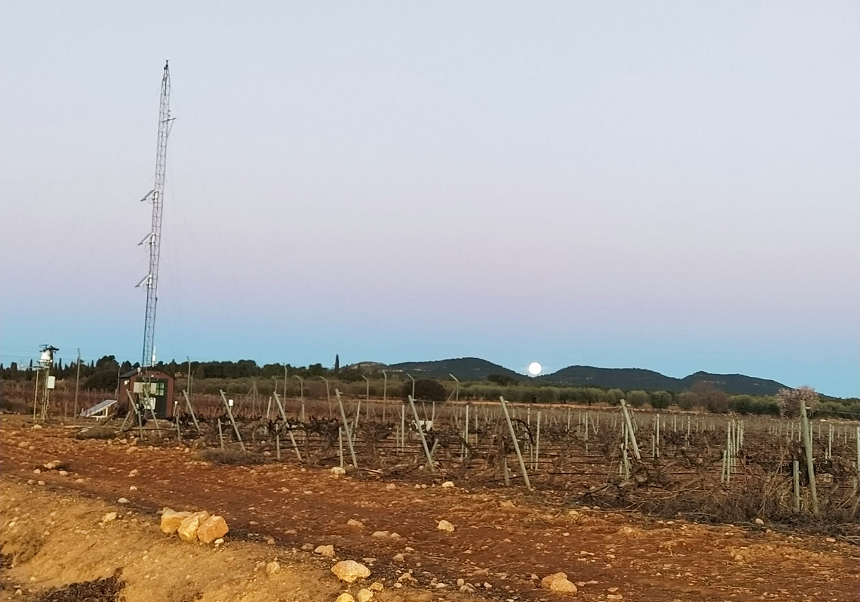
The Valencia Anchor Station is a meteorological station located in the Plana de Utiel-Requena region, representative of an area of about 100 square kilometers and has different sensors capable of taking measurements such as radiation fluxes, soil moisture, temperature and biophysical parameters of the vegetation. It also has an eddy-covariance station, capable of measuring CO2 fluxes and water vapor exchange between the surface and the atmosphere and a large number of mobile sensors for other field work related to measurements of chlorophyll and nitrogen concentration of vegetation, drone with multispectral camera, among other elements.
At this site, ASOTVAS aims to employ AI and data semantics algorithms on data collected in the area, both in situ and remotely sensed measurements, to provide innovative technologies to enrich satellite observations freely and openly available through the Copernicus program of the European Commission and the European Space Agency, among others.
The initiative also seeks to offer the facility to the international scientific community specialized in Earth Observation as a supersite in the framework of the CEOS LPV, ICOS (Integrated Carbon Observation System), etc. programs, by providing reference measurements and integrated products in the area of the station's own variables. Among the services with which it aims to contribute are the dynamic classifications of land use and vegetation cover following the phenological cycle of vegetation and the evolution of vegetation indices and trying, at the end, to offer this information to the farmers of the region.
ASOTVAS will have remote sensing products of all the complementary parameters of the available Sentinel Earth Observation missions of the Copernicus program that will allow users to have all the information, adequately prepared, for validation activities and process studies in the specific framework of the Mediterranean ecosystem.
The action will unify data semantics and artificial intelligence on said control area. The ontologies used will contribute to contextually interpret the heterogeneous big data of the collected measurements by associating the data concepts with other classes of ontologies and, therefore, provide properties that allow establishing the relationships between them.
Such ontologies arrange domain concepts in a hierarchical order to promote this modeling of logical relationships between them. Structuring concepts in this way provides ontologies with the highest degree of semantic richness of all common models for knowledge representation.
As a result, linking data concepts with ontology classes, also known as semantic mapping, helps machines interpret heterogeneous big data to understand the corresponding context, and can help detect big data anomalies and fill in missing information through the ability to infer new knowledge from existing knowledge.
CEOS LPV is a subgroup that coordinates the quantitative validation of satellite products. It focuses on intercomparison and standardized validation of products from different satellites, algorithms and agencies.
As for the Copernicus Program, it makes available to the scientific community global data from its six Earth Observation satellites (Sentinels), each focused on a specific topic, and is responsible for seeking information on the Earth and its environment for the benefit of the public. It offers information services based on Earth Observation satellite and ground-based data through the GBOV project (Ground-based Observations for the Validation of Copernicus Land Products).
It also supports a wide range of environmental and security applications, including climate change and sustainable development monitoring, transportation and mobility, regional and local planning, natural risks, maritime monitoring, agriculture and health. Copernicus data and products are fully, freely and openly available.
In addition, ICOS, a European-wide greenhouse gas research infrastructure, produces standardized data on greenhouse gas concentrations in the atmosphere, as well as on carbon fluxes between the atmosphere, land and oceans.


