

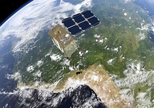
On 7 March, the ESA launched into orbit the Sentinel -2B, the second of the Sentinel satellites aimed to obtain data and images of the Earth for the Copernicus programme, which aims to collect and provide information related with the environmental status of the Earth, as well as the effects of the climate change.
Currently, the Sentinel -2B orbits with his brother, the Sentinel -2A, which was launched to the space in June 2015. Both satellites are identical and count on a high level of autonomy, can operate for periods of 15 days without receiving instructions from the Earth. Just over a week after being launched into orbit, the Sentinel -2B has already delivered its first images of Earth. Although the multispectral imager of the satellite is being calibrated during the commissioning phase – which will take about three months— it is the most advanced of its class in the world and the graphical quality of the images is already very high.
“The design of this tool was a formidable challenge to ensure that it would fulfil with the demanding requirements imposed by the user community”, highlights the ESA.
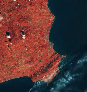
With a swath width of 290 km, the satellite’s first acquisition began over the Baltic Sea and made a strip-like observation through Eastern Europe, ending in northern Libya. The data were relayed in real time to the Matera ground station in Italy, where the images were then processed.
While eastern Europe was mostly cloudy, Italy’s sunny skies allowed the teams to get their first glimpse of the multispectral instrument’s capabilities over southern Italy’s Calabria and Apulia regions, the latter often referred to as the ‘heel of the boot’.
Better knowledge of the environment and the effects of the climate change:
Both satellites will provide repeat coverage of the entire surface of the Earth every five days. The principal aim of the Sentinel-2 is to provide data about the environmental management and data about the farm management which will serve to, for example, characterise crops and, from thereon, to establish strategies to optimise the use of fertilisers.
The Sentinel will map the status and the changes of the earth’s surface and will serve to monitor the forests. It will also alert the pollution of lakes and coastal waters. The images of floods, volcanic eruptions and landslides will contribute to manage the consequences of these disasters and will help in the tasksk of humanitarian aid.
According to Josep Aschbacher, Director of ESA’s Earth Observation Programmes, the Sentinel-2B will be one of the workhorses of Copernicus, as it will enable a whole range of applications with a focus on land. This will further improve data availability of the Copernicus Services and increase the usage of the Copernicus data, points out Aschbacher.
“With the launch of the B-unit, the quality of the data products will increase and Copernicus can better manage and protect the environment and natural resources, as well as improve civil security.”
To end the entry, we leave you an explanatory video about the satellite Sentinel-2B:
And for the curious, the video of its launching into orbit:


