


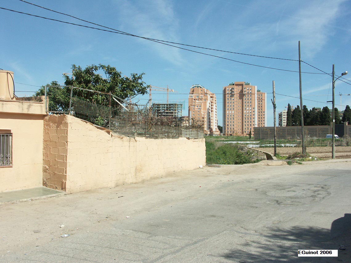
It can be reached by the Partida de Dalt (Upper part) track, which starts in Avinguda (avenue) Pio Baroja in València, at the Campanar cemetery. The approximate location is Partida de Dalt nº 22, about one hundred metres (328 ft 1 in) from the avenue, on the right-hand side. They can be found underground.
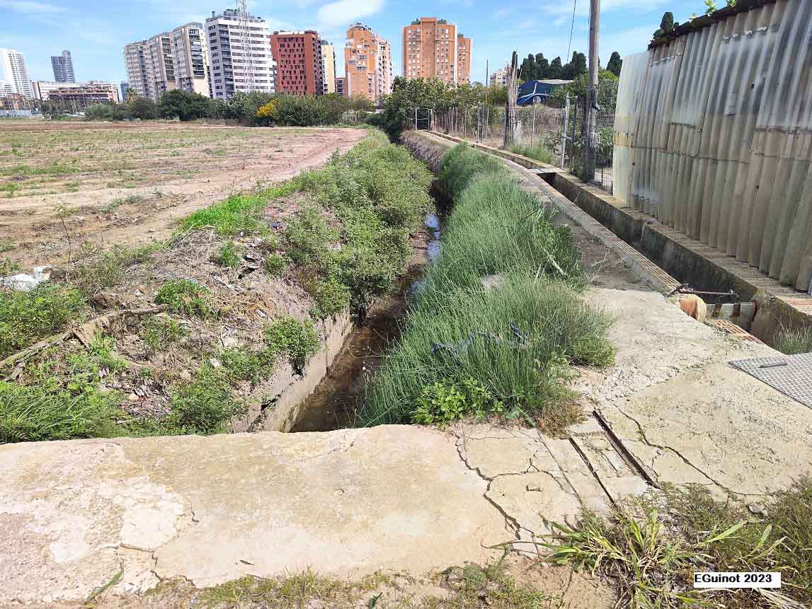
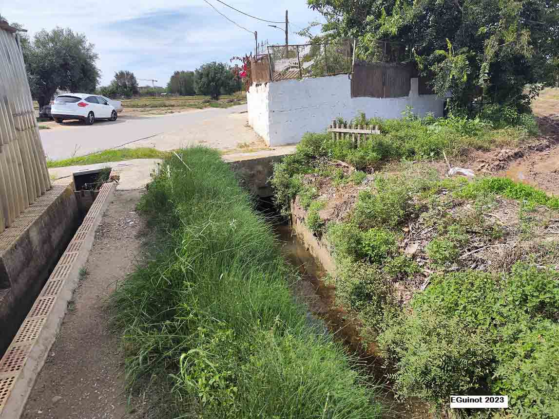
As it is buried, the current state is unknown, but the Petra irrigation canal continues to pass and is probably still in place.
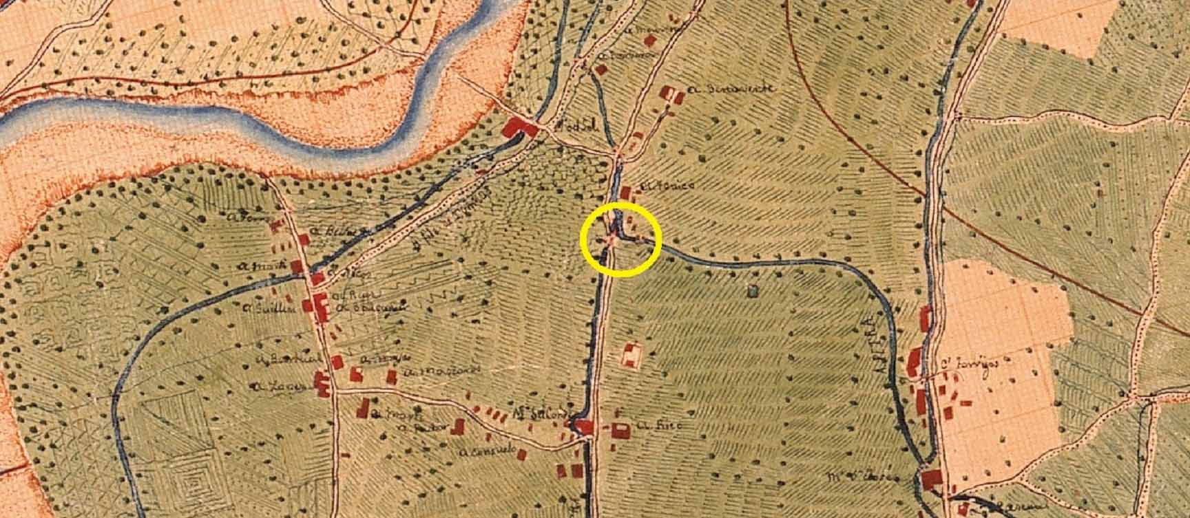
It dates back to the Andalusian period, prior to the 13th century, as it was the one that cut off the water to irrigate the whole area around the town of Campanar.
The tongues of land of Ponça, which take their name from the former Comte or Ponça mill located at the current Arturo Ballester street and which has now disappeared, are the first divisors of this type on the irrigation canal or Petra braç (arm). It was vital in its hydraulic system as it is from here that the water flowed to all the surroundings of the town centre of Campanar. Furthermore, its irrigation channel, the Campanar or del Mig braç, is the one that still draws the peculiar wavy route that crosses the old alqueria (farmhouse), nowadays called Mossén Rausell street and then Benidorm street. Hence, its origins are those of the first layout of the Petra irrigation canal and the irrigation of the medieval alqueria of Campanar, which must necessarily be prior to the conquest of Jaume I (James I) in the 13th century, from the Andalusian period and more probably from the 9th or 10th century than later to make Campanar one of the first cultivated areas in Muslim València. Subsequently, the changes in its situation are minimal. It has always been the property of the Mestalla commune, which has been responsible for its repair and maintenance. The most relevant fact that it has suffered in contemporary times has been its lack of use as a water carrier, although water still flows through the Petra irrigation canal. This took place in the 1990s when València City Council approved the urbanisation of the whole area around Campanar and the well-known "camí del Pouet". With the disappearance of the irrigated fields, this divisor also met its downfall.
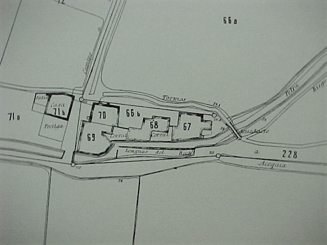
The tongues of land of Ponça are found in the braç (arm) of Petra when it separates from the path of the Dalt district. The right-hand braç was the Campanar or del Mig (on the Middle) braç, while the left-hand one was and is the Petra séquia mare (the main irrigation canal). As can be seen in the 1929 cadastral plans of València, the hydraulic work consists of a stone spur that divides the water between the two braços (arms), lengthened by a spike, probably also made of stone as usual, to keep the it in place. The sides would also be made of stone blocks and mortar, as well as the floor of the irrigation canal at this location, but given that they have been buried due to their uselessness it is not possible at this point to give any further details. An archaeological excavation is clearly useful.
It is currently buried and not visible from the surface.
GUINOT, E.; SELMA, S. (2005): Les séquies de l’Horta Nord de València: Mestalla, Rascanya i Tormos. València, Conselleria d’Agricultura, Col. Camins d’Aigua n. 6, pp.
SELMA CASTELL, S. (2014): Paisatges històrics, patrimoni i didàctica. (Les séquies i les hortes del Tribunal de les Aigües de València). Tesi doctoral publicada en PDF. Castelló, Universitat Jaume I de Castelló, p. 432. www.tdx.cat › bitstream › sselma
GUINOT, E. (2005): “L’Horta de València a la Baixa Edat Mitjana. De sistema hidràulic andalusí a feudal”, Revista Afers. Fulls de pensament i recerca, n. 51, pp. 271-300.
GUINOT, E.; SELMA, S., LLORIA, R. (2003). El patrimoni hidràulic de les séquies del Tribunal de les Aigües de València. Informe elaborat per a la Direcció General de Patrimoni de la Generalitat Valenciana, Conselleria de Cultura, València.
El patrimonio hidráulico del Bajo Turia. L’Horta de València. (Coord. J. Hermosilla), València, Direcció General de Patrimoni Cultural-Generalitat Valenciana, 2007.


Photos: E.Guinot, Google Earth