
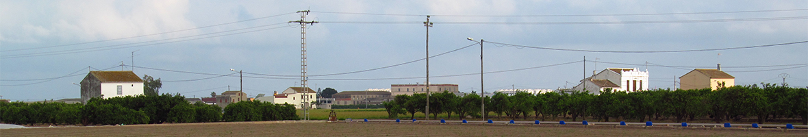
L’Horta of Valencia can be seen by many people as a very wide coastal plain, deprived of a significant relief, and with a bit of rationality with a general slope going down from west to east, from the highest areas of Moncada , Burjassot, Paterna, Manises, etc. Therefore, the simplest deduction is that the historical canals and channels that create such a plane have no relevant physical problems in the free circulation of the water they carry.
And this is largely true, although there are some exceptions to the fact that this coastal plain is not so flat but rather has more or less marked undulations which are the result of its progressive erosion over time. For this reason, the small depressions which drain off the heavy rainfall towards the sea, the so-called “paleobarrancs” (paleo-gullies), are quite general and were often converted into roads, known as “camins fondos” (deep trails), alternating with the route of the irrigation channels which passed and still pass through the highest levels of their surroundings (they are almost always watered from the top down, as is logical).
However, in l’Horta of Valencia there are also some larger gullies that run equally from west to east towards the sea, such as the Carraixet or the Calderona gully, in l'Horta Nord, and the Torrent gully / Paiporta gully / Catarroja gully to l’Horta Sud. But there are also some other gullies that empty into the Turia River, such as the Na Dolça gully, between Benimàmet and Campanar, or the Salt de l’Aigua gully in the municipality of Manises.
In medieval times, the crossing of these gullies or paleobarrancs (paleo-gullies) by the irrigation canals of l’Horta of Valencia was done by means of small levee. That is, a wall of earth and stones that crossed perpendicularly the riverbed of the gully, acting as a dam to allow the water to cross over to the other bank. Logically, this could be done in gullies that were not too deep, but it meant that with a “cold front” or intense rainfall, a flood of water through the gully would dissolve it and the barrier would have to be built again. But this was not a serious problem because it was cheap and simple: farmers' labour and extra land and stones.
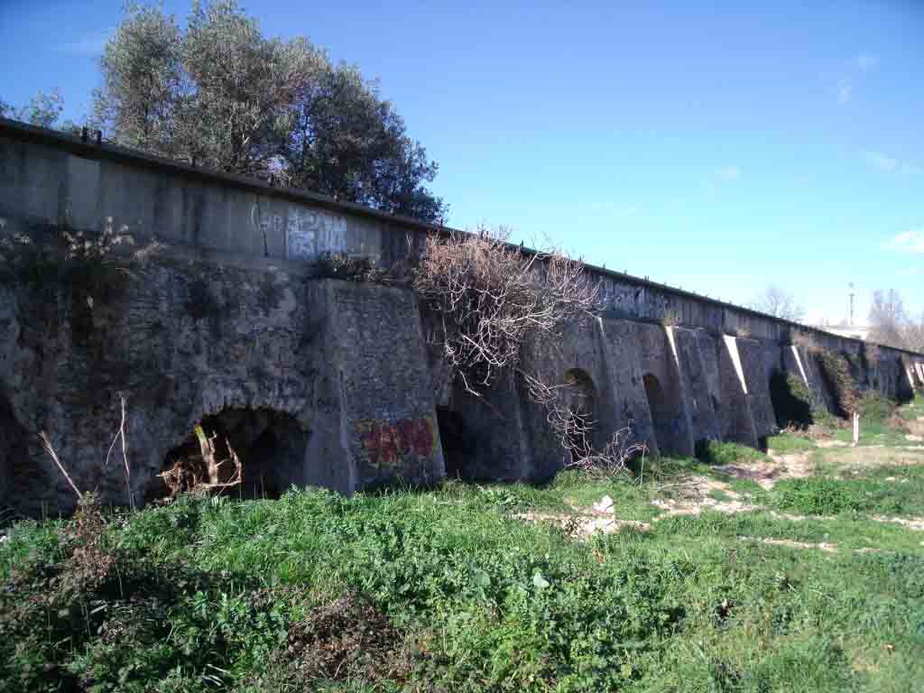
Nevertheless, in some cases, centuries ago, more important works were carried out, mainly where the gully was too deep. The solution was and is either to pass the water over or under the ground: in the first case it is a canyon or siphon; in the second case, an aqueduct. This is an architectural construction, generally made of stone, which is used to transport water by gravity from one point or place to another, allowing it to overcome geographical features such as hollows, depressions or gullies and to pass the water from one side to the other.
The aqueduct stands out in the landscape because of its built elements, generally arches and pillars, as the water pipeline runs above the set of arches, normally uncovered. However, there is a great variety of types, depending on the topographical needs.
These works are already of greater importance and durability, but logically they require more economic investment and more complex technical management of the works. In l’Horta of Valencia, probably due to the smaller size of the gullies mentioned, we only know of one case of a historical aqueduct: that of the Arcs, in the Salt de l’Aigua gully, in the district of Manises and near the district of Quart de Poblet. It carries water from the main irrigation canal in Quart-Benàger-Faitanar and has 28 arches, which have been rebuilt many times. It has been documented that it was in use during the reign of King James I in the 13th century, but its origins can be traced back to the Islamic period, probably before the year 1000.


© 2024 UV. - Av. Blasco Ibáñez, 28. 46010 València. Spain. Phone UV: (+34) 963 86 42 44