

It is located in the middle of the Túria riverbed, across the town of Manises, although the gorges and bottom and side of the irrigation canal belong to the municipality of Paterna, specifically in the area of La Closa. It can be accessed by the road from Paterna to Manises, crossing the bridge over the Túria River and taking a turn-off on the right, which immediately becomes a gravel path that borders the river up to the diversion weir and the floodgates, approximately 400 metres (1312 ft 4 in) away.
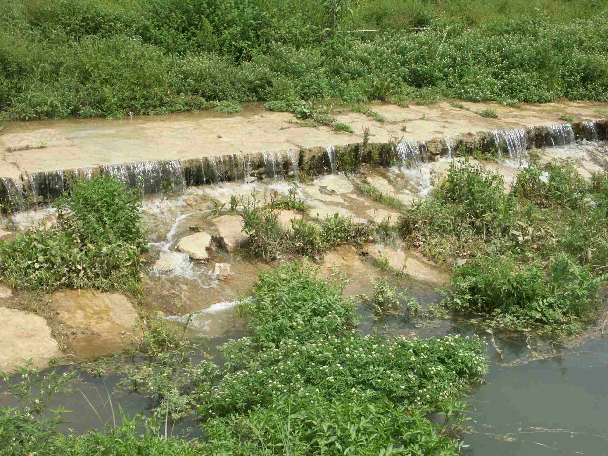
The large stone slab structure is still in an adequate state, but some repairs have been made in the 19th and 20th centuries due to partial breakage by flooding. The discharge channel and the floodgates were built after the flood of 1957.
The diversion weir was built at the same time as the irrigation canal in the Islamic period, between the 10th and 11th centuries. Afterwards, in the 17th century it was rebuilt in stone and has been partially rebuilt several times in the 19th and 20th centuries.
According to Guinot and Selma (2005), the origin of this element of hydraulic architecture dates back to the Islamic period, before the 13th century, as it was essential for the functioning of the Mestalla irrigation canal. It ranks third in descending order of the Túria River on its left bank and is located between the Mislata and the now extinct Favara rivers. According to Guinot (2005), it is likely that the Mestalla irrigation canal was the result of the union of three smaller irrigation canals (Petra, Rambla and Algiròs, which are now the braços (arms) of the Mestalla, a decision that was taken in the Muslim period, and which implied the construction in the 11th or 12th century of a new diversion weir upstream of the current position as well as the extension of the séquia mare (the main irrigation canal) from Campanar to here. In any case, the diversion weir has always been owned, used and repaired by the irrigation community of the aforementioned canal. The archives preserve some information about these works from the 17th century onwards when they were made of stone and there was greater investment in their repair. In fact, up until the 20th century, several floods caused considerable damage and therefore, the abundant repairs it has undergone. This is what a report from 1870 tells us about the flooding of the river in that year that took away the door of the floodgate, the lathe and the pillars of the discharge channel (Arxiu Dip.Provincial de València,, E.3.1, caixa 320, exp. 7356). The most relevant and recent transformations are due to the Túria flood in 1957.
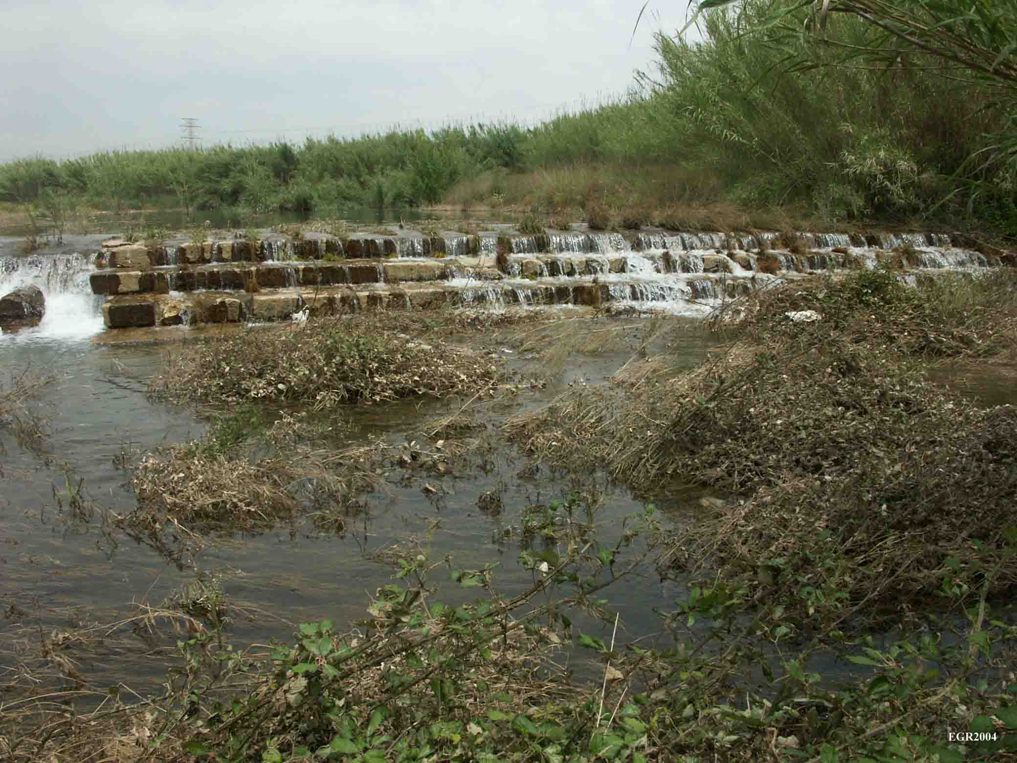
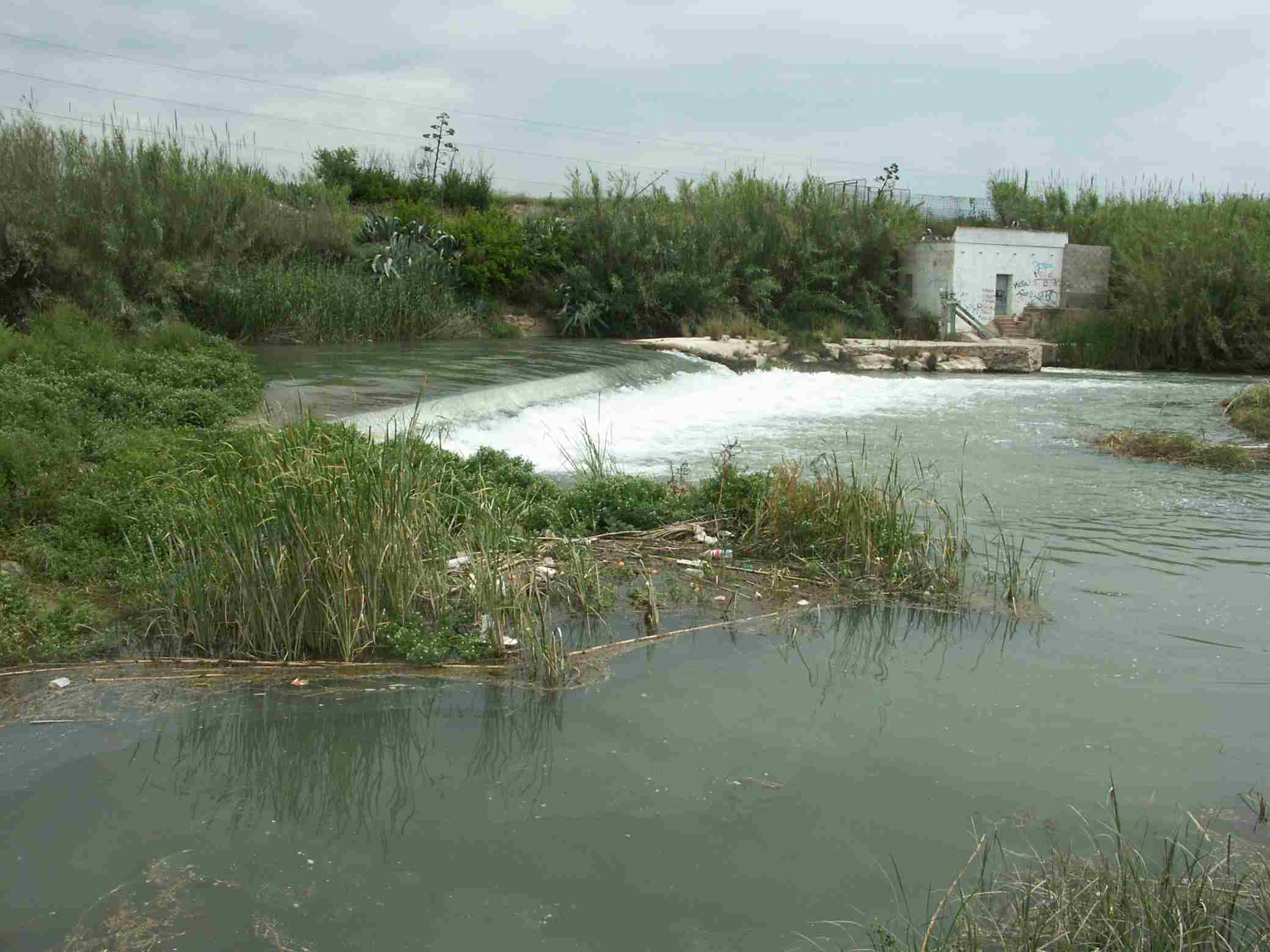
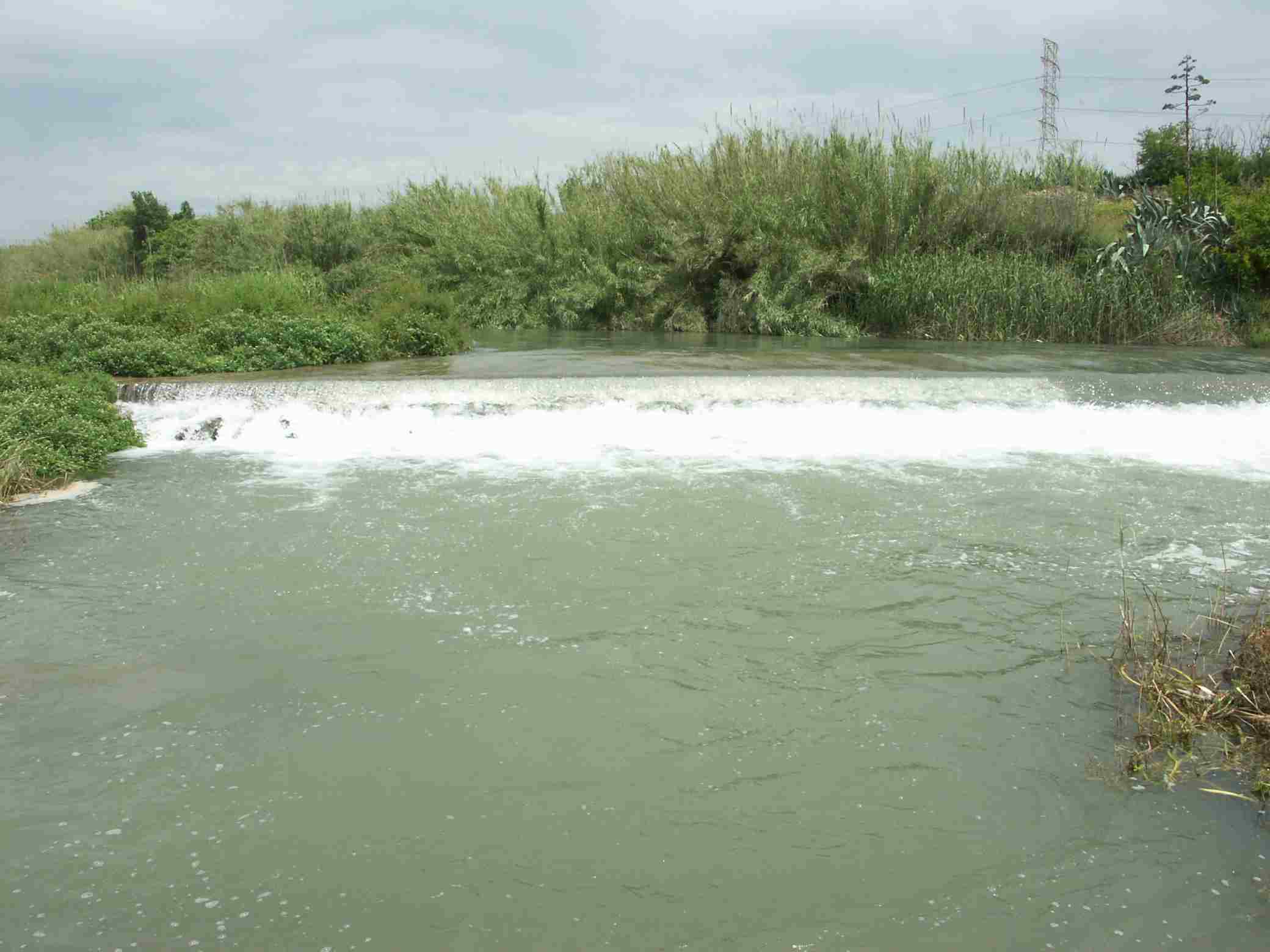
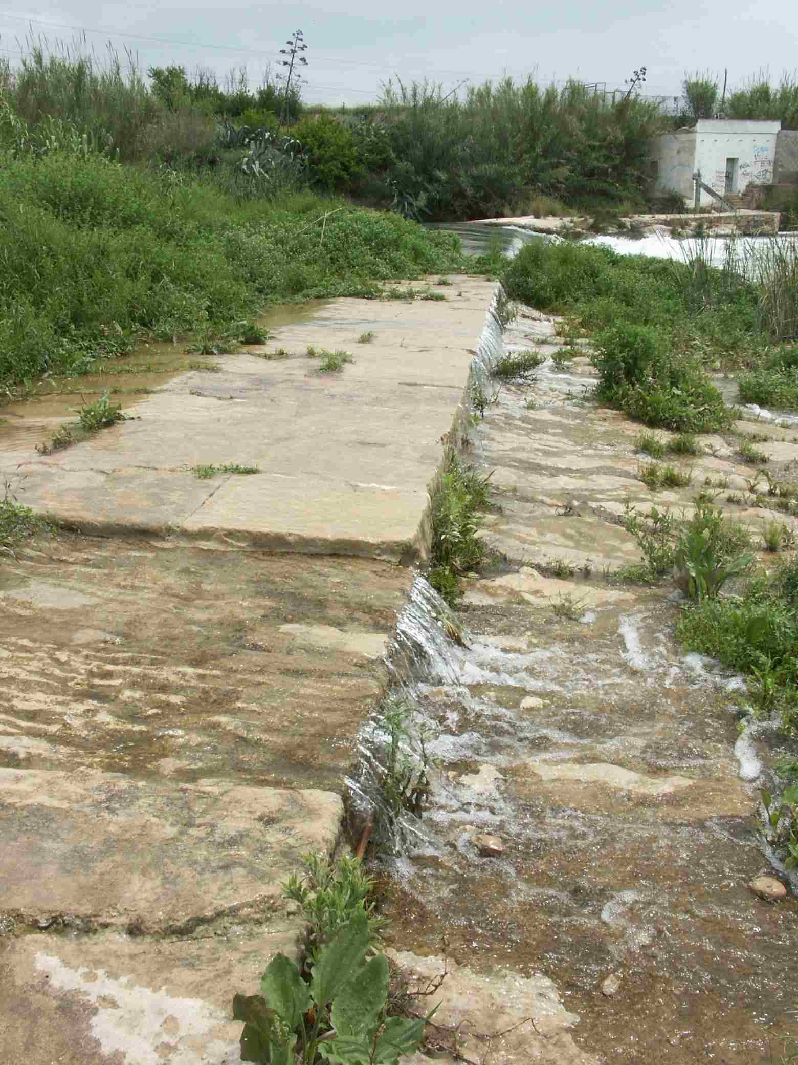
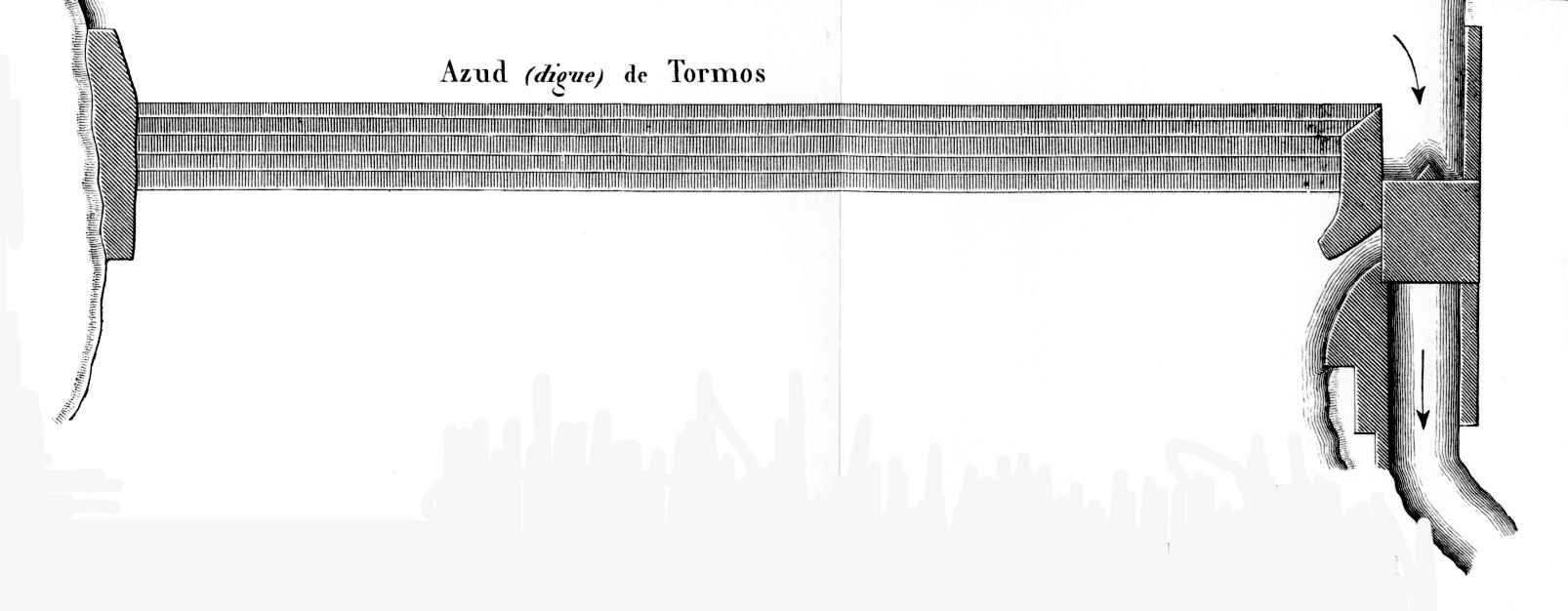
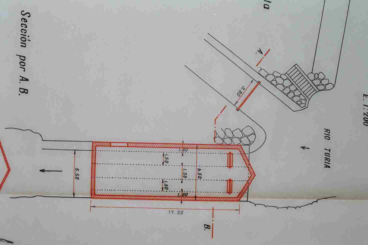
According to Selma and Guinot (2005), if the physical location of the dam has been at the same spot on the Túria River, its material structure, on the other hand, has undergone considerable changes over the centuries. Like other diversion dams in l’Horta (irrigated lands) of València, it was a barrier of logs, stones and wood. During the Muslim period and in the late Middle Ages, it was periodically destroyed by the Túria floods and reformed by the Mestalla community of owners. At the end of the 16th century, these diversion weirs in l’Horta were progressively built of stone, which was much more expensive, but more durable, as is the image we can witness today. The dam itself is a compact and straight wall, installed at a slight angle on the riverbed, made of large blocks of stone and mortar. All this facilitates the use of the water flow and its subsequent derivation. The diversion weir has a robust lime, mortar and stone slab factory of great proportions and a dam with a sloping gabled main wall and four steps made from stone slabs of one and a half metres (4 ft 11 in) wide each, which crosses the entire riverbed until it rests on the rocky promontories located on the left bank. It was here that the first section of the irrigation canal was excavated, becoming the most peculiar element of hydraulic construction, being unique among all the diversion weirs in l’Horta of València. The floodgate, devastated by the flood of 1957 and later reconstructed, consists of two gorges that allow the administration of the water to enter the Mestalla irrigation canal, separated by a large stone spur, on which the same floodgate rests thanks to two brick arches. The total dimensions of the hydraulic unit cannot be known because it is partially buried, but it is assumed to be around seventy metres (29 ft 7.9 in) long.
- Plan de Acción Territorial de Protección de la Huerta de Valencia. Versión Preliminar. Memoria de Ordenación. Anexo. Fichas de Elementos de Arquitectura Hidráulica. Índice de Fichas, (dir. Arancha Muñoz), Generalitat Valencia, 2008, Fitxa EPH_11.01, p. 175.
- Pla d’Acció Territorial d’Ordenació i Dinamització de l’Horta de València (PAT de l’Horta). Generalitat Valenciana, 2018. Catàleg annex. Element Patrimonial EPH_11.05, pàgs. 479-480.
- Pla General Ordenació Urbana de Paterna: Catàleg de Patrimoni (Modificació de l’any 2011). Autors de l’informe: Vicent Garcia Martínez i Adrià Bessó.
- «Assut de Mestalla». Inventari General del Patrimoni Cultural Valencià.
- El patrimonio hidráulico del Bajo Turia. L’Horta de València. (Coord. J. Hermosilla), València, Direcció General de Patrimoni Cultural-Generalitat Valenciana, 2007, fitxa 62, p.412.
GUINOT, E., SELMA, S., LLORIA, R. (2003): El patrimoni hidràulic de les séquies del Tribunal de les Aigües de València. Informe elaborat per a la Direcció General de Patrimoni de la Generalitat Valenciana, Conselleria de Cultura, València.
GUINOT, E., SELMA, S. (2005): Les sèquies de l’Horta Nord de València: Mestalla, Rascanya i Tormos. València, Conselleria d’Agricultura. Col. Camins d’Aigua n. 6, pp. 137-138.
GUINOT, E. (2005): “L’Horta de València a la Baixa Edat Mitjana. De sistema hidràulic andalusí a feudal”, Revista Afers. Fulls de pensament i recerca, n. 51, pp. 271-300.
SELMA, Sergi (2014): Paisatges històrics, patrimoni i didàctica (les séquies i les hortes del Tribunal de les Aigües de València). Tesi doctoral, Castelló, Universitat Jaume I, pp. 264-266.


Photos: Càtedra L'Horta de València - Google Earth