

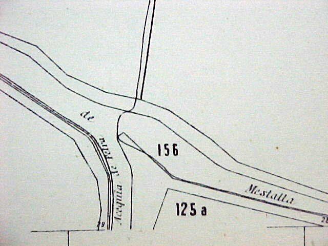
They are located in the Partida de Dalt (Upper part) in Campanar, in the middle of the vegetable garden and in the bottom and side of the séquia mare (the main irrigation canal) of Mestalla. They can be reached from Avinguda (avenue) Pio Baroja in València and by taking the path in the said Partida de Dalt, which is at the level of the cemetery in Campanar, towards the Frares and Llobera mills. After these, on the right-hand side, one must enter by the edge of the rills because there is no path to the tongues.
The tongues of land have been buried in concrete in the mid-1990s. Fortunately, this is a reversible action.
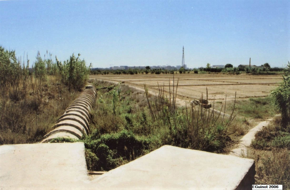
They are from the Andalusian period, 11th-12th centuries, and were buried in the 1990s.
The Mestalla-Petra tongues of land , located in the Campanar irrigated land, are the first and most important tongues of land in the Mestalla irrigation canal, as they create the Petra braç (arm), diverting one third of the flow of the Mestalla irrigation canal. They have a medieval origin, in the Andalusian period of the 11th-12th centuries as they represent the point of connection of this braç with the séquia mare (the main irrigation canal). Nevertheless, the Petra irrigation canal leads to a rather irregular itinerary for Campanar that causes it to cross the séquia mare of Mestalla at the point of the former mill of l’Horta or San José, at a location that was known as the “Bullidor” because it was carried out by a siphon. Therefore, as Guinot (2005) explains, it is reasonable to think that prior to the 13th century there was a diversion weir belonging to the Petra irrigation canal towards the River Túria and that even in Islamic times the three previously independent irrigation canals of Petra, Rambla and Algiròs were joined into a single séquia mare of Mestalla with a diversion weir situated quite upstream as it is now. It should also be pointed out that in the year 1324, a document refers to the Petra irrigation canal as the “irrigation canal of the mills of Pere Mercer”, which may be merely identifying (this is the same case as the Rovella irrigation canal, the said Ruzafa irrigation canal in the 13th century documents), as this initial diversion Petra (and therefore the tongues of land ) was from the 13th century following the reconstruction of the current Molí dels Frarers (Friars’ mill), owned by Pere Mercer. Its subsequent history, as in the case of most of the divisors of the tongues of land of l’Horta de València, is not significant. They have always been the property of the commune of owners of the Mestalla irrigation canal and have had as little work done on them as possible to avoid conflicts in the distribution of the water.
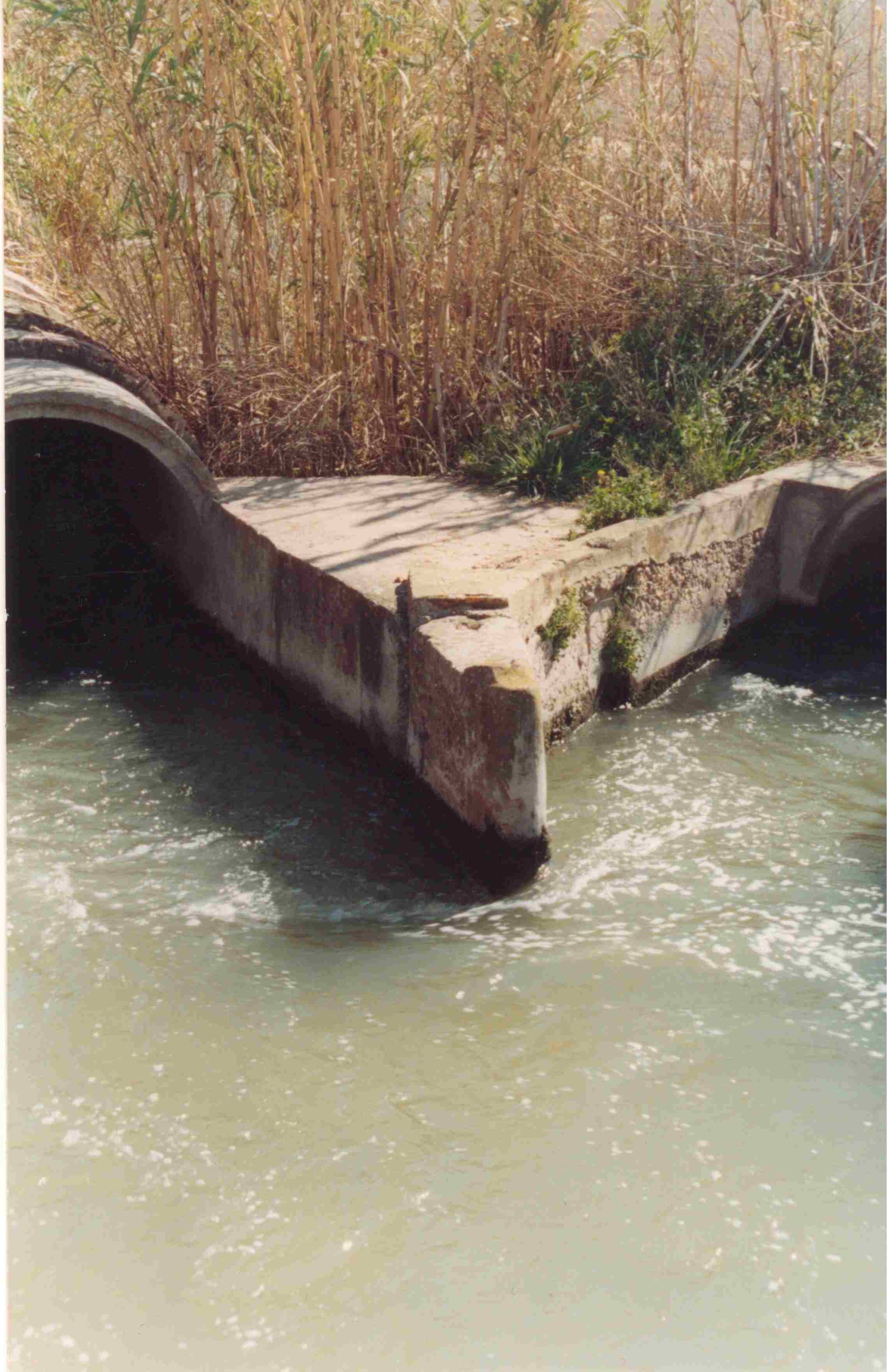
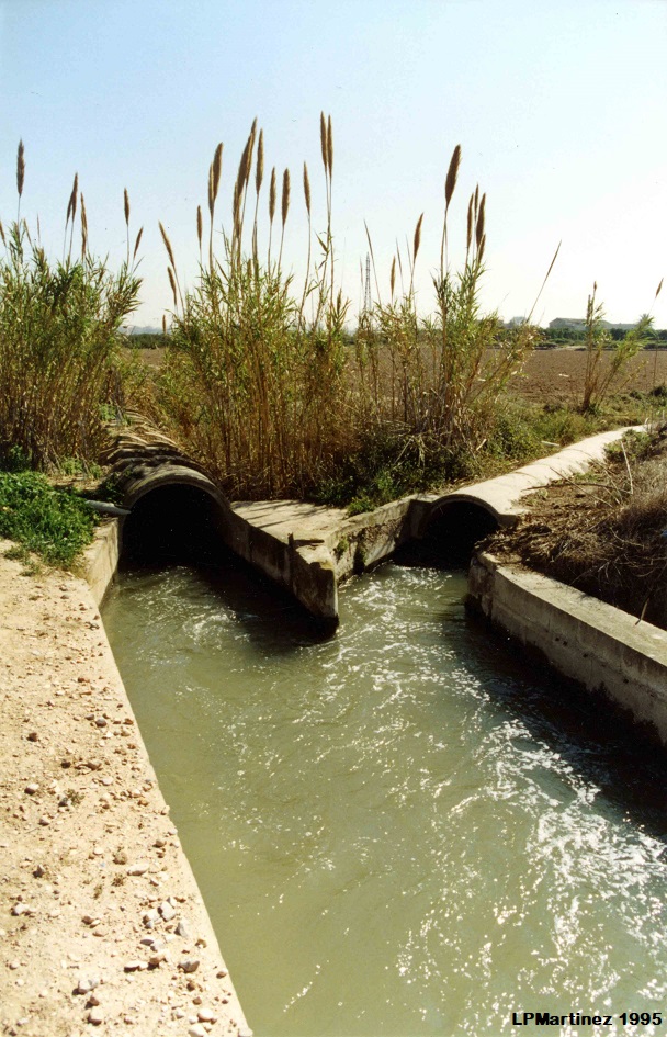
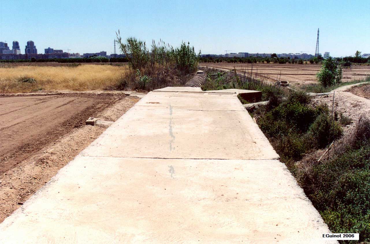
Like other tongues of land, it is a three-part irrigation canal divisor, with two continuing straight down the Mestalla séquia mare (the main irrigation canal) and a third drifting to the right starting at the Petra braç (arm). The partition is made by a stone spur finished at an angle, behind which there is also a spike of block stones to give it solidity, and the two strips of the irrigation canals are also made of stone joined by mortar. The unique and characteristic feature of this divisor, which is almost exclusive now in l’Horta of València, is that it has never had any gates to modify the water partition. Regardless of what came, it has always split two thirds and one third, and not having gates prevented manipulations in the proportions in times of drought. At the same time, in the 1990s, it suffered the greatest damage in its history: first by burying the Mestalla séquia mare with pipes, and shortly afterwards also by burying its own divisor with a casemate and concrete slab that makes it invisible today. We are confident that at some point it will be properly restored given its heritage value.
- Plan de Acción Territorial de Protección de la Huerta de Valencia. Versión Preliminar. Memoria de Ordenación. Anexo. Fichas de Elementos de Arquitectura Hidráulica. Índice de Fichas, (dir. Arancha Muñoz), Generalitat Valenciana, 2008, Fitxa EPH_10.03, p. 166.
- Revisió simplificada del Pla General de Valencia (2013): Catàleg de Béns i Espais Protegits de natura rural. EPH_SNU_04.02, pp. 77-80. (No té fitxa pròpia i està inclòs en l’àrea de protecció del Molí Nou amb la lletra A2).
- Pla d’Acció Territorial d’Ordenació i Dinamització de l’Horta de València (PAT de l’Horta). Generalitat Valenciana, 2018. Catàleg annex. Element Patrimonial EPH_10.04, p. 443-445. No tenen fitxa pròpia tot i que sí numeració i apareixen incloses en el càtàleg i en la fitxa del Molí Nou i la seua àrea de protecció.
GUINOT, E.; SELMA, S. (2005), Les séquies de l’Horta Nord de València: Mestalla, Rascanya i Tormos, Col·leció Camins d’Aigua n. 6, València, Conselleria d’Agricultura de la Generalitat Valenciana, pp. 159.
SELMA CASTELL, S. (2014): Paisatges històrics, patrimoni i didàctica. (Les séquies i les hortes del Tribunal de les Aigües de València). Tesi doctoral publicada en PDF. Castelló, Universitat Jaume I de Castelló, p. 295.
GUINOT, E. (2005): “L’Horta de València a la Baixa Edat Mitjana. De sistema hidràulic andalusí a feudal”, Revista Afers. Fulls de pensament i recerca, n. 51, pp. 271-300.
GUINOT, E.; SELMA, S., LLORIA, R. (2003). El patrimoni hidràulic de les séquies del Tribunal de les Aigües de València. Informe elaborat per a la Direcció General de Patrimoni de la Generalitat Valenciana, Conselleria de Cultura, València.
HERMOSILLA, J. (Coord.). El patrimonio hidráulico del Bajo Turia. L’Horta de València. València, Direcció General de Patrimoni Cultural-Generalitat Valenciana, 2007.


Photos: E.Guinot, Luis P. Martínez, I.Mangue