

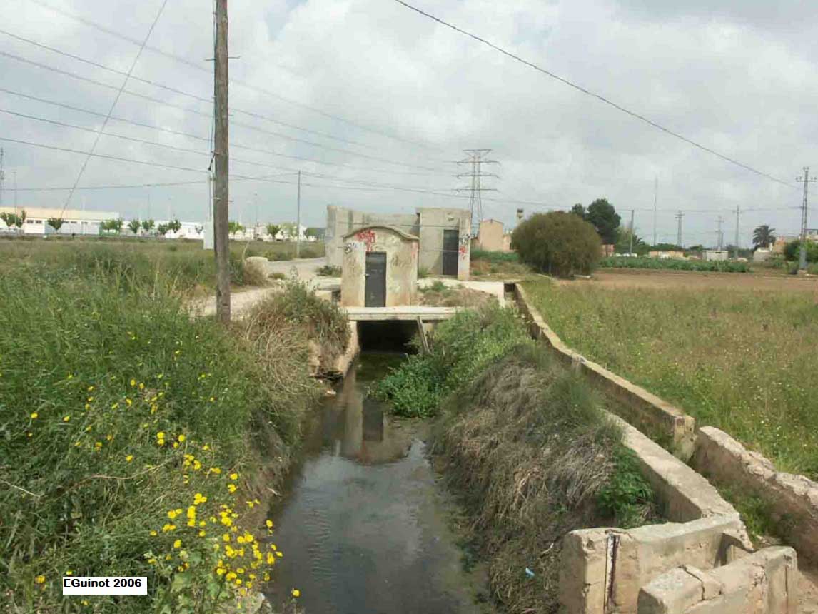
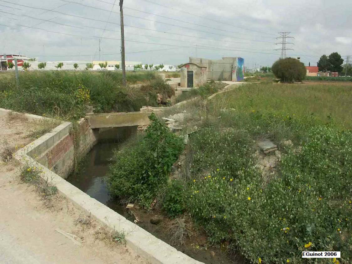
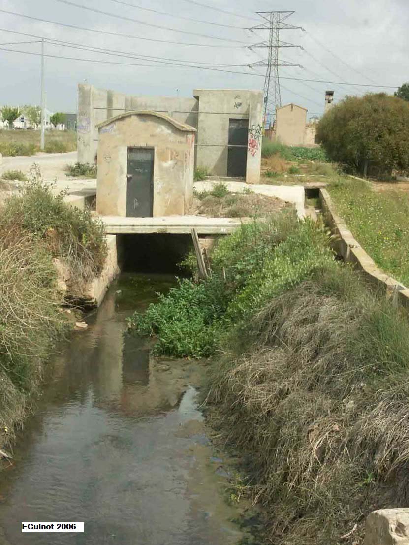
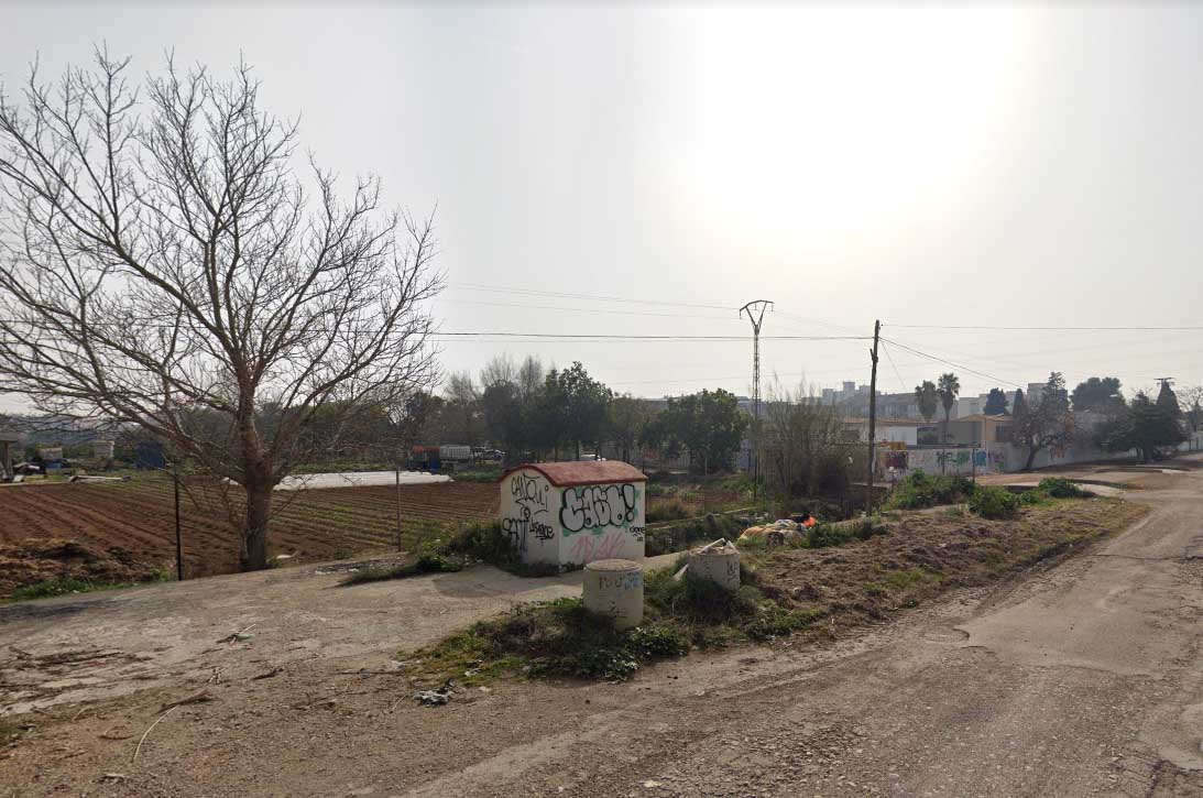
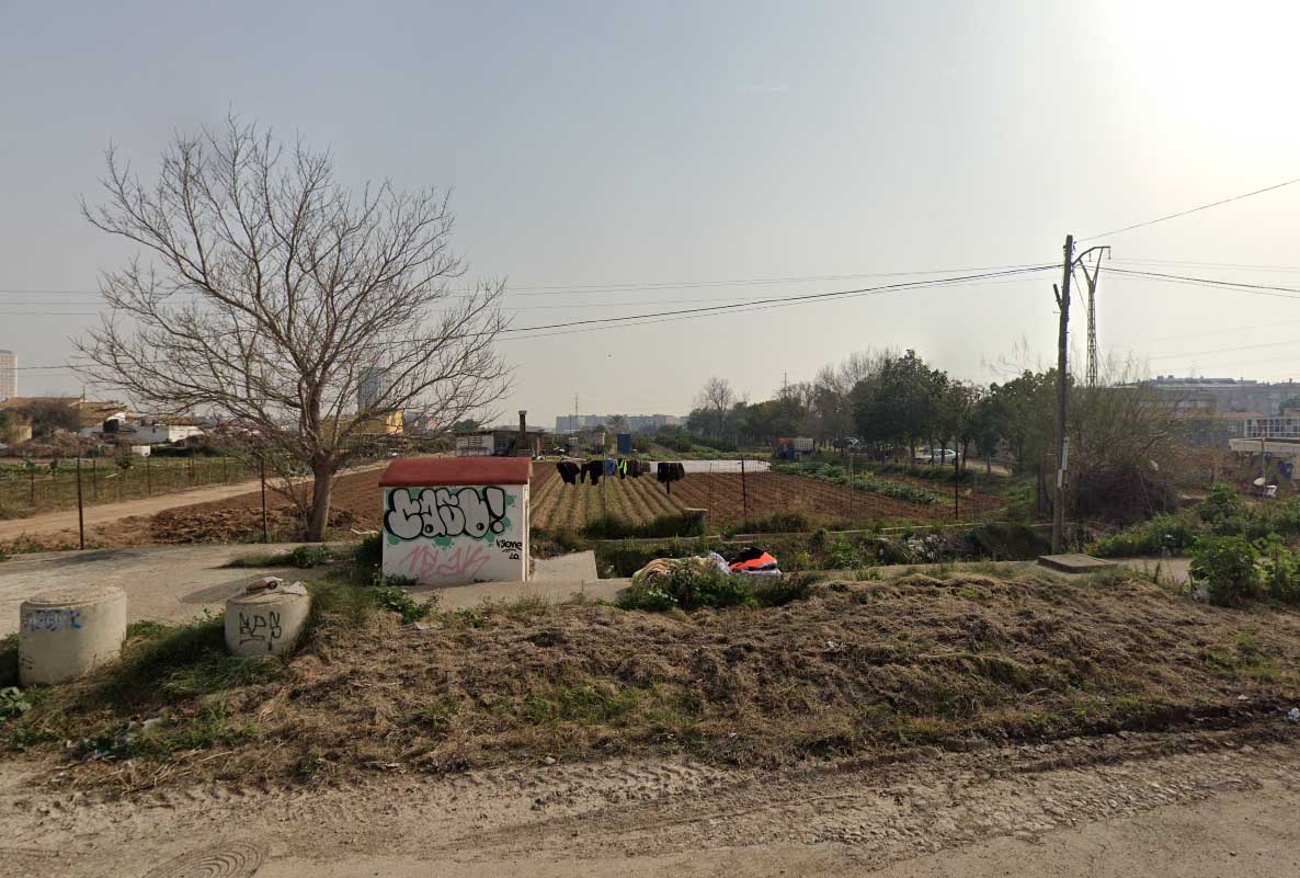
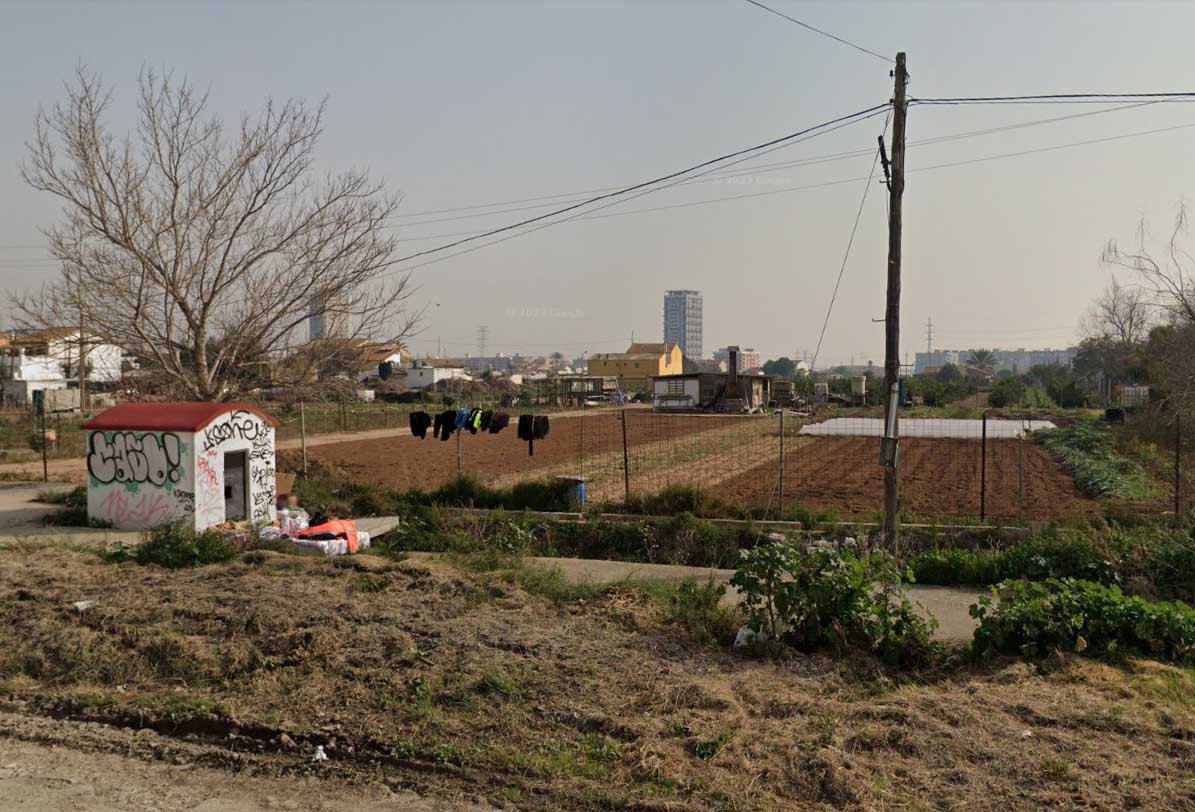
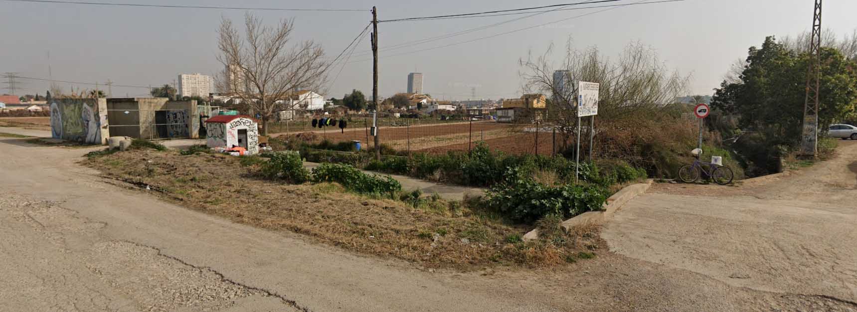
They are located near the old road of Picassent, now the V-4040 road, on the limit of the municipality of València with Alfafar and a hundred meters before the cemetery of the latter.
They are buried as far as Favara's own séquia mare (the main irrigation canal) and the concrete slab divisor are concerned. However, the San Jorge braç (arm), on its way out, remains made of soil.
11th-12th centuries.
As Guinot and Selma (2005, forthcoming) and Selma (2014) explain, the tongues of land of Sant Jordi are from medieval Islamic origin, prior to the conquest of València by Jaume I (James I) in the 13th century, although it is clear that their name is subsequent to that conquest. The Favara irrigation canal is mentioned in a Muslim chronicle as being in use in 1092. Nevertheless, as F. Esquilache explains (2014), the first reliable written reference to them dates back to 1362, when the commune of owners of the Acequia de Favara commissioned Andreu Julià, master builder of the Cathedral of València, to inspect the complex of the Acequia de Favara in order to identify all its divisors and tongues of land and to document its dimensions in writing in case the war with the kingdom of Castile in those years led to its destruction. (Arxiu de Protocols del Patriarca, València, VAR-201, f. 7r-10v). The aforementioned document refers to it as a "Sant Jordi's divisor" and attributes it a width of 3 Valencian palms and 2 fingers, which is 71,44 cm (28 in) (the same as the Estadella’s tongues of land), while the séquia mare (the main irrigation canal) of Favara, the other canal that runs through the tongue of land, was 2,562 metres (8 ft 5 in). The minutes of the commune of Favara in 1403 ratify the dimensions of this divisor, and they are also documented again with these dimensions in a lawsuit before the Governor of the Kingdom of València in 1456. The Ordinances of the Favara irrigation canal of 1701 mention this divisor of “major de Sant Jordi” in chapter 121, and it seems that the canal had water every Saturday of the week, as it was irrigated in parts or batches to meet the water shortage.. Nowadays they are still active. They have always been the property of the irrigation community of the Favara irrigation canal, which has taken charge of their preservation and repair.
According to Guinot and Selma (2005, forthcoming), Selma (2014) and Esquilache (2014), these tongues of land have the usual physical structure. There is a spur inside the bottom and side of the séquia mare (the main irrigation canal) of Favara to divide the water that arrives. This time, as we have just explained, it does not divide in half but both gorges had very different dimensions: 71,44 cm (28 in) the Sant Jordi braç (arm), which runs to the left of the tongue of land and for a few metres turns 90º east towards the sea, and 2,378 metres(7ft 9.6in) the séquia mare which continues straight to the south. However, we do not know the exact dimensions they have today as they are half buried. Remarkably, this braç of Sant Jordi remains one of the few soil irrigation canals in its original state. Traditionally, the spur and the two gorges were built with stone ashlars or stone blocks, and stone slabs were also placed on the floor of the irrigation canal. Nonetheless, as they have been buried, we do not know if they have suffered any significant modifications or if everything has been covered with concrete. Above the tongues of land, there is also a stall built at the same time to protect the metal lathes and be able to open and close the braços (arms).
According to the PAT de l'Horta (2018), they are a Second Level hydraulic element.
- Plan de Acción Territorial de Protección de la Huerta de Valencia. Versión Preliminar. Memoria de Ordenación. Anexo. Fichas de Elementos de Arquitectura Hidráulica. Índice de Fichas, (dir. Arancha Muñoz), Generalitat Valenciana, 2008, Element EPH_18.02, p. 191.
- Pla d’Acció Territorial d’Ordenació i Dinamització de l’Horta de València (PAT de l’Horta). Generalitat Valenciana, 2018. Catàleg annex. (Incloses en la fitxa general de la séquia de Favara). Referència pròpia: EPH2_18.02, pp. 791-792.
- El patrimonio hidráulico del Bajo Turia. L’Horta de València. (Coord. J. Hermosilla), València, Direcció General de Patrimoni Cultural-Generalitat Valenciana, 2007, fitxa 137, p.449.
GUINOT, E., SELMA, S. (2005, informe inèdit): Les séquies de l’Horta Sud de València: Rovella, Favara, Mislata-Xirivella, Benàger-Faitanar i Quart. València, Conselleria d’Agricultura-Generalitat Valenciana.
SELMA CASTELL, S. (2014): Paisatges històrics, patrimoni i didàctica (les séquies i les hortes del Tribunal de les Aigües de València). Tesi doctoral, Castelló, Universitat Jaume I, pp. 313.
ESQUILACHE MARTÍ, F. (2014): “La cuestión de la proporcionalidad en la distribución del agua de riego. El caso de la acequia de Favara (huerta de Valencia)”, dins Irrigation, society and landscape: tribute to Thomas F. Glick : proceedings [of the] International Conference, Valencia, September 25th, 26th and 27th, 2014, (coord. C. Sanchis, G. Palau-Salvador, I. Mangue, Luis P. Martínez), pp. 50-69.
GUINOT, E., SELMA, S., LLORIA, R. (2003): El patrimoni hidràulic de les séquies del Tribunal de les Aigües de València. Informe elaborat per a la Direcció General de Patrimoni de la Generalitat Valenciana, Conselleria de Cultura, València.
HERMOSILLA, J. (Coord.). El patrimonio hidráulico del Bajo Turia. L’Horta de València. València, Direcció General de Patrimoni Cultural-Generalitat Valenciana, 2007.


Photos: Enric Guinot, Google Earth