

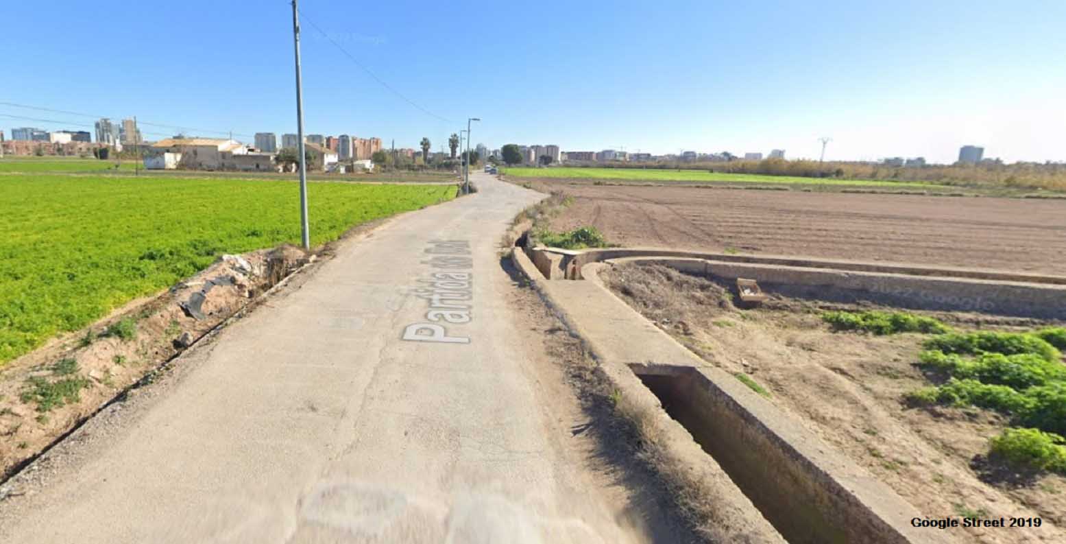
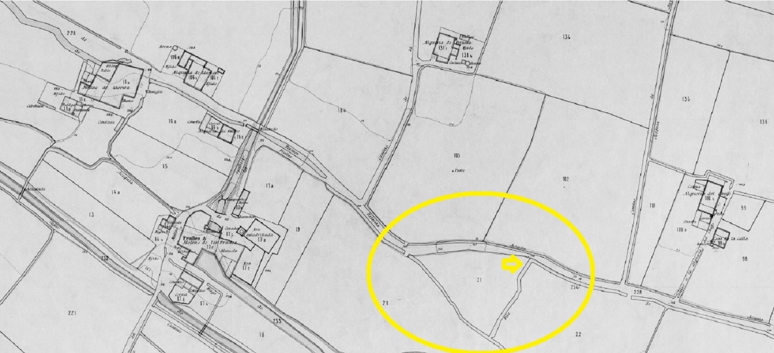
They are located in the Campanar row, in a section that runs parallel to the road to the Partida de Dalt. This road can be accessed from Avinguda Pio Baroja, at the level of the Campanar cemetery. They are on the roadside, on the left-hand side and before reaching the centre of the Frares mill and the Llobera mill.
They are probably medieval, but it is difficult to be certain that they are secondary in the hydraulic system of the Tormos irrigation canal.
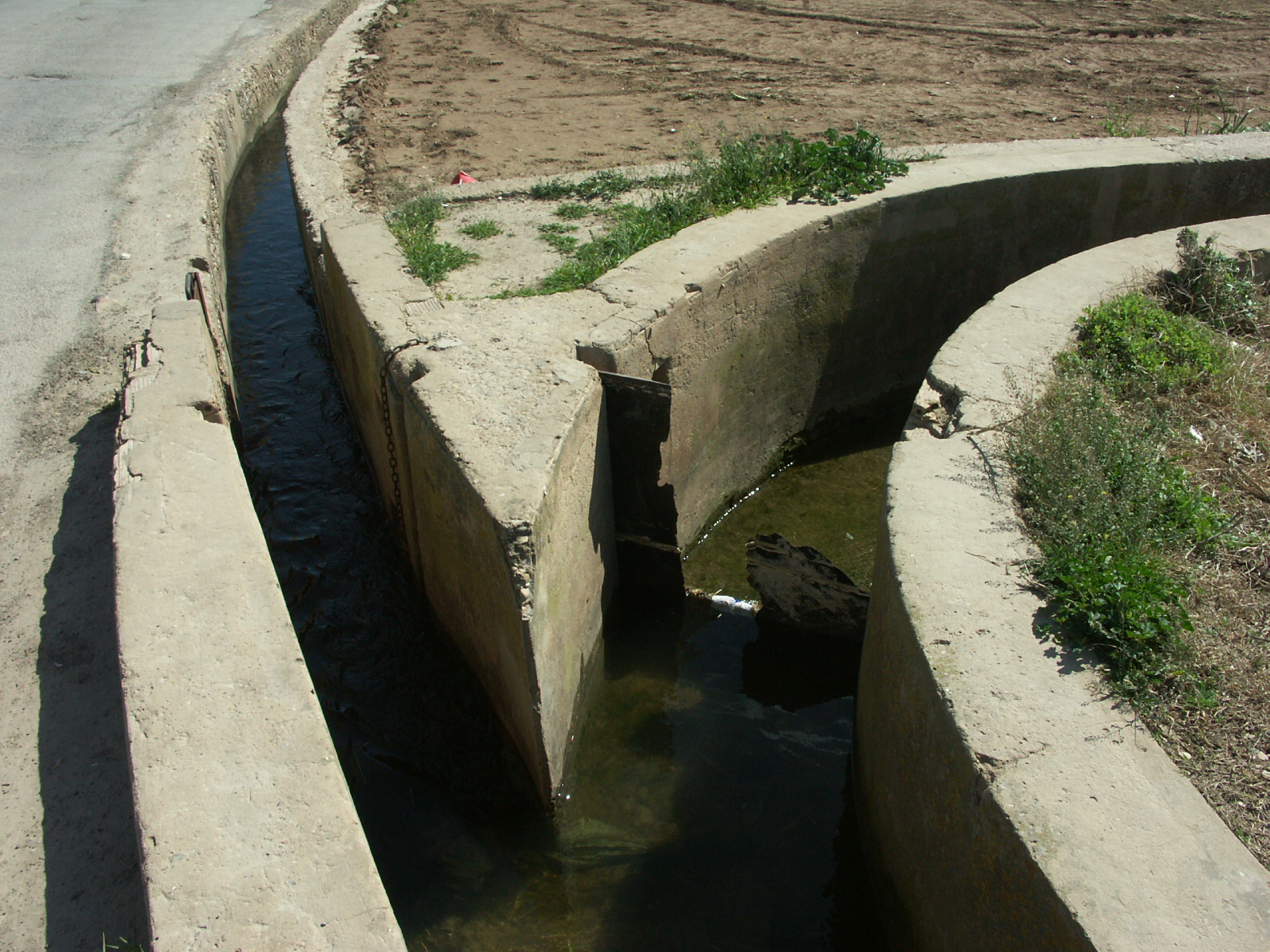
They are built in the Campanar row, in an area that also includes the Petra and Rascanya irrigation canals, but which is partly watered by the Tormos irrigation canals. According to Guinot and Selma (2005) and Selma (2014), it is a secondary divisor within this system, so it is not easy to trace data on its history, nor to be sure how old it is. The fact that the system for dividing the water into two irrigation canals (the Fila braç (arm) and the Pouet braç) consists of this small tongue of land leads to think that it does indeed have a medieval origin. Using a wooden paddle that closes one of the two irrigation canals, the water that arrives between the two canals is distributed in batches. This is usually done with a lateral intake in the main irrigation canal that comes in, stops there and enters the second irrigation canal. It is also an indication of its antiquity that the two new irrigation canals are called braços (arms), a medieval terminology always linked to allocating water in two areas with a divisor and a tongue of land. For now, the oldest written reference available to us is its citation in the Ordinances of the Tormos irrigation canal of 1843.
According to Guinot and Selma (2005) and Selma (2014), it is a very simple tongue of land in terms of its physical appearance, with a central spur ending in an angle and the start of the two new irrigation canals. Its peculiarity is that the right braç (arm) immediately makes an arch and opens considerably, and that this braç on the right is wider than the one on the left. Materially, the whole ensemble is currently built-in concrete from the second half of the 20th century, which makes it difficult to identify its traditional appearance. Both parts are prepared for the insertion of a water-stop paddle, currently made of metal, although until not so long ago they were made of wood.
GUINOT, E., SELMA, S. (2005): Les sèquies de l’Horta Nord de València: Mestalla, Rascanya i Tormos, València, Conselleria d’Agricultura, Col. Camins d’Aigua n. 6, pp. 166.
SELMA CASTELL, Sergi (2014). Paisatges històrics, patrimoni i didàctica. (Les séquies i les hortes del Tribunal de les Aigües de València). Tesi doctoral publicada en PDF. Castelló, Universitat Jaume I de Castelló, pp. 310.
GUINOT, E.; SELMA, S., LLORIA, R. (2003). El patrimoni hidràulic de les séquies del Tribunal de les Aigües de València. Informe elaborat per a la Direcció General de Patrimoni de la Generalitat Valenciana, Conselleria de Cultura, València.
HERMOSILLA, J. (Coord.). El patrimonio hidráulico del Bajo Turia. L’Horta de València, València, Direcció General de Patrimoni Cultural-Generalitat Valenciana, 2007.


Photos: E.Guinot, Google Earth