
The irrigation canals are one of the main elements of the historical territory and landscape of l’Horta of Valencia until our present. L’Horta is a large irrigated area and to be able to irrigate the fields it has been necessary to design and build the different types of canals that feed it, from the source of each hydraulic or irrigation system, to the small individual watering cans that enter each plot.
The majority of this Horta is structured on this basis, but there is a section that in the past, and in some cases even today, has required not only channels to bring water to the plots but also others to remove the surplus. We are referring to the coastal strip from Sagunt to Cullera, historically characterised by being swampy and full of lagoons, the largest and best known of which is the Albufera.
Located south of the Turia river estuary, between the historic centre of the city of Valencia and the town of Russafa, this marjals area, the traditional Valencian name for wetlands, has been progressively cleared since the late Middle Ages. Thus, gradually, until the 19th century, it was drained, pushing the Albufera back southwards, beyond the current villages of Castellar-l'Oliveral, and eastwards to the area of La Punta and Pinedo.
The drainage process has been going on for centuries, with some setbacks at certain historical moments, but above all, with a certain insecurity in its consolidation due to the difficulties of draining the area, both due to the surplus of the Rovella-El Vall Canal and Favara irrigation channels, and also due to the contribution of quite a few sources in this territory.
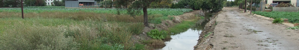
Technically, the constant drying out of the area has been resolved by run-off channels, “azarbes” in Spanish, which channeled and are still channeling the excess water both towards the old Turia River and towards the sea, and above all towards the Albufera. For logical reasons, the irrigation canals run along the highest levels of their surroundings, but the drains are the opposite: they run along the deepest areas, as their function is to collect the remaining water. However, this whole territory of Francs, Marjals and Extremals of the city of Valencia has not had an easy time building and maintaining this whole drainage system, among other things because it is a little deeper than the coastline, the old line of sand dunes between Nazaret and El Saler. But at the same time, it represents a peculiar and unique space from the rest of l’Horta of Valencia, so that the two types of channels or irrigation canals, which we have mentioned, intertwine, and complement each other. And although today we can identify them in most cases at first sight: the irrigation ones have been lined with cement to save water, while the drainage ones, in many cases, have been kept in the ground precisely to make it easier for the surplus water from the surrounding area to fall into them.


© 2025 UV. - Av. Blasco Ibáñez, 28. 46010 València. Spain. Phone UV: (+34) 963 86 42 44