
On the occasion of the commemoration of the 175th anniversary of the official cartography in Spain, Palau Cerveró of the Universitat de València hosts on 10 and 11 February a conference in which experts from different disciplines approach the public key aspects of science geographical representation. At the same time an exhibition composed of eighteen panels, which traces the history of the Spanish cartography will open.
These celebrations were organized by the National Geographic Institute (IGN), under the Ministry of Development (Government Delegation in the Valencian Community), and the Department for Participation and Territorial Projection of the Universitat de València.
The principal Esteban Morcillo opens the acts together with the government delegate in Valencia, Serafin Castilian; general director of the National Geographic Institute, Amador Elena Córdoba; and director of the Regional Service of the National Geographic Institute in Valencia and curator of the exhibition, Emilio Benitez Aguado.
The meeting will bring together specialists in Geodesy, Cartography, Topography, Astronomy, Geophysics or geography that through their presentations show the key elements to know and understand the territory today. The session on Tuesday 10 will start with the intervention of the general deputy director of Astronomy, Geophysics and Space Applications IGN, Jesús Gómez González, who will give a lecture entitled “Astronomy and Earth Science: its integration into the IGN”. Then the professor in the Department of Geography at the Universitat de València, Joan Mateu Bellés will explain the realization of Cadastre Parcel of Spain (1906-1959).
On Wednesday 11, the deputy general manager of Geodesy and Cartography of IGN, Sebastián Mas Mayoral, focused his speech on the topographic map 175 years in Spain; and the director of the School of Engineering Geodesy, Cartography and Surveying at the Universitat Politècnica, Ana Ánquela Julián, will give a presentation entitled “A university expert in Geomatics”.
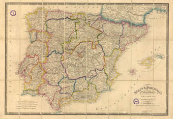
At the same time, the exhibition “175th Anniversary of Official Cartography. Completing the map of Spain”, curated by the director of the Regional Service of the National Geographic Institute in Valencia, Emilio Benítez Aguado, will open on Tuesday 10 at the Palau Cerveró, where it will remain on display until February 20. This exhibition, organized by the Support Unit Vice President of Participation and Territorial Projection, along with the National Geographic Institute, aims to bring to the public key to knowing the territory elements and performing the work carried IGN since its founding in 1870.
The eighteen panels that form the exhibition, written by IGN technicians, provide insight into the time of initial difficulties in establishing a modern cartography of the state in the nineteenth century, the work needed geodesic triangulation, levelling or representation of jurisdictional boundaries territory, among others, until today the achievement of an entire corpus cartographic material as the Topographic Map of Spain or the National Atlas of Spain.
Last update: 9 de february de 2015 11:27.
News release