
.jpg)
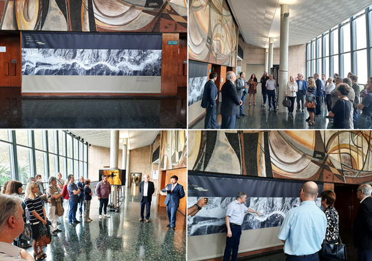
On 20 October, at the Faculty of Geography and History, the exhibition "History and Landscapes of the Tous pantanà" was inaugurated, together with a seminar with the participation of historians, geographers, staff of the Confederación Hidrográfica del Júcar, meteorologists... to commemorate one of the most terrible disasters that occurred in our lands.
The exhibition has been curated by Emili Iranzo, vice-dean of the faculty, José Rueda and Concepció Castells, from the Cartoteca of the University, and, within it, there are photograms of two images that were made on the occasion of the "pantanà", and that are in the Cartoteca of the University: the photogrammetric flight of the Flood of 1982, at a scale of 1. 25,000, from October 1982, and the photogrammetric flight of the Flood, at a scale of 1,10,000, from November 1982, in which you can see in detail the state of the bursting of the Tous dam, the flooded fields, the towns and their streets with water, the outflows of water towards the sea, as well as the flooding of the water. Plans, photographs and newspapers of the time have also been used.
It is located in the hall on the 1st floor of the Faculty of Geography and History and will be on display until 30 November.