

Exhibitions
Maps are complex cultural products. Over time, factors such as technical and technological development, geographical knowledge or the advance of mathematical sciences, but also cultural ideas, political interests or aesthetics trends have taken part in its making.
With the goal of showing all these aspects of cartography documents and to disseminate within the university community and society in general its collections and services, the map library schedules in its academic course cartography exhibitions related to the study plans of different disciplines, such as Geography, History, History of Art... Exhibitions take place in the main hall of the map library and access is free.
 History and Landscapes of the Tous Flood. 40 years of the disaster in the region of the Ribera of the Xúquer river. October, 20, 2022. Seminar, Exhibition and Gathering
Virtual Exhibition
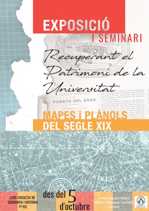
Recovering University heritage: maps and plans from the 19th century. From 5 October 2020 to 7 January 2021
Virtual Exhibition
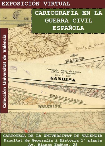
Maps of Spanish Civil War. UV's Collection. From 2 November 2016 to 31 March 2017
Virtual Exhibition
Leaflet
Previous exhibitions
- Mediterranean Cities in the Modern Age (16th to 18th Centuries). From 21 de September 2015 to 31 January 2016. Further information
- Mapes of the Spanish Civil War (1936-1939). From 9 September to 31 December 2013. Extenden until 28 February 2014. Further information
- Irrigation in Valencian lands. From 17 April to 30 June 2012.
- Evolution of the Valencian coastline. From 20 September to 31 December 2010.
- Cities of the Colonial America. From 30 March to 30 June 2009
- Military architecture of Bourbon Valencia. From 7 April to 30 June 2008.
- The Carlist Wars. From 17 April to 30 June 2007.
- Valencian network of roads in the 18th and 18th centuries. From 30 October 2006 to 10 January 2007.
- Provincial maps of Francisco Coello (1822-1898). From 25 April to 30 June 2006.
- Colonialism and cartography. From 23 January to 31 March 2006.
- Cartography of the port of Valencia and seaside villages. From 7 November 2005 to 10 January 2006.