
30/06/20
Summer Timetable
July: mornings from monday to Thursday from 9:00 to 14:00
By appointment: cartoteca@uv.es
August closed
25/03/20
Map Library closed
Due to the coronavirus pandemic the University of Valencia has approved several measures that affect university services and facilities.
In relation to the libraries, these will be closed from March 13 at 3:00 p.m. and until further announcement, for reasons of emergency and public health.
Loans will automatically renew until April 21.
You can send any incident or question through The Library Responds and it will be solved.
Starting Monday the 23rd, the library team will continue to work online to offer our services in the best possible way. We will inform you of any news on our website.
More information: Coronavirus special information webpage.
11/06/19
Summer timetable
June and July: mornings from 9:00 to 14:30
August closed
11/04/19
New digitalised maps at RODERIC
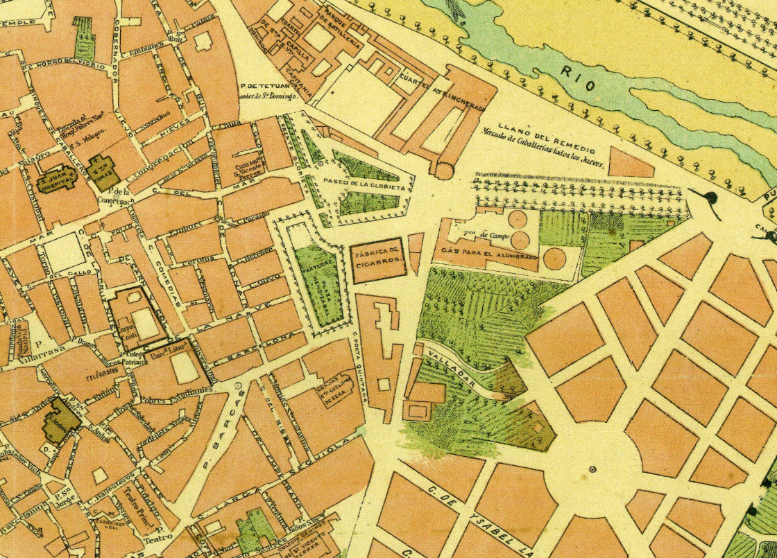
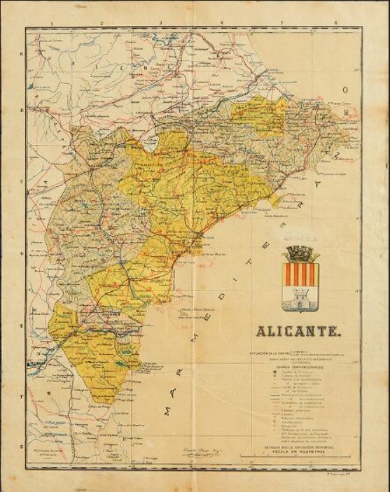
The Map Library has digitalised 20 new maps in RODERIC, almost all of the maps of the city of València since the late 19th until the 1970s. With this, the task to digitalise the maps preserved at the map library continues so as to contribute with the dissemination of the rich bibliographical and documental legacy of the Universitat de València. They will be followed by many more. We hope they are useful for everyone.
14/12/18
Christmas timetable
Open from 27 to 28 December and from 09:00 to 14:30
Closed from 29 December to 6 January
05/06/18
Summer timetable
June and July: mornings from 9:00 to 14:30
August: closed from 1 to 26 August


- "María Moliner" Library of Education
- "Joan Reglà" Library of Humanities
- "Eduard Boscà" Library of Sciences
- "Pelegrí Casanova" Library of Health Sciencies
- "Gregori Maians" Library of Social Sciences
- "Joan Lluís Vives" Library of Psychology and Sport
- Botanical garden library
- Depository Library
- UN Depositary Library (ONUBIB)
- Historical Library
- "Vicent Peset Llorca" Historical Medical Library
- Map Library
- Campus Ontinyent Library
- Historical Archive
- Semi-current records center information
- Administration and management
© 2026 UV. - C/ Universitat 2 46003 València. Phones