


21/05/15
Links to guide how to cite cartograhy
The guide to write bibliographic citations of cartographic materials carried out by the Maps Library of universities of Valencia and Cantabria has become linked to three universities: Polythechnic of Valencia, Girona and Barcelona. The National Geographic Institute has made the same and it has been published by the journal Mapping Interactivo (Interactive Mapping) on its May issue.
13/05/15
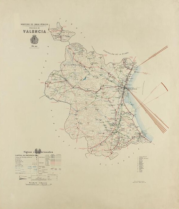
New digitalised maps at RODERIC
The Map Library has digitalised 61 new maps at RODERIC, 36 from de map collection of the Spanish Civil War, 12 nautical charts from the 19th and 20th Century and 13 monthly rainfall maps of the years 1915-1917, all of them from the territory of Valencia. Thus, the Map Library carries on with the task of digitalizing the maps conserved at the Map Library in order to contribute to the dissemination of the rich documental and bibliographical heritage of the Universitat de Valencia. We hope they may be useful to everybody

10/02/15
Holy Week timetable
Opening hours during the Holy Week:
Closed on Thursdayn afternoon, 2 April, and from 3 to 13 April 2015
15/01/15
How to cite cartographic documents in academic and research work
The maps library of the universities of Cantabria and Valencia have jointly composed a guide how to cite cartographic documents in academic and research works according to the norm ISO-690 for the use of the university community.
The guide includes indicators on how to write the different fields of citation and specific examples of paper and electronic documents

09/12/14
Christmas Schedule
Map Library Christmas Schedule
Close: from 24 to 28 December and from 31 to 6 January
Open: 29 and 30 December and from 09:00 to 14:30
21/05/14
Digitized maps in RODERIC
The Map Library of the UV has started digitalising its collection in the institutional repository of the University, RODERIC, with the Valencian sheets of its civil war maps collection. They are 1:25.000 and 1:10.000 maps made by the republican side, that include Castellón and some parts of Tarragona, Teruel and Valencia, as well as specific areas in Alicante.
38 sheets are already available, and the rest will be available later to a total of over 80 sheets. Several maps of the Valencian area dated from the eighteenth century (nautical charts, urban maps, etc.) will be also available in RODERIC.


- "María Moliner" Library of Education
- "Joan Reglà" Library of Humanities
- "Eduard Boscà" Library of Sciences
- "Pelegrí Casanova" Library of Health Sciencies
- "Gregori Maians" Library of Social Sciences
- "Joan Lluís Vives" Library of Psychology and Sport
- Botanical garden library
- Depository Library
- UN Depositary Library (ONUBIB)
- Historical Library
- "Vicent Peset Llorca" Historical Medical Library
- Map Library
- Campus Ontinyent Library
- Historical Archive
- Semi-current records center information
- Administration and management
© 2026 UV. - C/ Universitat 2 46003 València. Phones