
The cartographic heritage of the Biblioteca Històrica, considering maps and exempt plans, books of different subjects, atlas and even two blaviana globes, is not large and doesn’t contain many individual pieces of great value, but is characterized by its variety.
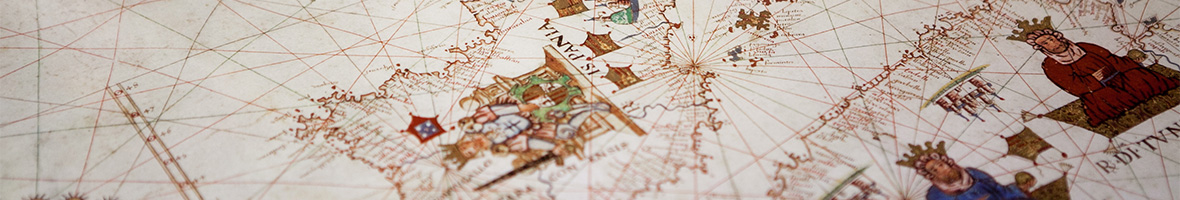
Th e most valuable pieces are the oldest, as the codex of the Cosmographia by Ptolomeo, a masterpiece, or the portulano by Jacobus Russus (Messina, 1563), but the most estimable and complete collection may correspond to the publications of the 17th and 18th, with significant models of Dutch or French spheres, respectively. Thus, we have various publications of the Theatrum Orbis Terrarum by Abraham Ortelius; with 9 volumes of the great Castillian work Atlas Maior o Geographia Blaviana; with different works by Philip Cluver, creator of the historical geography, etc. From the 18th century we can highlight the atlas by Alexis Hubert Jaillot, the Atlas Général de Le Rouge (1763) or the Atlas du voyage de la Pérousse, work of the extraordinary artistic value and quality.
We also have other works of exquisite quality as the Atlas Coelestis by John Flamsteed, 1729 or the nautical atlas Carta esférica de la Costa de España by Tofiño de San Miguel, 1786. From the 19th century the Library also has beautifully engraved atlas, some out-of- print, belonging to the recovery fund.
Of interest for the Valencian Community we have a plane of Valencia by the Father Tosca "Valentia edetanorum, vulgo del Cid" (incomplete, only 3 of the 4 sheets that comprises).
Our cartographic collection has been studied, among others, by Professor Vicenç M. Rosselló.